

- Usage in publication:
-
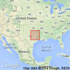
- Washita division*
- Modifications:
-
- Overview
- AAPG geologic province:
-
- Ouachita folded belt
Summary:
Defined as uppermost of the three stratigraphic groups of Comanche series. Overlies Fredericksburg division of Comanche series. Underlies Dakota division of Gulf series. In Red River section (region of its typical development) consists of eight broad subdivisions: 1) Basement beds of bituminous clays rather abruptly succeeding Edwards limestone; 2) beds of white, arenaceous, chalky limestone alternating with marls, which terminate with 3) a conspicuous limestone formation; 4) a group of beds of marls and shell conglomerates; 5 and 6) two groups of clays and sands separated by limestone; 7) an upper limestone, and 8) an uppermost lime marl. These subdivisions (locally still further subdivided) may be named the Kiamitia, Duck Creek, Fort Worth, Denton, Weno, Pawpaw, Main Street, and Grayson beds. To the south, in the Colorado River sections, only three lithologic members are recognizable--Georgetown limestone, Del Rio clays, and Buda limestones. To preserve the affinities of these coalesced subdivisions and to avoid confusion that may arise in discussing the broader correlation features, the writer has used certain collective names, such as (beginning with the lowest) Preston beds for the combined Kiamitia and Duck Creek formations, and Denison beds for Denton, Weno, Pawpaw, Main Street, and Grayson formations. Assigned Early Cretaceous age in TX and southern Indian Territory [generally Ouachita tectonic belt province].
Source: GNU records (USGS DDS-6; Denver GNULEX).

- Usage in publication:
-
- Washita Group, undivided
- Modifications:
-
- Areal extent
- Mapped 1:250k
- Dominant lithology:
-
- Clay
- Limestone
- AAPG geologic province:
-
- Arkla basin
- Ouachita folded belt
Summary:
Washita Group, undivided. Alternating thick clay units and thin limestone units. Clay, calcareous, commonly sandy, dark bluish-gray and black. Limestone in lower part hard, bluish-gray to white, in upper part soft, thick-bedded, gray and yellowish-gray. Marine megafossils. Thickness 200 feet, feathers out eastward. Lies above Goodland Limestone and below Upper Cretaceous Woodbine Group, undivided. Age is Early Cretaceous.
Mapped north of Red River along northern boundary of map sheet, in Bryan, Choctaw, and McCurtain Cos., southeastern OK, and Sevier Co., southwestern AR. Not mapped in TX.]
Source: Publication.
For more information, please contact Nancy Stamm, Geologic Names Committee Secretary.
Asterisk (*) indicates published by U.S. Geological Survey authors.
"No current usage" (†) implies that a name has been abandoned or has fallen into disuse. Former usage and, if known, replacement name given in parentheses ( ).
Slash (/) indicates name conflicts with nomenclatural guidelines (CSN, 1933; ACSN, 1961, 1970; NACSN, 1983, 2005, 2021). May be explained within brackets ([ ]).