- Usage in publication:
-
- Warren Point sandstone lentil
- Modifications:
-
- Original reference
- Dominant lithology:
-
- Sandstone
- AAPG geologic province:
-
- Appalachian basin
Summary:
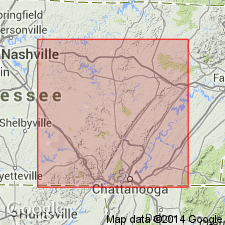
Pg. 43, 44, 148-149, and 184. Warren Point sandstone lentil. A sandstone in upper part of Gizzard formation, varying in thickness from 25 to 175 feet. Is first sandstone beneath Sewanee conglomerate, from which it is in places separated by as much as 135 feet of beds. In other places the beds between Warren Point sandstone and overlying Sewanee conglomerate thin out, and the Warren is in contact with the Sewanee. The lower sandstone members of the Warren Point vary greatly, some being thick and heavy cross-bedded sandstones, while others are thin slab-like, very fine-grained ripple-marked micaceous sandstones, often containing partings of yellowish-gray or gray fissile shale containing white or pink plastic clay bands. Around Sewanee the Warren Point is a fine-grained hard nonconglomeratic sandstone. In eastern part of plateau and northern part of Southern Tennessee coal field it becomes conglomeratic. On Tennessee River it is very conglomeratic in lower part. There is marked erosional unconformity at base of the Warren Point at widely scattered places over entire field. In extreme southern part of field the Etna coal lies at base of the sandstone. It was called cliff sandstone by Safford, as it forms prominent bluffs in southern and central parts of the plateau.
The name Warren Point is taken from a point 0.5 mi north of Monteagle, Grundy Co., southeastern TN, where this sandstone forms a prominent bluff 65 feet thick [=type locality].
[GNC remark (ca. 1936, US geologic names lexicon, USGS Bull. 896, p. 2275): Warren Point sandstone member of Gizzard formation adopted by the USGS. Recognized in southeastern Tennessee in Bledsoe, Franklin, Grundy, Hamilton, Marion, and Sequatchie Counties. Age is Pennsylvanian.]
Source: US geologic names lexicon (USGS Bull. 896, p. 2275).
- Usage in publication:
-
- Warren Point sandstone
- Modifications:
-
- Revised
- AAPG geologic province:
-
- Appalachian basin
Summary:
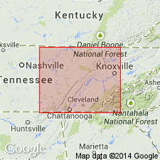
Pg. 1, 4, 19, pls. 3, 4, 12-D. Warren Point sandstone. Rank raised to formation in Gizzard group (herein rank raised). Attains its maximum thickness, a little more than 200 feet, in vicinity of Signal and Lookout Mountains near Chattanooga, where it is conglomeratic. The Warren Point of this area may be composite sandstone, with true Warren Point sandstone resting unconformably on one or more sandstones of Raccoon Mountain formation (new); from Chattanooga northeastward to Sale Creek-Soddy mining district, the Warren Point thins gradually and splits into several nonconglomeratic sandstones; this change makes identification difficult; farther northeast, in Roddy quadrangle, it is again a single massive conglomeratic sandstone. Underlies Signal Point shale (new); overlies Raccoon Mountain formation. Age is Early Pennsylvanian (Pottsville). Type locality stated.
Type locality: Warren Point, just north of Monteagle, Grundy Co., southeastern TN. [Extends into GA.]
Source: US geologic names lexicon (USGS Bull. 1200, p. 4130-4131).
- Usage in publication:
-
- Warren Point Sandstone Member*
- Modifications:
-
- Revised
- AAPG geologic province:
-
- Appalachian basin
Summary:
New nomenclature defined in this report for Early Pennsylvanian of northwest GA. Johnson's (1946) nomenclature was based on miscorrelation with rock units of TN. In type area (Lookout Mountain, GA) top bed of Lookout Sandstone is the Lower Conglomerate, not the Upper Conglomerate as shown by Pennsylvanian Subcommittee (R.C. Moore and others, 1944: GSA Bull., v. 55, no. 6); and top bed correlates with Warren Point Sandstone, not Sewanee Conglomerate as implied by Johnson's use of name Sewanee member of Lookout sandstone. On Lookout Mountain, bed Johnson calls Sewanee Member of Lookout Sandstone is same bed that Wanless (1946: GSA Mem 13) calls Warren Point Sandstone member of Lookout sandstone. On Sand Mountain, at Cole City, GA, Sewanee member of Johnson is top bed of Lookout sandstone of Hayes (1894: USGS Geol. Atlas, Folio 2), the Lower Conglomerate of McCalley (1904, GA G.S. Bull 12) and McCalley (1891: AL G.S. Spec. Rept 3), and Warren Point sandstone member of Wanless (1946). Johnson's map adjoins the type locality of Raccoon Mountain formation of Wilson and others (1956), where Sewanee member of Johnson directly overlies Raccoon Mountain formation and is thus the same unit as their Warren Point sandstone. In present report, the Warren Point is classified as a member of Gizzard Formation. Overlies Raccoon Mountain Member; underlies Signal Point Shale Member.
Source: GNU records (USGS DDS-6; Reston GNULEX).
- Usage in publication:
-
- Warren Point Sandstone
- Modifications:
-
- Areal extent
- AAPG geologic province:
-
- Appalachian basin
Summary:
(East-central sheet; not separately mapped.) Warren Point Sandstone of Gizzard Group. Gray to brown, fine- to medium-grained sandstone and conglomeratic sandstone; locally interbedded with shale containing coal. Thickness 0 to 300 feet, thins from southeast to northwest; average thickness about 100 feet. Lies below Signal Point Shale and above Raccoon Mountain Formation; both of Gizzard Group. Age is Pennsylvanian.
Source: Publication.
- Usage in publication:
-
- Warren Point Sandstone
- Modifications:
-
- Revised
- AAPG geologic province:
-
- Appalachian basin
Summary:
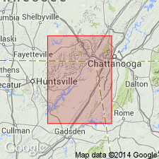
Warren Point Sandstone mapped at northern end of Sand Mountain in Tennessee, Alabama, and Georgia. Previous workers had mapped Warren Point Sandstone overlying Sewanee Conglomerate. Upper unit is indeed Warren Point, but lower unit actually correlates with a lower sandstone member of Raccoon Mountain Formation, here named Flat Rock Member.
[Classification not adopted by the Alabama and Georgia Geol. Surveys, nor the USGS. See Pottsville Formation.]
Source: Modified from GNU records (USGS DDS-6; Reston GNULEX).
- Usage in publication:
-
- Warren Point Sandstone
- Modifications:
-
- Revised
- AAPG geologic province:
-
- Appalachian basin
Summary:
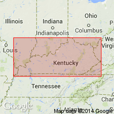
Pg. 9-10, 11, pl. 1. Warren Point Sandstone of Breathitt Group. Quartzose sandstone [channel sands] in basal part of Breathitt Group. Thickness 0 to 500 feet (0 to 150 m). Underlies and interfingers with /Bottom Creek formation (informal) of Breathitt Group. [In some places where the Bottom Creek is absent, the Warren Point underlies and is undifferentiated from the Sewanee Sandstone; the two are referred to as the /Warren Point-Sewanne Sandstones.] Overlies Bluestone Formation of Pennington Group or Pocahontas Formation of Breathitt Group. Rocks previously included in Middlesboro, White Rocks Sandstone, and Chadwell Members of Lee Formation by Englund (1964) and Englund and DeLaney (1966). Correlates with lower part of New River Formation of Virginia and West Virginia. [Age is Pennsylvanian.] Formal nomenclature presented in this report for units occurring in Kentucky has been accepted by the Kentucky Stratigraphic Nomenclature Committee. [Classification not adopted by the Tennessee, Virginia, and West Virginia Geol. Surveys.]
Source: Publication.
For more information, please contact Nancy Stamm, Geologic Names Committee Secretary.
Asterisk (*) indicates published by U.S. Geological Survey authors.
"No current usage" (†) implies that a name has been abandoned or has fallen into disuse. Former usage and, if known, replacement name given in parentheses ( ).
Slash (/) indicates name conflicts with nomenclatural guidelines (CSN, 1933; ACSN, 1961, 1970; NACSN, 1983, 2005, 2021). May be explained within brackets ([ ]).

