- Usage in publication:
-
- Wall Creek sandstone lentil*
- Modifications:
-
- Named
- Dominant lithology:
-
- Sandstone
- AAPG geologic province:
-
- Wind River basin
Summary:
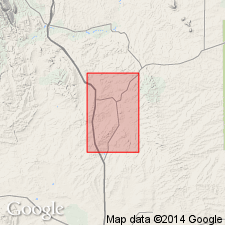
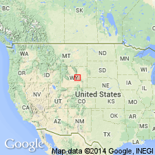
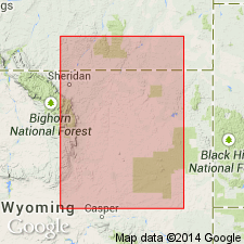
Named as a lentil in the Benton shale for the stream Wall Creek, Salt Creek oil field, Ts38 to 41N, Rs78 and 79W, Natrona Co, WY in the Wind River basin. No type locality designated. Forms an escarpment around the Powder River dome. Is 80 to 100 ft thick along Wall Creek, but may be as much as 150 ft thick in the subsurface. Occurs 1,370 ft above the top of the Dakota? sandstone and 220 ft below top of Benton. Units directly above and below are unnamed. Composed of buff, well cemented, medium-grained sandstone that may be ripple marked and cross-bedded. Contains numerous fossils (PRIONOCYCLUS WYOMINGENSIS and INOCERAMUS), fossil wood showing worm borings. Late Cretaceous age.
Source: GNU records (USGS DDS-6; Denver GNULEX).
- Usage in publication:
-
- Wall Creek sandstone member*
- Modifications:
-
- Revised
- AAPG geologic province:
-
- Wind River basin
- Powder River basin
Summary:
Wall Creek lentil of Benton shale of Wegemann (1911) designated Wall Creek sandstone member of Benton shale in the Salt Creek field area, T29N, R74W, Converse Co, Powder River basin, and in T32N, R78W, Natrona Co, Wind River basin, WY. Described as a 100 to 200 ft thick fossiliferous, brown to gray sandstone in three measured sections. Individual beds are coarse grained, friable, massive to ledge-forming. Some interbedded dark shales. Geologic map. Wall Creek mapped along southwest and south-central part of map. Assigned to the Late Cretaceous.
Source: GNU records (USGS DDS-6; Denver GNULEX).
- Usage in publication:
-
- Wall Creek sandstone member*
- Modifications:
-
- Revised
- AAPG geologic province:
-
- Wind River basin
Summary:
Reassigned from Benton shale (Wegemann's use in USGS Bulletin 670, 1918) to Frontier formation as its uppermost member in the Salt Creek oil field, U. S. Naval Petroleum Reserve No. 3, Natrona Co., WY in the Wind River basin. Term Benton shale not used. Is the same as the "First Wall Creek sand" of drillers. Consists of two cross-bedded sandstones separated by shale that total 90-160 ft thick. Overlies unnamed gray shale, sandy shale, and thin sandstone of the Frontier. Underlies dark marine shale of the Carlile shale; Carlile of this report was the unnamed uppermost shale of Benton according to Wegemann (cited above). Stratigraphic table. Columnar section. Of Late Cretaceous age
Source: GNU records (USGS DDS-6; Denver GNULEX).
- Usage in publication:
-
- Wall Creek member
- Modifications:
-
- Areal extent
- AAPG geologic province:
-
- Chadron arch
Summary:
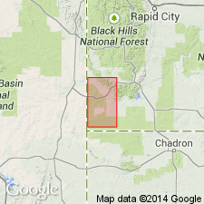
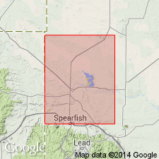
Extends name to southern part of Black Hills uplift, Fall River Co, SD on the Chadron arch for a member of Carlile formation. Lies about 250 ft above base of Carlile, and is a zone of sand and sandy shales which occupies the stratigraphic position of Wall Creek sand in WY. The top is characterized by two thin, persistent beds of fine sand about 2 ft thick and separated by 10 ft of sandy shale and fine-grained sandstone. This upper unit is underlain by 45 ft of largely black shales in eastern part of area. Toward west these beds become sandy and in westernmost outcrops are largely fine sandstone with alternations of dark shale. Below the zone just described comes another pair of ledge makers, each from 6 in to 2 ft thick, and made of very coarse sandstone, separated by 6 to 10 ft of poorly cemented sand. Shark teeth are abundant, and the teeth together with the coarseness of the sand are the chief characteristics that identify the lower ledge. Does not give a measured section or the total thickness [total for units described above about 70 ft]. Lists fossils collected from upper ledge-forming sandstones. Underlain by an unnamed lower part of Carlile; overlain by an unnamed concretionary zone in Carlile. Cretaceous in age.
Source: GNU records (USGS DDS-6; Denver GNULEX).
- Usage in publication:
-
- Wall Creek facies
- Modifications:
-
- Revised
- Areal extent
- AAPG geologic province:
-
- Williston basin
Summary:
An informal subdivision of the Carlile formation in Buffalo, SD in the Williston basin. Is a sandy and silty interval lying 86 to 126 ft above the base of the formation. Thickness 20-60 ft. Underlain by an unnamed lower part and overlain by an unnamed upper part of Carlile formation. Correlates with lower part of Turner sandy member of Carlile (unit 1) as described in the northern part of the Black Hills by Cobban (1951). Late Cretaceous in age.
Source: GNU records (USGS DDS-6; Denver GNULEX).
- Usage in publication:
-
- Wall Creek Sandstone Member*
- Modifications:
-
- Biostratigraphic dating
- Areal extent
- AAPG geologic province:
-
- Green River basin
Summary:
Extended into northwestern Carbon Co, WY, Greater Green River basin. Assigned as upper member of Frontier Formation. As used in this report, unit includes all sandstone beds in upper part of Frontier except those in thin unnamed middle member of Frontier. Is about 350 ft thick along Rawlins uplift; well logs indicate thickness in subsurface ranges from 230-350 ft; thickness varies irregularly but decreases to east and south. Unconformably overlies middle member; underlies and interfingers with unnamed noncalcareous shale. Correlates in part with Turner Sandy and Sage Breaks Members of Carlile Shale at northern end of Black Hills uplift. Cross sections. Burrows including OPHIOMORPHA are abundant and fossiliferous concretions are common. Fossils are late Turonian age (zones 15 through 19; table 1). Basal beds contain INOCERAMUS PERPLEXUS (zones 14-16); at a few localities they also contain SCAPHITES WHITFIELDI (zone 15). Younger beds contain INOCERAMUS cf. I. PROBLEMATICUS (zone 18) and INOCERAMUS ERECTUS (zone 19).
Source: GNU records (USGS DDS-6; Denver GNULEX).
- Usage in publication:
-
- Wall Creek Member*
- Modifications:
-
- Overview
- Redescribed
- Dominant lithology:
-
- Sandstone
- Siltstone
- Shale
- AAPG geologic province:
-
- Powder River basin
- Green River basin
- Wind River basin
Summary:
Is upper member of Frontier Formation in southern Powder River basin and in eastern Greater Green River and eastern Wind River basins, WY. Consists of interstratified sandstone, siltstone, and shale; thus "Sandstone" designation dropped from name. Isopach maps. Thickness is generally 50-130 m. Correlation diagram (table 1); representative electric logs; cross section. Correlates with part of Turner Sandy Member of Carlile Shale in Black Hills. Unconformably overlies unnamed member of Frontier; conformably underlies Cody Shale and interfingers with lower part of Cody along west side of Powder River basin. Contains sandstone units VI-VIII (ascending). These sandstone units have had other designations by previous workers: sandstone unit VI has been called "First Wall Creek Member" and is probably lower part of "first Frontier sandstone"; sandstone unit VII has been called "First Wall Creek Member," and "first Frontier sandstone"; sandstone unit VII has been called "First Wall Creek Member" and "Wall Creek Sandstone Member." Fossil mollusks range in age from late Turonian (SCAPHITES WARRENI Range Zone to early Coniacian (INOCERAMUS ERECTUS Range Zone).
Source: GNU records (USGS DDS-6; Denver GNULEX).
- Usage in publication:
-
- Wall Creek Member*
- Modifications:
-
- Overview
- AAPG geologic province:
-
- Wind River basin
- Green River basin
Summary:
Extends from Natrona and Fremont Cos (Wind River basin) into Carbon Co (Greater Green River basin). Is the upper member of the Frontier Formation disconformably above the unnamed member. Deposited in shallow water marine environment in late Turonian to middle Coniacian time. Marine fossils along southern margins indicate member is younger to northwest. Ranges from less than 98 to 197 ft thick. Correlates with Dry Hollow Member of Cumberland Gap in the overthrust belt. Correlation chart. Underlies Cody Shale or Sage Breaks Shale.
Source: GNU records (USGS DDS-6; Denver GNULEX).
- Usage in publication:
-
- Wall Creek Member*
- Modifications:
-
- Biostratigraphic dating
- AAPG geologic province:
-
- Wind River basin
Summary:
Within report area of Natrona Co, WY, Wind River basin, Wall Creek is upper of two or three members of Frontier Formation. Report describes most of known species of cephalopods (chiefly ammonites) from Frontier in Natrona Co. Three zones of late Turonian age can be recognized in Wall Creek in Natrona Co (see fig. 2 for ammonite zonation). Disconformably overlies the informal member of Emigrant Gap of the Frontier (formerly called the unnamed member) or where member of Emigrant Gap is absent, disconformably overlies Belle Fourche Member of Frontier. Conformably underlies Cody Shale.
Source: GNU records (USGS DDS-6; Denver GNULEX).
- Usage in publication:
-
- Wall Creek Member*
- Modifications:
-
- Overview
- AAPG geologic province:
-
- Powder River basin
Summary:
In southwest Powder River basin, WY, assigned as uppermost member of three members of Frontier Formation. Outcrops in southern half of Johnson Co, in Natrona Co, and southern Converse Co form ridges. Core of Wall Creek from Johnson Co consists of silty shale, sandy siltstone, and sandstone; silty sandstone is commonly bioturbated. Disconformably overlies either newly named Emigrant Gap Member of Frontier or Belle Fourche Member of Frontier; conformably underlies Cody Shale. Thickness ranges from 3-85 m. Unit is thickest, exceeding 61 m, in an irregular area in east-central Natrona Co, west-central Converse Co, and in smaller areas near southeast corner of Johnson Co. Stratigraphic chart; measured section; cross sections; geophysical logs. Fossils consists of foraminifers and mollusks; ammonites and bivalves indicate late Turonian age, however, age varies slightly as basal part of Wall Creek onlaps an erosional surface and upper part interfingers with lower part of overlying Cody Shale.
Source: GNU records (USGS DDS-6; Denver GNULEX).
For more information, please contact Nancy Stamm, Geologic Names Committee Secretary.
Asterisk (*) indicates published by U.S. Geological Survey authors.
"No current usage" (†) implies that a name has been abandoned or has fallen into disuse. Former usage and, if known, replacement name given in parentheses ( ).
Slash (/) indicates name conflicts with nomenclatural guidelines (CSN, 1933; ACSN, 1961, 1970; NACSN, 1983, 2005, 2021). May be explained within brackets ([ ]).

