

- Usage in publication:
-
- Wahweap sandstone*
- Modifications:
-
- First used
- Dominant lithology:
-
- Sandstone
- Shale
- AAPG geologic province:
-
- Plateau sedimentary province
- Paradox basin
Summary:
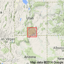
First published use as a name applied in Kane Co, UT, in the Plateau sedimentary province, to sequence of sandstone and shale conformably above the Straight Cliffs sandstone (named) and beneath the Kaiparowits formation (named). Intent to name and designation of type locality not stated. Extends north into adjoining Garfield Co in the Paradox basin. Section 1,245 ft thick measured in Last Chance Canyon, sec 7, T40S, R4E, Kane Co. At that locality sandstone is the predominant (740 ft) lithology. The sandstone varies from yellow brown to buff, massive, cliff-former. The shale is brown and sandy. Wahweap has an average thickness of about 1,250 ft. Some of the sandstone is cross-bedded. Some sandstone beds are thin-bedded; some are lenticular. Geologic map. Fragments of crocodile or turtle bone found. Has stratigraphic position of upper Mancos. Assigned to the Late Cretaceous.
Source: GNU records (USGS DDS-6; Denver GNULEX).
- Usage in publication:
-
- Wahweap Formation*
- Modifications:
-
- Contact revised
- AAPG geologic province:
-
- Plateau sedimentary province
Summary:
Lower contact revised in that Wahweap overlies Drip Tank Member, a new name, of Straight Cliffs Formation in Plateau sedimentary province. Assigned to late Campanian or Late Cretaceous.
Source: GNU records (USGS DDS-6; Denver GNULEX).
For more information, please contact Nancy Stamm, Geologic Names Committee Secretary.
Asterisk (*) indicates published by U.S. Geological Survey authors.
"No current usage" (†) implies that a name has been abandoned or has fallen into disuse. Former usage and, if known, replacement name given in parentheses ( ).
Slash (/) indicates name conflicts with nomenclatural guidelines (CSN, 1933; ACSN, 1961, 1970; NACSN, 1983, 2005, 2021). May be explained within brackets ([ ]).