The National Geologic Map Database is migrating to a new infrastructure. We apologize for any service disruptions during this process.
|
|---|


- Usage in publication:
-
- Vernal Mesa granite
- Modifications:
-
- Named
- Dominant lithology:
-
- Granite
- AAPG geologic province:
-
- Southern Rocky Mountain region
Summary:
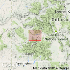
Named for exposure 1 mi by 1 1/2 mi wide and 2 mi long across Black Canyon and Vernal Mesa, T50N, R8W, Montrose Co, CO in the Southern Rocky Mountain region. Made up chiefly biotite granite with porphyritic texture. Near its borders contains numerous inclusions of biotite schist and gneiss. Is a mixture of quartz, feldspar, and biotite studded with phenocrysts of pink or flesh-colored feldspar, up to 3 cm long, some of which show Carlsbad twinning. Cut by many aplite and pegmatite dikes. Rough and pitted surface owing to coarse, uneven texture. Eastern boundary crosses Black Canyon above mouth of Grizzly Gulch on south line of sec 19, T50N, R7W and extends up west side of Big Draw. Bordered on east by River Portal schist, on west with granite gneiss, on north and south plunges under Mesozoic rocks. Assigned to pre-Cambrian.
Source: GNU records (USGS DDS-6; Denver GNULEX).
- Usage in publication:
-
- Vernal Mesa Quartz Monzonite*
- Modifications:
-
- Overview
- AAPG geologic province:
-
- Southern Rocky Mountain region
Summary:
Occurs in a body of indeterminate size partly exposed in Black Canyon of Gunnison River and in batholith in northwest Uncompahgre Plateau in the Southern Rocky Mountain region. Listed with granitic rocks and gabbro of circa 1,400 m.y. (Precambrian Y) age group.
Source: GNU records (USGS DDS-6; Denver GNULEX).
- Usage in publication:
-
- Vernal Mesa Quartz Monzonite*
- Modifications:
-
- Areal extent
- Overview
- AAPG geologic province:
-
- Southern Rocky Mountain region
Summary:
Is one of ten formally named lithodemic units assigned to the Middle Proterozoic Berthoud Plutonic Suite (a new name). Forms a large batholith in area of Uncompahgre Plateau in Montrose and Mesa Cos, CO and in adjoining UT, all in the Southern Rocky Mountain region. A narrow, dike-like body about 95 mi long branches north-northeast of main batholith. Is coarsely porphyritic biotite quartz monzonite and granodiorite with abundant, blocky crystals of pink microcline and fairly abundant biotite. Is complexly intertongued with older rocks and with slightly younger Curecanti Quartz Monzonite.
Source: GNU records (USGS DDS-6; Denver GNULEX).
For more information, please contact Nancy Stamm, Geologic Names Committee Secretary.
Asterisk (*) indicates published by U.S. Geological Survey authors.
"No current usage" (†) implies that a name has been abandoned or has fallen into disuse. Former usage and, if known, replacement name given in parentheses ( ).
Slash (/) indicates name conflicts with nomenclatural guidelines (CSN, 1933; ACSN, 1961, 1970; NACSN, 1983, 2005, 2021). May be explained within brackets ([ ]).