The National Geologic Map Database is migrating to a new infrastructure. We apologize for any service disruptions during this process.
|
|---|


- Usage in publication:
-
- Verdos alluvium*
- Modifications:
-
- Named
- Dominant lithology:
-
- Sand
- AAPG geologic province:
-
- Denver basin
Summary:
"Typically exposed" on slope of a pediment on Verdos Ranch, for which unit is named, in NE1/4 NW1/4 SE1/4 sec 22, T6S, R69W, Littleton quad, Jefferson Co, CO in the Denver basin. Is a sheet 16 to 35 ft of brown, well-stratified coarse sand containing some larger stones and a volcanic ash bed. Unconformably overlies Mesozoic bedrock. Lies 100 ft below Rocky Flats alluvium (new) and 150 ft above Slocum alluvium (new). Is older than Slocum. Interpreted to be of Kansan or Yarmouth age on basis of included volcanic ash. Thought to be correlative with Pearlette ash of Kansan or Yarmouth, or Pleistocene age.
Source: GNU records (USGS DDS-6; Denver GNULEX).

- Usage in publication:
-
- Verdos alluvium*
- Modifications:
-
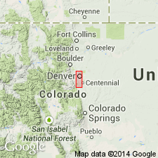
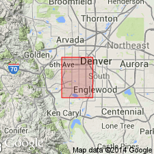
- Mapped 1:24k (Littleton quad, Arapahoe, Douglas, and Jefferson Cos, CO)
- Dominant lithology:
-
- Gravel
- Sand
- Ash
- AAPG geologic province:
-
- Denver basin
Summary:
Is Pleistocene (Kansan or Yarmouth) formation mapped in east-central Jefferson, west Arapahoe, and northwest Douglas Cos, CO (Denver basin). Occurs on many of the higher hills east of Dakota hogback and west of South Platte River and probably underlies plain between South Platte River and Plum Creek. Is older than Slocum alluvium (Pleistocene, Illinoian or Sangamon); younger than Rocky Flats alluvium (Pleistocene, Nebraskan or Aftonian). Consists of moderate-brown bouldery or cobbly pebble deposit in a matrix of poorly stratified sand. Most diagnostic feature is a bed of volcanic ash at base at type locality; ash also found at seven other places in Denver area; ash is well stratified and ranges in thickness from 11-30 ft. A Yarmouth? Brown soil was developed on Verdos. Fossil mollusks found in water-laid ash at type; four species identified. Maximum thickness of Verdos is 20 ft at type; elsewhere in quad unit is much thinner and at many localities consists only of a thin lag deposit of stones.
Source: GNU records (USGS DDS-6; Denver GNULEX).
- Usage in publication:
-
- Verdos alluvium*
- Modifications:
-
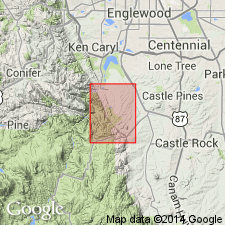
- Mapped 1:24k (Kassler quad, Douglas and Jefferson Cos, CO)
- Dominant lithology:
-
- Sand
- Pebbles
- Cobbles
- Boulders
- AAPG geologic province:
-
- Denver basin
Summary:
Is Pleistocene formation mapped in northwestern Douglas Co, CO (Denver basin). Occurs on tops of long mesas and isolated hills in eastern half of quad. Unconformably overlies Rocky Flats alluvium (Pleistocene); unconformably underlies Slocum alluvium (Pleistocene). Unit described (p.16) as thick stratified deposit of firmly compacted brown coarse sand containing some boulders of metamorphic and igneous rocks; color is brown, yellowish brown, and, in zone of calcium carbonate accumulation, yellowish gray; pebbles and cobbles are common; boulders larger than 2 ft are abundant and a few larger than 5 ft also are present. Type section measured. Contains ash layers that probably came from same vent as Pearlette ash member. Thickness ranges from 16-35 ft. Contains sparse fossil mollusks. Considered to by Kansan or Yarmouth age.
Source: GNU records (USGS DDS-6; Denver GNULEX).

- Usage in publication:
-
- Verdos Alluvium*
- Modifications:
-
- Mapped 1:24k (Morrison quad, Jefferson Co, CO)
- Dominant lithology:
-
- Silt
- Clay
- Gravel
- AAPG geologic province:
-
- Denver basin
Summary:
Is Pleistocene (Yarmouth Interglaciation or Kansas Glaciation) alluvium mapped in Jefferson Co, CO (Denver basin). Numerous outcrops scattered over eastern two-thirds of quad. Correlation of Map Units shows unit to unconformably overlie Rocky Flats Alluvium (Pleistocene--Aftonian Interglaciation or Nebraskan Glaciation) and to unconformably underlie Slocum Alluvium (Pleistocene--Sangamon Interglaciation or Illinoian Glaciation). Map unit described as yellowish-brown pebbly silt and clay interlayered with gravel. Gravel contains larger and more abundant boulders near mountains than to east; stones are altered by weathering and are coated by calcium carbonate. Thin beds of sand are crudely interlayered with thick beds of gravel. Upper part of most deposits is overbank silt on which is a very strong Brown soil of pre-Bull Lake (Yarmouth?) age. B horizon commonly has high swell potential. Cca (white calcium carbonate-enriched horizon) underlies B horizon and has abrupt upper boundary but has stringers that fade out downward at about 4 or more ft. Thickness of alluvium averages 15 ft. Lower of two terraces or pediments (locally separately mapped) lies about 200 ft above modern stream. Upper terrace or pediment (locally separately mapped) lies about 250 ft above modern stream; alluvium in upper terrace contains ash layer (map unit Qva) in lower part. Unit Qva described as Pearlette-like volcanic ash layer type O of Izett and others (1970).
Source: GNU records (USGS DDS-6; Denver GNULEX).
- Usage in publication:
-
- Verdos Alluvium*
- Modifications:
-
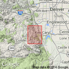
- Mapped 1:24k (Indian Hills quad, Jefferson Co, CO)
- Dominant lithology:
-
- Sand
- Gravel
- AAPG geologic province:
-
- Denver basin
Summary:
Is Pleistocene (Yarmouth or Kansan) formation mapped in central Jefferson Co, CO (Denver basin). Older than Slocum Alluvium (Pleistocene); younger than Rocky Flats Alluvium (Pleistocene). Map unit described as yellowish-red silty clayey sand containing layers of silty gravelly sand and pebble gravel. Cobbles and boulders of crystalline rocks and sandstone from the Fountain, Lytle, and South Platte Formations are common near the sandstone ridges. Fragments larger than a few feet in diameter become sparse near eastern edge of quadrangle. Remnants west of Hogback generally are cobble gravel in reddish-brown to yellowish-red sandy matrix containing boulders as large a 5 ft across. Well-developed pre-Bull Lake (Yarmouth?) soil contains a B horizon enriched in reddish-brown hard plastic clay and a thick zone extending into coarse alluvium that is enriched in calcium-carbonate. Deposited as part of pediment cycle. Thickness ranges from thin lag concentrate of scattered boulders and cobbles on pediment west of hogbacks to gravel more than 10 ft thick on pediment east of the Hogback.
Source: GNU records (USGS DDS-6; Denver GNULEX).
- Usage in publication:
-
- Verdos Alluvium*
- Modifications:
-
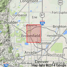
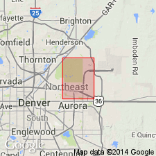
- Mapped 1:24k (Lafayette quad, Adams, Boulder, and Jefferson Cos, CO)
- Dominant lithology:
-
- Sand
- AAPG geologic province:
-
- Denver basin
Summary:
Is Pleistocene formation mapped in southeastern Boulder, northeastern Jefferson, and northwestern Adams Cos, CO (Denver basin). Unconformably overlies Rocky Flats Alluvium (Pleistocene); unconformably underlies Slocum Alluvium (Pleistocene). Unit described as reddish-brown gravelly to silty sand. Gravel derived from reworked Rocky Flats. Two distinct pediment surfaces 60-90 m above local streams. Contains partly eroded Cca (calcium carbonate-enriched) horizon in upper part of unit; locally, a well-developed B (clay-enriched) horizon overlies Cca horizon. Soil profile shown. Older and younger pediment alluviums also each separately mapped. In Adams Co part of quad only a single, small outcrop of older pediment alluvium is present; few scattered small outcrops of older and younger pediment alluviums occur in Boulder Co part of quad. Thickness commonly less than 5 m. Correlated with Kansan Glaciation or Yarmouth Interglaciation.
Source: GNU records (USGS DDS-6; Denver GNULEX).
- Usage in publication:
-
- Verdos Alluvium*
- Modifications:
-
- Mapped 1:24k (Fort Logan quad, Arapahoe, Denver, and Jefferson Cos, CO)
- Dominant lithology:
-
- Clay
- Silt
- Sand
- Gravel
- AAPG geologic province:
-
- Denver basin
Summary:
Is Pleistocene formation mapped in western Adams Co, CO (Denver basin). On Correlation of Map Units, Verdos is shown to unconformably overlie Rocky Flats Alluvium (Pleistocene) and unconformably underlie Slocum Alluvium (Pleistocene). Unit is described as light-brown to reddish-brown, poorly sorted, stratified gravel, containing lenses of clay, silt, and sand; in places contains thin beds of white volcanic ash similar to Pearlette family of ash beds. Has strongly developed calcium carbonate-enriched zone in upper part. Outcrops in small areas in northwestern part of quad. Engineering properties discussed. Thickness is up to 20 ft.
Source: GNU records (USGS DDS-6; Denver GNULEX).
- Usage in publication:
-
- Verdos Alluvium*
- Modifications:
-
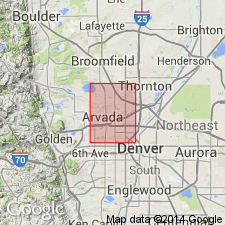
- Mapped 1:24k (Arvada quad, Adams, Denver, and Jefferson Cos, CO)
- Dominant lithology:
-
- Gravel
- Clay
- Silt
- Sand
- AAPG geologic province:
-
- Denver basin
Summary:
Is Pleistocene formation mapped in southwestern Adams, northwestern Denver, and northeastern Jefferson Cos, CO (Denver basin). On Correlation of Map Units, Verdos is shown to unconformably overlie Rocky Flats Alluvium (Pleistocene) and to unconformably underlie Slocum Alluvium (Pleistocene). Unit is described as light-brown to reddish-brown, poorly sorted, stratified gravel, containing lenses of clay, silt, and sand; in places may contain thin beds of white volcanic ash similar to Pearlette family of ash beds. A strongly developed calcium carbonate-enriched zone (relict soil) occurs in upper part. Most extensive outcrops occur in northwestern part of quad. Engineering properties discussed. Ranges up to 40 ft thick.
Source: GNU records (USGS DDS-6; Denver GNULEX).
- Usage in publication:
-
- Verdos Alluvium*
- Modifications:
-
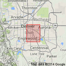
- Mapped 1:24k (Englewood quad, Adams, Arapahoe, and Denver Cos, CO)
- Dominant lithology:
-
- Sand
- Gravel
- AAPG geologic province:
-
- Denver basin
Summary:
Is Pleistocene formation mapped in eastern Denver Co, CO (Denver basin). Shown on Correlation of Map Units to unconformably overlie Denver Formation (Upper Cretaceous and Paleocene) and unconformably underlie Slocum Alluvium (Pleistocene). Unit described as reddish-brown, silty pebbly sand interbedded with pebble to cobble gravel. Mapped only where unit caps small hill about 45 m above Cherry Creek near intersection of East Hampden Avenue and South Yosemite Street. In places buried by up to 5 m of loess. Table of physical properties. Thickness is about 1.5-5 m.
Source: GNU records (USGS DDS-6; Denver GNULEX).
- Usage in publication:
-
- Verdos Alluvium*
- Modifications:
-
- Mapped 1:24k (Sable quad, Adams and Denver Cos, CO)
- Dominant lithology:
-
- Gravel
- Clay
- Silt
- Sand
- AAPG geologic province:
-
- Denver basin
Summary:
Is Pleistocene formation mapped in southwestern Adams, Co, CO (Denver basin). On Correlation of Map Units, Verdos is shown to unconformably overlie undivided Denver (Upper Cretaceous and Paleocene) and Arapahoe (Upper Cretaceous) Formations and to unconformably underlie Slocum Alluvium (Pleistocene). Unit is described as light- to reddish-brown, poorly sorted, stratified gravel, containing lenses of clay, silt and sand. In places unit contains thin beds of white volcanic ash similar to Pearlette family of ash beds. Contains a strongly developed calcium carbonate-enriched zone in upper part. Outcrops only in three small areas in northern part of quad. Engineering properties discussed. Thickness ranges up to 15 ft.
Source: GNU records (USGS DDS-6; Denver GNULEX).
- Usage in publication:
-
- Verdos Alluvium*
- Modifications:
-
- Mapped 1:12k (Jefferson Co, CO)
- Dominant lithology:
-
- Gravel
- Sand
- AAPG geologic province:
-
- Denver basin
Summary:
Is lower middle Pleistocene formation mapped in northern Jefferson Co, CO (Denver basin). Correlation of Map Units shows Verdos unconformably overlying Rocky Flats Alluvium (lower Pleistocene) and unconformably underlying Slocum Alluvium (middle Pleistocene). Map unit described as commonly consisting of beds and lenses of poorly sorted, clast-supported, cobbly pebble gravel that contains brown to reddish-brown sand matrix; clast-supported, sandy pebble gravel; and matrix-supported, pebbly, silty sand. Most clasts are subangular quartzite that are in part reworked from Rocky Flats Alluvium. Forms remnants of pediment deposits that are about 35-45 m above stream level in eastern part of map area and about 30 m above stream level near northwest corner of map. Upper part of unit contains thin, clayey, argillic B (Bt) horizon that overlies a stage III, calcium carbonate-rich K horizon about 50-80 cm thick. Beds and lenses of 620 ka Lava Creek B volcanic ash are present in upper part of unit at a few localities in Denver area. Thickness is about 1-4 m.
Source: GNU records (USGS DDS-6; Denver GNULEX).
For more information, please contact Nancy Stamm, Geologic Names Committee Secretary.
Asterisk (*) indicates published by U.S. Geological Survey authors.
"No current usage" (†) implies that a name has been abandoned or has fallen into disuse. Former usage and, if known, replacement name given in parentheses ( ).
Slash (/) indicates name conflicts with nomenclatural guidelines (CSN, 1933; ACSN, 1961, 1970; NACSN, 1983, 2005, 2021). May be explained within brackets ([ ]).