

- Usage in publication:
-
- Vedder sand
- Modifications:
-
- First used
- AAPG geologic province:
-
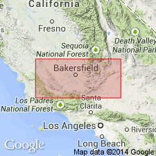
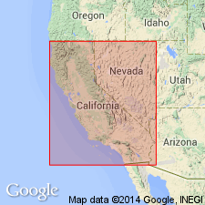
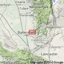
- San Joaquin basin
Summary:
Sections show Vedder sand as subsurface unit of Temblor [formation] in Richfield Oil Co. Boston No.1 well and in F.M. Sayer McNeil No.3 well, near Sharktooth Hill, sec.25 T28S R28E, Kern Co, CA.
Source: GNU records (USGS DDS-6; Menlo GNULEX).
- Usage in publication:
-
- Vedder sand
- Modifications:
-
- Named
- Dominant lithology:
-
- Sand
- Silt
- AAPG geologic province:
-
- San Joaquin basin
Summary:
Lower part of [so-called] Temblor formation in Mount Poso oil field is known as Vedder sand [member]. Divided into upper Vedder zone, Vedder silt, and lower Vedder zone. Thickness is from 290 to 750 feet. Underlies Jewett silt member of [so-called] Temblor formation.
Source: GNU records (USGS DDS-6; Menlo GNULEX).
- Usage in publication:
-
- Vedder Sand*
- Modifications:
-
- Adopted
- AAPG geologic province:
-
- San Joaquin basin
Summary:
Vedder Sand as first used by Hanna (1930) and redefined by Diepenbrock (1933) is adopted. Formerly called 'Vedder zone" by Wilhelm and Saunders (1927). Named believed to be after Shell Oil "Vedder" No.1 (sec.9 T27S R28E, Kern Co, CA). Type section designated as cored 751 ft subsurface interval from 1902 to 2653 ft in Vedder No.1 well. Is widespread subsurface unit in southeast San Joaquin Valley. Consists of sand, silty sand, sandy clay, and calcareous sandstone. Unconformably underlies Jewett Sand. Shallow-water marine fossils are common in upper part of unit including TURRITELLA INEZAMA Conrad which indicate early Miocene age.
Source: GNU records (USGS DDS-6; Menlo GNULEX).
- Usage in publication:
-
- Vedder Sand*
- Modifications:
-
- Age modified
- AAPG geologic province:
-
- San Joaquin basin
Summary:
Vedder Sand, principally subsurface unit in southeastern San Joaquin Valley, crops out in narrow belt north of Poso Creek, where it is composed of light-gray well sorted fine- to medium-grained sandstone cemented with silica. Conformably overlies Walker Formation. Unconformably underlies Jewett Sand. Diagnostic microfossils from subsurface support Zemorrian age; unit here restricted to Oligocene.
Source: GNU records (USGS DDS-6; Menlo GNULEX).
- Usage in publication:
-
- Vedder Sand*
- Modifications:
-
- Areal extent
- AAPG geologic province:
-
- San Joaquin basin
Summary:
Vedder Sand questionably extended to the northwest to Coalinga-Kettleman Hills area based on data from three wells (Terra Resources "Piexoto" 1, Canus Petroleum "Hansen Farms" 1, and Chevron U.S.A. "Mills" S8-8).
Source: GNU records (USGS DDS-6; Menlo GNULEX).
For more information, please contact Nancy Stamm, Geologic Names Committee Secretary.
Asterisk (*) indicates published by U.S. Geological Survey authors.
"No current usage" (†) implies that a name has been abandoned or has fallen into disuse. Former usage and, if known, replacement name given in parentheses ( ).
Slash (/) indicates name conflicts with nomenclatural guidelines (CSN, 1933; ACSN, 1961, 1970; NACSN, 1983, 2005, 2021). May be explained within brackets ([ ]).