

- Usage in publication:
-
- Vaughn bentonitic member*
- Modifications:
-
- Named
- Dominant lithology:
-
- Siltstone
- Bentonite
- AAPG geologic province:
-
- Sweetgrass arch
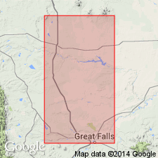
Summary:
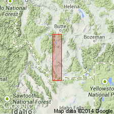
Named as a member of Blackleaf formation of Colorado group for town of Vaughn in sec 24, T21N, R1E, Cascade Co, MT on the Sweetgrass arch. Type section is 3.5 mi to northeast in low south-facing bluffs in NE1/4 sec 6, T21N, R2E and SE1/4 sec 31, T22N, R1E. Is about 97 ft thick at type. Thins to east of type and thickens to west of type. About half the member consists of dull to greenish-gray bentonitic and tuffaceous siltstone characterized by erratic development of heulandite, a brilliant orange-red secondary zeolite called the red speck zone. Individual beds of bentonite and devitrified crystal tuff. Arkosic massive 15 ft thick sandstone bed near base has small sections of petrified wood. Overlies Flood member (new) of Blackleaf unconformably. May interfinger with Taft Hill glauconitic member (new) of Blackleaf, though exact relationship not clear. Is also unconformably overlain by Bottlegger member (new) of Blackleaf on Sweetgrass arch. Is the upper member of Blackleaf at east Glacier-Marias Pass area. Of Early Cretaceous, Albian age. Correlation chart.
Source: GNU records (USGS DDS-6; Denver GNULEX).
- Usage in publication:
-
- Vaughn Member*
- Modifications:
-
- Overview
- Revised
- Reference
- Dominant lithology:
-
- Sandstone
- Tuff
- Claystone
- AAPG geologic province:
-
- Sweetgrass arch
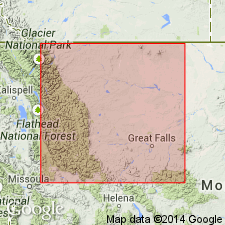
Summary:
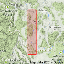
Is third from base of four members of Blackleaf Formation of Colorado Group on Sweetgrass arch considered to be exclusively of continental origin. Transitional beds of marine origin at base at type section removed from Vaughn and placed in underlying Taft Hill Member. Description of measured type section presented. Composite reference section designated (because type is inaccessible) in secs 31 and 32, T22N, R2E to NE cor sec 6, T21N, R2E. Is 25 m thick and overlies Taft Hill Member disconformably and underlies Bootlegger Member of Blackleaf at reference section. Consists at reference of light gray, fine- to medium-grained, massive to cross bedded that is predominantly fine to medium, angular to subangular quartz, olive-gray water-laid tuff, olive gray claystone. Some dark gray, clayey, carbonaceous shale. Top of Vaughn easy to select at change from dark gray shale of Vaughn to light-colored clay or white bentonitic sandstone or lignitic shale of Bootlegger. Thins east; is 7.9 m thick near Belt Butte, sec 30, T19N, R7E. Thickens west; is 114 m in Wolf Creek area. Crops out only on south part of South arch, and in Disturbed belt. Fossil leaves, logs, and reptile bones. Thought to correlate with Newcastle Sandstone of Black Hills. Of late Albian, Early Cretaceous age.
Source: GNU records (USGS DDS-6; Denver GNULEX).
- Usage in publication:
-
- Vaughn Member*
- Modifications:
-
- Overview
- AAPG geologic province:
-
- Montana folded belt
Summary:
Four measured sections of Vaughn described. Two of the sections represent its use in the western area--west of the Ruby River where it is a member of the Blackleaf Formation, above the Flood Member of the Blackleaf and below Frontier Formation. Two of the sections represent its use in the eastern area--east of the Ruby River where it is a member of the Mowry Shale, above the Muddy Sandstone and below the Frontier. The pastel-beds assigned to the Vaughn in this report have been variously assigned to the Colorado Group, Colorado Formation, Mesaverde Formation, Aspen Formation, part of the Colorado and Montana Groups, and Beaverhead? Formation. Correlation chart. Of Albian, Early Cretaceous age.
Source: GNU records (USGS DDS-6; Denver GNULEX).
- Usage in publication:
-
- Vaughn Member*
- Modifications:
-
- Principal reference
- Revised
- Dominant lithology:
-
- Mudstone
- Tuff
- Sandstone
- Shale
- AAPG geologic province:
-
- Montana folded belt
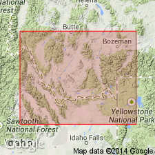
Summary:
Is the upper member of Blackleaf Formation above Flood Member of Blackleaf and beneath Frontier Formation in Snowcrest Range, Lima Peaks, and Pioneer Mountains, Beaverhead Co, MT, Montana folded belt province. In Greenhorn, Madison, Gallatin and Gravelly Ranges, Beartooth and Centennial Mountains, MT, Montana folded belt province, east of axis of Ruby River valley, it is assigned as basal member of Mowry Shale; it unconformably overlies Muddy sandstone and unconformably underlies upper part of Mowry. Consists of nonresistant nonmarine bentonitic mudstone in pastel shades of green, gray, pink, orange, brown. Mainly pastel-colored in west. Entirely pastel-colored in east. Weathered surfaces show popcorn structure. Is missing at Bozeman, thinnest (2.5 m) near McLeod in Beartooths, thickest (271 m) at Lima Peak. Rocks assigned to Vaughn were called Mowry Shale, Colorado Shale or Group, Aspen Formation in earlier reports. Principal reference section designated in W1/2 NE1/4 sec 7, T9S, R4E, Gallatin Co, where it is 82.3 m thick consisting of gray to green bentonitic mudstone, with some gray to orange tuff, orange, very fine to fine grained, thin-bedded, heulandite-bearing sandstone with rip-up clasts, and dark-gray porcellanitic shale. Fossils: palynomorphs, ferns. Age bracketed by Muddy which has a late Albian bivalve and Albian palynomorphs in upper part, Mowry. Of late Albian. Stratigraphic chart. Floodplain or marsh deposit.
Source: GNU records (USGS DDS-6; Denver GNULEX).
- Usage in publication:
-
- Vaughn Member*
- Modifications:
-
- Age modified
- Overview
- AAPG geologic province:
-
- Montana folded belt
Summary:
Is upper member of Blackleaf Formation in eastern Pioneer Mountains and Lima Peaks areas, Beaverhead Co, MT, Montana folded belt province. Overlies Flood Member of Blackleaf. Unconformably underlies Frontier Formation in Lima Peaks area. Unconformably underlies unnamed Cretaceous rocks in eastern Pioneer Mountains. Contains the first significant amount of volcanic detritus found in Blackleaf. Lithology of member at Lima Peaks includes abundant pastel beds. In eastern Pioneers, porcelanitic mudstones and tuffs are abundant. Ranges from 899 to 2890 ft thick in area; thickens northward. Base placed at base of olive-green nonvolcanic mudstone. Top placed at base of salt-and-pepper sandstone of Frontier at Lima Peaks. Top placed provisionally at top of porcelanite that overlies the highest maroon mudstone beneath the unnamed Cretaceous in eastern Pioneers. Freshwater clam, gastropod fragments, palynomorphs, seed ferns identified, though none are age diagnostic. Is equivalent to upper part of Colorado Group of Zen (1988). Correlation chart. Age changed from Albian, Early Cretaceous to early Cenomanian, Late Cretaceous on basis of correlation with Mowry Shale whose age has been modified to early Cenomanian? (Cobban, Kennedy, 1989, USGS Bull. 1787-L). Measured sections.
Source: GNU records (USGS DDS-6; Denver GNULEX).
- Usage in publication:
-
- Vaughn Member*
- Modifications:
-
- Areal extent
- AAPG geologic province:
-
- Montana folded belt
Summary:
Extended into area of Drummond, Granite Co, MT, Montana folded belt province. Is uppermost member of Blackleaf Formation. Blackleaf was divided into, ascending, Flood Shale, Taft Hill, and Dunkleberg Members by Gwinn (1961, Montana Bureau of Mines and Geology Special Publication 21). Mapping by Wallace and others (1986, USGS Open-File Report 86-292) showed some of rocks grouped with Taft Hill by Gwinn belong in lower part of Vaughn Member, conglomerate and sandstone at base of Dunkleberg are medial sandstone and conglomerate of Vaughn, and Taft Hill is commonly absent below Vaughn. Dunkleberg not used in this report. Marker units within Vaughn include medial sandstone and conglomerate and lapilli tuff zones in upper part. Vaughn and its medial sandstone and conglomerate marker bed have been traced to near Anaconda, MT, about 55 km southeast of Drummond. Stratigraphic columns. Assigned early Cenomanian age.
Source: GNU records (USGS DDS-6; Denver GNULEX).
- Usage in publication:
-
- Vaughn Member*
- Modifications:
-
- Geochronologic dating
- AAPG geologic province:
-
- Montana folded belt
Summary:
Zircons from two porcellanite beds about 210 m and 170 m below top of Vaughn Member of Blackleaf Formation yielded precise U-Pb ages of 96.9 +/-0.3 Ma and 96.2 +/-0.4 Ma, respectively. Another bed 25 m below top of Vaughn was less precisely dated at 93-95 Ma. Study area is within eastern Pioneer Mountains, Montana folded belt province. Eighty mi north of Pioneer Mountains, near Drummond, a fourth porcellanite bed 255 m below top of Vaughn yielded an age of 95.4 +/-0.4 Ma. Thus, upper nonmarine part of Vaughn is assigned an early to middle Cenomanian (Late Cretaceous) age. Correlation chart from Lima to Drummond, MT.
Source: GNU records (USGS DDS-6; Denver GNULEX).
For more information, please contact Nancy Stamm, Geologic Names Committee Secretary.
Asterisk (*) indicates published by U.S. Geological Survey authors.
"No current usage" (†) implies that a name has been abandoned or has fallen into disuse. Former usage and, if known, replacement name given in parentheses ( ).
Slash (/) indicates name conflicts with nomenclatural guidelines (CSN, 1933; ACSN, 1961, 1970; NACSN, 1983, 2005, 2021). May be explained within brackets ([ ]).