The National Geologic Map Database is migrating to a new infrastructure. We apologize for any service disruptions during this process.
|
|---|


- Usage in publication:
-
- Twin Creek formation*
- Modifications:
-
- Original reference
- Dominant lithology:
-
- Shale
- Limestone
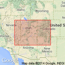
- AAPG geologic province:
-
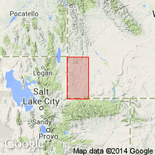
- Green River basin
Summary:
Pg. 56+, chart opp. p. 50, map, etc. Twin Creek formation. Black and gray calcareous shales and thin-bedded shaly limestones with occasional beds of yellow sandstone. Thickness in southwestern Wyoming 3,500 to 3,800 feet. Abundant marine Jurassic fauna [listed, identified by T.W. Stanton, USGS, see p. 56, 57, pl. 6]. Conformably underlies Beckwith formation and conformably overlies Nugget formation. [Age is Late Jurassic.]
Named from excellent exposures on Twin Creek, between Sage and Fossil, southwestern WY.
Source: US geologic names lexicon (USGS Bull. 896, p. 2203).
- Usage in publication:
-
- Twin Creek limestone*
- Modifications:
-
- Areal extent
Summary:
Pg. 3. Typical Twin Creek limestone of southwestern Wyoming is considered = Carmel formation. [Age is Late Jurassic.]
Source: US geologic names lexicon (USGS Bull. 896, p. 2203).
- Usage in publication:
-
- Twin Creek Limestone*
- Modifications:
-
- Revised
- AAPG geologic province:
-
- Green River basin
Summary:
Divided in Greater Green River basin into Gypsum Spring Member at base and an unnamed upper part. Gypsum Spring is extended into map area, reduced in stratigraphic rank from formation, and is applied to rocks formerly called member A by Imlay (1950). Name Gypsum Spring applied to the brick-red mudstone and light-gray limestone breccia. The upper part is a thin-bedded, locally sandy, dark-gray, argillaceous limestone, calcareous siltstone, and calcareous claystone. The upper part also has some massive, oolitic and coquinoid limestone. Overall age is Middle and Late Jurassic. Epoch boundary falls within the upper part.
Source: GNU records (USGS DDS-6; Denver GNULEX).
- Usage in publication:
-
- Twin Creek Limestone*
- Modifications:
-
- Revised
- AAPG geologic province:
-
- Green River basin
- Snake River basin
- Yellowstone province
- Uinta basin
- Wasatch uplift
- Uinta uplift
Summary:
Crops out over an extensive area from Teton Co, WY in the Yellowstone province west to eastern ID, Bingham Co in Snake River basin and south through western WY, Greater Green River basin into UT in Uinta uplift and Uinta basin west to Wasatch uplift. Divided into seven members (ascending): Gypsum Spring, Sliderock (new), Rich (new), Boundary Ridge (new), Watton Canyon (new), Leeds Creek (new) and Giraffe Creek (new) Members. Thickens westward from 665 ft in northwest WY to 2,720 ft in eastern ID and from 440 ft in Uinta Mountains, UT to 2,850 ft near Salt Lake City, UT. Characterized by thick sequences of gray shaly limestone of marine origin that weathers into long splinters and forms conspicuous barren slopes. Overlies Nugget Sandstone. Underlies Preuss Sandstone. Is not very fossiliferous, but has a varied fauna (pelecypods, cephalopods). Correlation chart. Cross sections. Faunal lists. Of Bajocian, Bathonian and Callovian age, or Middle and Late Jurassic.
Source: GNU records (USGS DDS-6; Denver GNULEX).

- Usage in publication:
-
- Twin Creek Limestone*
- Modifications:
-
- Age modified
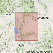
- AAPG geologic province:
-
- Snake River basin
- Yellowstone province
- Wasatch uplift
- Uinta uplift
- Uinta basin
Summary:
Exposed along the WY-ID border in area of thrust faulting east to Teton Co, WY and south to Monks Hollow, sec 32, T4S, R5E and sec 5, T5S, R5E, Utah Co, UT. Divided into seven members: Gypsum Spring (base), Sliderock, Rich, Boundary Ridge, Watton Canyon, Leeds Creek, and Giraffe Creek (top) Members. Gypsum Spring is of formation rank in Teton Co, WY. Sliderock, Rich, Boundary Ridge and Watton Canyon wedge out between Lake Fork and Vernal, UT. Measured section. Correlation charts show thickness and lithology as well as correlation of Twin Creek with the Sundance, Carmel, and Arapien Formations. Ranges from 285 ft thick at Burr Fork, Salt Lake Co, UT to 2,278 ft thick in southeast ID. Occurs in Snake River basin, ID, Yellowstone province, WY, and in Wasatch uplift, Uinta uplift and Uinta basin, UT. Age changed from Middle and Late Jurassic (Bajocian, Bathonian, and Callovian) to Middle Jurassic (Bajocian, Bathonian and Callovian). Callovian Stage removed from Late Jurassic Epoch and reassigned to the Middle Jurassic Epoch.
Source: GNU records (USGS DDS-6; Denver GNULEX).
- Usage in publication:
-
- Twin Creek Limestone*
- Modifications:
-
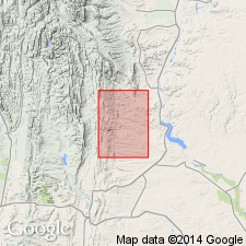
- Areal extent
- AAPG geologic province:
-
- Wasatch uplift
Summary:
Beds chiefly of carbonate have been identified in Red Canyon, near Nephi, eastern Juab Co., and in subsurface nearby beneath Arapien Shale and above the Navajo Sandstone. These carbonate beds have been assigned to Arapien Shale by some. Arapien therefore rests on Twin Creek rather than Navajo Sandstone as previously thought.
Source: GNU records (USGS DDS-6; Denver GNULEX).
- Usage in publication:
-
- Twin Creek Limestone*
- Modifications:
-
- Areal extent
Summary:
Carbonate rocks between Navajo Sandstone (below) and predominantly mudstone and evaporites of Arapien Shale (above) are assigned to lower five members of Twin Creek (Gypsum Spring, Sliderock, Rich, Boundary Ridge, and Watton Canyon Members, in ascending order) from about data point 11 (NE/4 SE/4 sec. 13, T. 5 S., R. 12 W., Wasatch Co, UT), southward to about data point 27 (USGS I-1631) over an area that includes Utah and Sanpete Cos (Wasatch uplift), Juab Co (Great Basin province), and Emery Co, (Paradox basin). Upper two members of Twin Creek (Leeds Creek and Giraffe Creek Members, in ascending order) are correlative to Arapien Shale between data points 7 (USGS GQ-852, 864) and 8 (NW/4 NW/4 sec. 5, T. 5 S., R. 5 E.), Wasatch Co, UT, Uinta basin. From data point 27 eastward to end of section in Emery Co, lower part of Carmel Formation is used rather than Twin Creek. Middle Jurassic age.
Source: GNU records (USGS DDS-6; Denver GNULEX).
- Usage in publication:
-
- Twin Creek Limestone*
- Modifications:
-
- Areal extent
- AAPG geologic province:
-
- Wasatch uplift
Summary:
Limestone beds beneath the Arapien Shale and above the Navajo Sandstone are considered equivalent to the lower 5 members of the Twin Creek--the Gypsum Spring, Sliderock, Rich, Boundary Ridge, and Watton Canyon. Some geologists have included these limestones in the Arapien; this author assigns them to the Twin Creek. These beds also thought to be equivalent to the Carmel Formation. Of Middle Jurassic (Bajocian and Bathonian) age. Presence of a younger part of Twin Creek in this part of central UT (Thistle to Richfield, Wasatch uplift) uncertain because these rocks not exposed. Assignment of the limestone beds beneath Arapien modifies areal limits of Twin Creek as many earlier workers, where they have not recognized Twin Creek, have shown Arapien resting on Navajo Sandstone. Stratigraphic charts, cross sections, geologic maps.
Source: GNU records (USGS DDS-6; Denver GNULEX).
For more information, please contact Nancy Stamm, Geologic Names Committee Secretary.
Asterisk (*) indicates published by U.S. Geological Survey authors.
"No current usage" (†) implies that a name has been abandoned or has fallen into disuse. Former usage and, if known, replacement name given in parentheses ( ).
Slash (/) indicates name conflicts with nomenclatural guidelines (CSN, 1933; ACSN, 1961, 1970; NACSN, 1983, 2005, 2021). May be explained within brackets ([ ]).