

- Usage in publication:
-
- Tradewater formation
- Modifications:
-
- Named
- Dominant lithology:
-
- Shale
- Sandstone
- AAPG geologic province:
-
- Illinois basin
Summary:
Tradewater formation, here introduced, consists chiefly of shale with occasional inconstant sandstone beds, 175-700 ft thick in Webster Co., KY. Includes coal No. 5 near top and Bell coal near base. Unconformably underlies Pennsylvanian DeKoven formation and overlies Caseyville conglomerate. Age is Pennsylvanian.
Source: GNU records (USGS DDS-6; Reston GNULEX).

- Usage in publication:
-
- Tradewater formation*
- Modifications:
-
- Revised
- AAPG geologic province:
-
- Illinois basin
Summary:
Tradewater formation of Pottsville group. Top formation of Pottsville group in western Kentucky and southeastern Illinois [according to Wallace Lee, 1916 (Geology of the Shawneetown quadrangle, Illinois-Kentucky, Kentucky Geol. Survey, 73 p.). Underlies Carbondale formation and overlies Caseyville sandstone. Age is Pennsylvanian.
Named from exposures along Tradewater River east of Battery Rock, western KY.
Source: US geologic names lexicon (USGS Bull. 896, p. 2175); supplemental information from GNU records (USGS DDS-6; Reston GNULEX).

- Usage in publication:
-
- Tradewater group
- Modifications:
-
- Revised
- AAPG geologic province:
-
- Illinois basin
Summary:
Tradewater group, formerly called upper Pottsville, is known from outcrops in southern, western, and northern IL. Top of group in southern and western IL is placed at base of Palzo and Isabel sandstones. Base in southern IL is at base of Grindstaff sandstone. Beds from the Tarter to base of Carbondale have been placed in Tradewater group. Maximum thickness 445 ft, southern IL; 100 ft, western IL; possibly as much as 600 ft in central IL. Group includes a number of sandstones, shales, coal beds, and two marine limestones, the Stonefort and Curlew in southern IL, and the Seville and Seahorne limestones in eastern IL. Overlies Caseyville group; underlies Carbondale group.
Source: GNU records (USGS DDS-6; Reston GNULEX).
- Usage in publication:
-
- Tradewater group
- Modifications:
-
- Revised
- AAPG geologic province:
-
- Illinois basin
Summary:
Tradewater group in Beardstown, Glasford, Havana, and Vermont quads. divided into pre-Babylon strata (at base) and the Babylon, Tarter, Pope Creek, Lower DeLong, Middle DeLong, Upper DeLong, Seahorne, Wiley, and Greenbush cyclothems. Underlies Carbondale group. Pre-Babylon strata conform in position to knobs or other projections of the Mississippian surface and locally may fill solution cavities.
Source: GNU records (USGS DDS-6; Reston GNULEX).

- Usage in publication:
-
- Tradewater formation
- Modifications:
-
- Areal extent
- Revised
- AAPG geologic province:
-
- Illinois basin
Summary:
Name Tradewater discontinued in IL. Lower part of Tradewater included in McCormick group (new) and upper part in Kewanee group (new). [Presumed name is still valid in KY.]
Source: GNU records (USGS DDS-6; Reston GNULEX).

- Usage in publication:
-
- Tradewater Formation*
- Modifications:
-
- Overview
- AAPG geologic province:
-
- Illinois basin
Summary:
The USGS uses the term Tradewater Formation in KY, but has discontinued use of the term Pottsville Group in KY.
Source: GNU records (USGS DDS-6; Reston GNULEX).
- Usage in publication:
-
- Tradewater Formation
- Modifications:
-
- Areal extent
- Revised
- AAPG geologic province:
-
- Illinois basin
Summary:
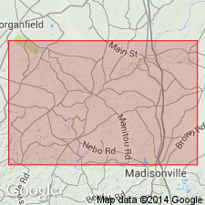
Tradewater Formation in the Goreville quad. is subdivided into two informal mapping units, the lower Tradewater and the upper. These two units were mapped originally as the Abbott and Spoon Formations, but this earlier nomenclature was abandoned midway through the COGEOMAP project. The term Tradewater was adopted from KY and applied to this interval of rocks in IL as part of an agreement with the IN and KY Surveys to standardize Pennsylvanian terminology in the Illinois basin. The top of the lower Tradewater is mapped as the top of the Murray Bluff Sandstone Member (a correlative of the Bernadotte Sandstone Member of Willman, 1975). The remainder of the lower Tradewater is subdivided into the ascending informal Ferne Clyffe member, Cedar Creek sandstone lentil, and Lake of Egypt member. The Reynoldsburg Coal Bed is near the base of the Ferne Clyffe. The informal Bethlehem sandstone lentil occupies the approximate middle of the upper Tradewater. Unit unconformably underlies Quaternary strata and overlies the Pound Sandstone Member of the Caseyville Formation. Tradewater is Middle Pennsylvanian (Morrowan, Atokan, and Desmoinesian). [Morrowan here considered Early and Middle Pennsylvanian.]
Source: GNU records (USGS DDS-6; Reston GNULEX).

- Usage in publication:
-
- Tradewater Formation*
- Modifications:
-
- Revised
- Overview
- AAPG geologic province:
-
- Illinois basin
Summary:
Tradewater Formation replaces Pottsville and Spoon Formations in western IL [following usage of Weibel and others (1991, Geologic map of the Waltersburg quadrangle, Pope County, Illinois: Illinois Geologic Quadrangle Map IGQ-8)].
Source: GNU records (USGS DDS-6; Reston GNULEX).
- Usage in publication:
-
- Tradewater Formation
- Modifications:
-
- Revised
- Dominant lithology:
-
- Shale
- Siltstone
- Sandstone
- AAPG geologic province:
-
- Illinois basin
Summary:
Pg. 2 (fig. 1), 6-8, pl. 1. Tradewater Formation of Raccoon Creek Group. Recognized in Illinois and Kentucky. Consists of 70 to 80 percent shale and siltstone, 20 to 30 percent sandstone, and generally <5 percent coal and limestone. Sandstones more abundant in lower part. Modified from Lee (1916, Geol. Shawneetown quadrangle, Kentucky Geol. Survey, 4th ser., v. 4, pt. 2). Interval from top of Caseyville Formation to base of the Seelyville Coal Member, or Davis Coal Member (Davis coal bed), of Carbondale Formation. Recent mapping in southern Illinois in type area of Abbott Formation has documented lateral facies changes which have led to miscorrelations in the past and which have rendered differentiation of the Spoon and Abbott Formations impractical in many areas (Nelson and others, 1991, Illinois State Geol. Survey Bull., no. 96; Jacobson, 1992, Illinois State Geol. Survey Bull., no. 97). Usage of †Abbott and †Spoon Formations are therefore abandoned and the Tradewater Formation of western Kentucky (has priority) is reintroduced into Illinois. Tradewater is not extended into Indiana at this time because the boundary between the Caseyville and Tradewater Formations has not been identified and mapped in Indiana. The Tradewater is equivalent to the upper part of the Mansfield Formation and the entire Brazil and Staunton Formations in Indiana. Age is Early to Middle Pennsylvanian (Morrowan to Desmoinesian). Classification proposed in this report agreed upon by State Geological Surveys of Illinois, Indiana, and Kentucky. Report includes correlation chart, history of nomenclature.
Source: Publication.
For more information, please contact Nancy Stamm, Geologic Names Committee Secretary.
Asterisk (*) indicates published by U.S. Geological Survey authors.
"No current usage" (†) implies that a name has been abandoned or has fallen into disuse. Former usage and, if known, replacement name given in parentheses ( ).
Slash (/) indicates name conflicts with nomenclatural guidelines (CSN, 1933; ACSN, 1961, 1970; NACSN, 1983, 2005, 2021). May be explained within brackets ([ ]).