The National Geologic Map Database is migrating to a new infrastructure. We apologize for any service disruptions during this process.
|
|---|


- Usage in publication:
-
- Teckla sand member
- Modifications:
-
- Named
- Dominant lithology:
-
- Sandstone
- Shale
- Bentonite
- AAPG geologic province:
-
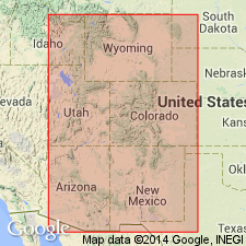
- Powder River basin
Summary:
Named as a member of the Lewis shale for the Teckla Post Office, southwest Campbell Co, WY. Type section is the interval between 5,158 and 6,014 ft in Gulf Oil Co. No. 1 Government Teckla in SE1/4 SE1/4 sec 10, T41N, R70W. Is mappable over a 1,600 sq mi area and is limited to subsurface of Powder River basin. Is overlain and underlain by unnamed shale members of the Lewis. The lower shale is dark gray to black; the upper shale is gray, tan, buff. Is divided into a lower sand, "Kara bentonitic shale" [bed], upper sand. The lower sand is about 44 ft thick and has 25 to 40 percent quartz, 10 to 15 percent chert, 10 to 15 percent potassium feldspar, 10 to 15 percent plagioclase, minor glauconite, biotite, muscovite. The Kara is about 38 ft thick and is composed of dark-gray shale, bentonitic shale, bentonite, and shaly bentonite. Kara is assigned to Pierre shale in the Red Bird area. The upper sand is gray, very fine grained, calcareous sandstone 30 ft thick. The top of the Teckla is about 414 ft below the top of the Lewis. Correlation chart. E-log diagrams. Of marine origin. A subarkose in composition Teckla has ammonites of latest Campanian age.
Source: GNU records (USGS DDS-6; Denver GNULEX).

- Usage in publication:
-
- Teckla Sandstone Member*
- Modifications:
-
- Areal extent
- AAPG geologic province:
-
- Powder River basin
Summary:
Identified as the middle member of the Lewis Shale in the subsurface of the western Powder River basin in Johnson, Sheridan, western Campbell, Converse, and Niobrara Cos, WY. Tongues out eastward into an undivided upper part of Pierre Shale. Overlies and underlies unnamed parts of Lewis. Of Late Cretaceous age. [Identified on several cross sections in this OC series.]
Source: GNU records (USGS DDS-6; Denver GNULEX).
For more information, please contact Nancy Stamm, Geologic Names Committee Secretary.
Asterisk (*) indicates published by U.S. Geological Survey authors.
"No current usage" (†) implies that a name has been abandoned or has fallen into disuse. Former usage and, if known, replacement name given in parentheses ( ).
Slash (/) indicates name conflicts with nomenclatural guidelines (CSN, 1933; ACSN, 1961, 1970; NACSN, 1983, 2005, 2021). May be explained within brackets ([ ]).