

- Usage in publication:
-
- Taft Hill glauconitic member*
- Modifications:
-
- Named
- Dominant lithology:
-
- Siltstone
- Sandstone
- Shale
- AAPG geologic province:
-
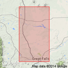
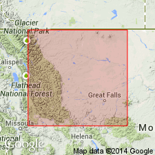
- Sweetgrass arch
Summary:
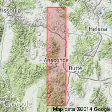
Named as a middle member of Blackleaf formation of Colorado group for exposures on east slope of Taft Hill, Cascade Co, MT on the Sweetgrass arch. Type section is a composite from four localities between east face of Taft Hill and a point 5 mi east (secs 25 and 36, T21N, R1E and secs 1 and 12, T20N, R1E, and secs 2, 11 and 9, T20N, R2E. Is about 240 ft thick. Includes several lithic types: gray bentonitic siltstone, 48 percent; sandstone, 32 percent, non-bentonitic marine shale and siltstone, 20 percent. Most diagnostic feature is a widespread 30 ft thick massive greenish-gray impure glauconitic sandstone. A few other thin glauconitic sandstone occur. May interfinger with Vaughn bentonitic member (new) of Blackleaf. Overlies Flood member (new) of Blackleaf. Underlies Vaughn member. Of Early Cretaceous, Albian age. Correlation chart.
Source: GNU records (USGS DDS-6; Denver GNULEX).
- Usage in publication:
-
- Taft Hill Member*
- Modifications:
-
- Overview
- Reference
- Revised
- Dominant lithology:
-
- Sandstone
- Shale
- Bentonite
- AAPG geologic province:
-
- Sweetgrass arch
Summary:
Is second from base of four members of Blackleaf Formation of Colorado Group on Sweetgrass arch. Crops out on southern part of South arch and in Disturbed belt. Deposited as a shelf deposit of neritic zone of the first Lower Cretaceous transgression. Detailed description of measured type section. Composite reference section designated and measured in S1/2 sec 36 and 19, T21N, R2E, Cascade Co, MT where it overlies Flood Member and is overlain by Pleistocene gravels. Transitional beds of marine origin formerly part of overlying Vaughn reassigned to Taft Hill. The three units at reference section total 31 m. Lower unit consists of gray, fine- to medium-grained sandstone (some beds are conglomeratic, calcareous, cherty, glauconitic and/or friable), olive-gray sandy clay, dark gray shale, gray bentonite, light gray tuff, and dark gray siltstone. Local transitional beds of marine origin at base at type section removed from Vaughn and placed in Taft Hill Member. Middle unit consists of olive-gray, fine- to medium-grained sandstone (some beds are calcareous, glauconitic, and thinly laminated), bentonite, tuff, gray siltstone, sandy clay, and olive-gray shale. Upper unit consists of gray siltstone and gray bentonite. Predominant lithologies are sandstone and shale. Thickens west. Contains a marine late Albian, Early Cretaceous fauna (gastropods, brachiopods, bivalves).
Source: GNU records (USGS DDS-6; Denver GNULEX).
- Usage in publication:
-
- Taft Hill Member*
- Modifications:
-
- Not used
Summary:
Taft Hill Member of the Blackleaf Formation not recognized in southwest MT, Montana folded belt province, by authors.
Source: GNU records (USGS DDS-6; Denver GNULEX).
- Usage in publication:
-
- Taft Hill Member*
- Modifications:
-
- Areal extent
- AAPG geologic province:
-
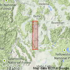
- Montana folded belt
Summary:
Lithologies of Taft Hill or Bootlegger Members of Blackleaf Formation not recognized in study area which extends from Lima Peaks area to eastern Pioneer Mountains, MT, Montana folded belt province. Here Blackleaf consists of Flood and Vaughn Members.
Source: GNU records (USGS DDS-6; Denver GNULEX).
- Usage in publication:
-
- Taft Hill Member*
- Modifications:
-
- Areal extent
- AAPG geologic province:
-
- Montana folded belt
Summary:
Recognized as middle member of Blackleaf Formation in Flint Creek Range, Granite and Powell Cos, MT, Montana folded belt province. Here consists of thin, flat to rippled beds of tan to gray lithic- and quartz-rich sandstone with interbeds of mudstone, siltstone and shale; interbedded with silty shales from a few ft to tens of ft thick; no conglomerate present. Overlies Flood Member of Blackleaf; underlies Vaughn Member of Blackleaf. Unit is lithic equivalent of upper clastic unit of Flood Member in eastern Pioneer Mountains. Taft Hill is 520 ft thick at Barnes Creek (about 8 mi south of Drummond). Unit is absent in eastern Pioneer Mountains and at Drummond. Cross section; correlation chart. Late Albian (Early Cretaceous) age.
Source: GNU records (USGS DDS-6; Denver GNULEX).
For more information, please contact Nancy Stamm, Geologic Names Committee Secretary.
Asterisk (*) indicates published by U.S. Geological Survey authors.
"No current usage" (†) implies that a name has been abandoned or has fallen into disuse. Former usage and, if known, replacement name given in parentheses ( ).
Slash (/) indicates name conflicts with nomenclatural guidelines (CSN, 1933; ACSN, 1961, 1970; NACSN, 1983, 2005, 2021). May be explained within brackets ([ ]).