

- Usage in publication:
-
- Sunset division
- Modifications:
-
- Named
- Dominant lithology:
-
- Limestone
- AAPG geologic province:
-
- Cincinnati arch
Summary:
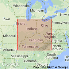
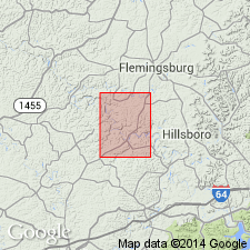
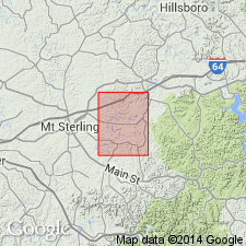
Named Sunset division of Arnheim bed for Sunset, Fleming Co, KY. Composed of poorly fossiliferous argillaceous limestone.
Source: GNU records (USGS DDS-6; Reston GNULEX).
- Usage in publication:
-
- Sunset Member
- Modifications:
-
- Not used
- AAPG geologic province:
-
- Cincinnati arch
Summary:
Name considered inappropriate in south-central KY. Most of what is herein call Terrill Member of Arnheim Formation was referred to as Sunset Member of Arnheim by Foerste (1910).
Source: GNU records (USGS DDS-6; Reston GNULEX).
- Usage in publication:
-
- Sunset Member*
- Modifications:
-
- Revised
- AAPG geologic province:
-
- Cincinnati arch
Summary:
Sunset division of Arnheim bed (Foerste, 1910) changed in rank to Sunset Member and assigned to Bull Fork Formation. Unit is restricted to micrograined limestone and interbedded shale similar to that cropping out near Sunset, Fleming Co, KY. Occurs at base of Bull Fork where it overlies the Grant Lake Limestone. Adopted for use by USGS.
Source: GNU records (USGS DDS-6; Reston GNULEX).
- Usage in publication:
-
- Sunset Member*
- Modifications:
-
- Revised
- AAPG geologic province:
-
- Cincinnati arch
Summary:
Sunset Member (Bull Fork Formation) reassigned to Ashlock Formation for use in Preston quad, Fleming Co, KY, only.
Source: GNU records (USGS DDS-6; Reston GNULEX).
- Usage in publication:
-
- "Sunset"
- Modifications:
-
- Overview
- AAPG geologic province:
-
- Cincinnati arch
Summary:
The Cincinnatian Series is divided into five depositional sequences in this report, which correspond to lithostratigraphic units. The following stratigraphic names in KY should be abandoned as they have been applied to bodies of rock already named in downramp areas of OH and IN: Bardstown (=Lower Whitewater), Reba (=Oregonia), Stingy Creek (=Mount Auburn), Calloway Creek (=Bellevue), and Clays Ferry (=Fairview). The following units in KY, OH, and IN lump dissimilar facies and straddle sequence boundaries and therefore should be abandoned: Drakes, Ashlock, Dillsboro, Tanners Creek, and Bull Fork. Grant Lake has been defined in several different ways and consequently should be abandoned. Several units will be redefined at a later date, including the Upper Whitewater and the "Sunset" and "Saluda" of OH and IN. Formal naming of new lithostratigraphic units will follow further study.
Source: GNU records (USGS DDS-6; Reston GNULEX).
For more information, please contact Nancy Stamm, Geologic Names Committee Secretary.
Asterisk (*) indicates published by U.S. Geological Survey authors.
"No current usage" (†) implies that a name has been abandoned or has fallen into disuse. Former usage and, if known, replacement name given in parentheses ( ).
Slash (/) indicates name conflicts with nomenclatural guidelines (CSN, 1933; ACSN, 1961, 1970; NACSN, 1983, 2005, 2021). May be explained within brackets ([ ]).