- Usage in publication:
-
- Summitville andesite
- Modifications:
-
- Original reference
- Dominant lithology:
-
- Andesite
- Breccia
- AAPG geologic province:
-
- San Juan basin
- San Juan Mountains province
- San Luis basin
Summary:
(E.S. Larsen's 1917 provisional and field names for Summitville quadrangle), p. 20, 35-38. Summitville andesite of Potosi volcanic series. Augite andesite flows and interbedded breccias and agglomerates of like material. Thickness, 2,400+ feet. Included in Potosi volcanic series of Platoro-Summitville quadrangle. Probably belongs to Sheep Mountain formation. Underlies Alboroto formation and overlies Treasure Mountain latite. [Age is Miocene.]
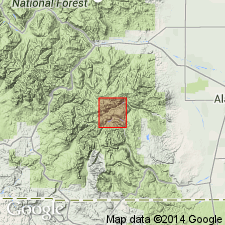
Named from extensive development in vicinity of Summitville, Rio Grande Co., southwestern CO.
Source: US geologic names lexicon (USGS Bull. 896, p. 2085).

- Usage in publication:
-
- Summitville andesite†
- Modifications:
-
- Abandoned
- AAPG geologic province:
-
- San Juan Mountains province
Summary:
[†Summitville andestie abandoned. E.S. Larsen proved that the rocks around Summitville underlie, instead of overlie, Treasure Mountain latite, and that they belong to Conejos andesite. He therefore abandoned "Summitville," and applied Sheep Mountain andesite to the rocks underlying Alboroto quartz latite and overlying Treasure Mountain latite.]
Source: US geologic names lexicon (USGS Bull. 896, p. 2085).

- Usage in publication:
-
- Summitville Andesite*
- Modifications:
-
- Reinstated
- AAPG geologic province:
-
- San Luis basin
Summary:
Reinstated and applied to a thick, local (about 500 sq km) assemblage of dark, sparsely porphyritic lavas and related rocks that accumulated within the Platoro caldera complex after its collapse. Occurs in Rio Grande Co, CO in the San Luis basin. Patton (1917) was correct in noting the equivalence of Summitville to Sheep Mountain elsewhere in the San Juan field. A lower member defined as including andesitic lavas and related rocks in and near the Platoro caldera that are younger than Las Jara Canyon Member of Treasure Mountain Tuff and older than Ojito Creek Member of treasure Mountain. The upper member includes lavas in and near the Summitville caldera that are younger than Ojito Creek and older than Masonic Park Tuff. Formerly part of Potosi; term Potosi not used. Lower member is 29.8 m.y. old. Upper member intruded by 29.1 m.y. Alamosa River stock. Poorly preserved carbonized plant remains of Florissant, Creede, or Oligocene, probably late Oligocene found in intracaldera sedimentary rocks in several places.
Source: GNU records (USGS DDS-6; Denver GNULEX).
For more information, please contact Nancy Stamm, Geologic Names Committee Secretary.
Asterisk (*) indicates published by U.S. Geological Survey authors.
"No current usage" (†) implies that a name has been abandoned or has fallen into disuse. Former usage and, if known, replacement name given in parentheses ( ).
Slash (/) indicates name conflicts with nomenclatural guidelines (CSN, 1933; ACSN, 1961, 1970; NACSN, 1983, 2005, 2021). May be explained within brackets ([ ]).

