The National Geologic Map Database is migrating to a new infrastructure. We apologize for any service disruptions during this process.
|
|---|


- Usage in publication:
-
- Straight Creek Member
- Modifications:
-
- Named
- Dominant lithology:
-
- Limestone
- Shale
- AAPG geologic province:
-
- Cincinnati arch
Summary:
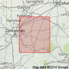
Informal Straight Creek member of Schumacher and others (1987) is here given formal status as upper member of Grant Lake Limestone in southern OH. A composite type section is designated. Grant Lake Limestone and Grant Lake Formation (of the informal Cincinnati group) are adopted by the Ohio Geological Survey for southwestern OH. The shale content of the Grant Lake Limestone progressively increases between Maysville, KY, and Cincinnati, OH. The term Grant Lake Formation is used where the unit becomes predominantly shale. The Grant Lake Formation is divided into (ascending) Bellevue, Corryville, and Mount Auburn Members. Name is applied in Butler, Hamilton, and Warren Cos. and in portions of Brown, Clermont, and Clinton Cos. The Grant Lake Limestone is divided into the Bellevue, Corryville, and Straight Creek Members. Name is applied in Adams and Highland Cos. and in portions of Brown, Clermont, and Clinton Cos. The Straight Creek is characterized by interbedded, wavy- to irregular-bedded limestone and irregular-bedded, fissile-parted, fossiliferous shale. Mean shale percentage ranges from 12 to 50 percent. Thickness ranges from a maximum of 8+ m near Maysville, KY, to <6 m in Clermont Co., OH. Lateral contact with the Mount Auburn Member is gradational. The transitional zone between the two members winds from southeastern Clinton Co. to southeastern Clermont Co. The laterally equivalent members are differentiated from each other by mean shale percentage and limestone bedding styles. The Straight Creek underlies the informal Bull Fork or Arnheim formations.
Source: GNU records (USGS DDS-6; Reston GNULEX).
For more information, please contact Nancy Stamm, Geologic Names Committee Secretary.
Asterisk (*) indicates published by U.S. Geological Survey authors.
"No current usage" (†) implies that a name has been abandoned or has fallen into disuse. Former usage and, if known, replacement name given in parentheses ( ).
Slash (/) indicates name conflicts with nomenclatural guidelines (CSN, 1933; ACSN, 1961, 1970; NACSN, 1983, 2005, 2021). May be explained within brackets ([ ]).