The National Geologic Map Database is migrating to a new infrastructure. We apologize for any service disruptions during this process.
|
|---|


- Usage in publication:
-
- St. Louis group
- Modifications:
-
- Revised
- AAPG geologic province:
-
- Illinois basin
- Ozark uplift
Summary:
Revised in that St. Louis underlies newly named Aux Vases sandstone of Kaskaskia group (revised). Aux Vases occurs in southern IL, Illinois basin and southeastern MO, Ozark uplift. Overlies Osage group. Mississippian age.
Source: GNU records (USGS DDS-6; Denver GNULEX).

- Usage in publication:
-
- St. Louis limestone*
- Modifications:
-
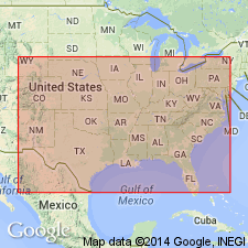
- Areal extent
- AAPG geologic province:
-
- Anadarko basin
Summary:
Extended into the subsurface of Baca County, Colorado, in the Anadarko basin. Composed mostly of buff, oolitic to brown, dense, thick-bedded limestone, and cream-colored finely granular dolomite and dolomitic limestone. Is 140 feet thick. Overlies Spergen limestone and underlies Ste. Genevieve limestone. Age is Late Mississippian (Meramecian). Report includes correlation chart.
Source: Modified from GNU records (USGS DDS-6; Denver GNULEX).
- Usage in publication:
-
- St. Louis Formation
- Modifications:
-
- Revised
- AAPG geologic province:
-
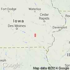
- Iowa shelf
Summary:
St. Louis Formation in southeast IA divided [by McKay] into the following members (ascending): Croton, Verdi, and Waugh (newly named). Descriptions of members given at several localities in Keokuk Co at Showman Station Quarry and roadcut (p. 55-59), Kessel property (p. 60-65), Waugh Branch roadcut (p. 67-71), and Taylor Quarry (p. 72-73). Overlies Warsaw Shale unconformably. Underlies Pella Formation. The Croton is probably a shallow marine reworked sand transported to area by a fluvial system. The Verdi was deposited during a shallowing-upward marine, to shallow restricted marine, and a nearshore to shoreface environment. Representatives of fluvial, marginal marine, deltaic and lagoonal deposits found in the Waugh. Fossils (brachiopods, bryozoans, trilobites, bivalves, solitary rugose and tabulate corals, conodonts, ostracodes, fish teeth and scales, tetrapods, root casts) listed as to their occurrence within members of St. Louis. Cross sections. Of Mississippian age.
Source: GNU records (USGS DDS-6; Denver GNULEX).
- Usage in publication:
-
- St. Louis Limestone
- Modifications:
-
- Overview
- AAPG geologic province:
-
- Illinois basin
Summary:
Blue River Group of IN revised in this report. Supersedes State nomenclature established by Shaver and others (1986). Both in the subsurface and in outcrop, Blue River divided into (ascending) St. Louis, Ste. Genevieve, and Paoli Limestones. Usage of St. Louis remains unchanged. Conformably overlies Salem Limestone of Sanders Group and underlies Lost River Chert Bed of Fredonia Member of Ste. Genevieve Limestone. No type section in MO nor reference section in Indiana has been designated. In some places in southwestern IN the lower part of the St. Louis contains minor amounts of material more typical of Salem rocks than of St. Louis rocks and these were assigned by Lineback (1972) to the Salem. However this lower zone is clearly contiguous with the lower St. Louis elsewhere in Indiana and is here included with the St. Louis following Keller and Becker (1980). In the subsurface unit ranges in thickness from less than 100 ft in the northwest to just less than 600 ft in the southwest. Outcrop thicknesses range from 200 to 450 ft. The X marker identified by Keller and Becker (1980) is used here to divide the St. Louis into informal lower and upper parts. The X marker horizon, a characteristic signature on electric logs, is caused by light-colored dolomites directly above and by nonporous limestones containing scattered chert directly below. The Sisson Member, a distinctive body of porous packstone and grainstone, occurs at the base of the lower part.
Source: GNU records (USGS DDS-6; Reston GNULEX).

- Usage in publication:
-
- St. Louis Limestone Member
- Modifications:
-
- Revised
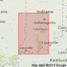
- Areal extent
- AAPG geologic province:
-
- Appalachian basin
Summary:
In this report, Greenbrier Limestone divided into (ascending) Little Valley Limestone Member, St. Louis Limestone Member (Hillsdale Member of Reger, 1926), the "St. Genevieve" Limestone Member, and the Gasper Limestone Member. The St. Louis (or Hillsdale) consists of dark-gray to grayish-black cherty limestone. The chert is black, pale red, or gray and occurs as stringers or nodules. Contains fossils considered to be diagnostic of the Meramecian St. Louis Limestone of MO.
Source: GNU records (USGS DDS-6; Reston GNULEX).
- Usage in publication:
-
- St. Louis Limestone*
- Modifications:
-
- Overview
- Revised
- AAPG geologic province:
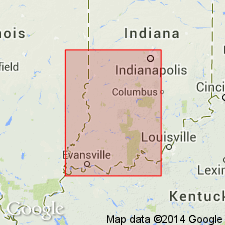
-
- Illinois basin
Summary:
In IN, used as Mississippian (Valmeyeran) St. Louis Limestone of Blue River Group. Authors follow usage of Droste and Carpenter (1990). Informally divided into 1) lower part, consisting of cyclic beds of grainstone, packstone, wackestone, mudstone, dolomite, and evaporite (anhydrite and gypsum), and organic-rich beds interspersed throughout; and 2) upper part containing diagenetic chert "nodules", a few dolomite beds, no evaporite beds, abundant grainstones. Overlain by Ste. Genevieve Limestone of Blue River Group; underlain by Salem Limestone of Sanders Group.
Source: GNU records (USGS DDS-6; Reston GNULEX).
- Usage in publication:
-
- St. Louis Limestone*
- Modifications:
-
- Revised
- AAPG geologic province:
-
- Cincinnati arch
Summary:
St. Louis Limestone revised in south-central KY to address problem of use of "St. Louis" for both a formation and a member in south-central and northeastern Kentucky. Abandoned use of "St. Louis Member of Slade Formation" in Kentucky. Rocks reallocated to Burnside Member (new), upper member of St. Louis Formation. Two other distinct lithologic units occurring in the St. Louis Limestone and in correlative rocks of the Slade Formation are the Ringgold Bed and Big Sinking Bed (both new).
[F.R. Ettensohn, 2009 (Miss. Appal. basin, Kentucky Spec. Pub. 10, ser. XII, p. 24, fig. 3.2) places the St. Louis in Middle Mississippian (Visean; Meramecian).]
Source: Publication.
For more information, please contact Nancy Stamm, Geologic Names Committee Secretary.
Asterisk (*) indicates published by U.S. Geological Survey authors.
"No current usage" (†) implies that a name has been abandoned or has fallen into disuse. Former usage and, if known, replacement name given in parentheses ( ).
Slash (/) indicates name conflicts with nomenclatural guidelines (CSN, 1933; ACSN, 1961, 1970; NACSN, 1983, 2005, 2021). May be explained within brackets ([ ]).