

- Usage in publication:
-
- Spruce formation*
- Modifications:
-
- Named
- Dominant lithology:
-
- Argillite
- Quartzite
- AAPG geologic province:
-
- Northern Rocky Mountain region
Summary:
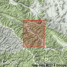
Named as one of five mapped units and as one of four newly named formations and the basal unit in the Missoula group of the Belt series for exposures on Spruce Ridge (its type locality) in secs 32, 33, and 34, T17N, T27W, Mineral Co, MT in the Northern Rocky Mountain region. Estimated to be 3,500 ft thick. Contact with underlying Wallace is marked by lithologic change from interbedded quartzite, argillite and carbonate to thin-bedded, light-green quartzose argillite interbedded with green, very fine grained quartzite of Spruce. Consists of lower grayish, yellow-green quartzose argillite interlaminated with dusky yellow-green, very fine grained, argillitic quartzite; a middle unit that is thicker bedded, predominantly greenish-gray quartzite, and lesser greenish-gray argillite; and an upper unit, similar to the lower unit, except that the rocks are slightly dolomitic and weather reddish brown. Underlies newly named Lupine formation of Missoula group. Upper contact placed at base of gray-purple argillite of Lupine. Correlated with Miller Peak of Missoula group as a partial equivalent. Geologic map. Mapped in east-central and southwest part of report area. Of Precambrian age.
Source: GNU records (USGS DDS-6; Denver GNULEX).

- Usage in publication:
-
- Spruce Formation†
- Modifications:
-
- Abandoned
Summary:
Abandoned in favor of the Precambrian Miller Peak Formation of Missoula Group of Precambrian Belt Supergroup in the Northern Rocky Mountain region of southwest MT.
Source: GNU records (USGS DDS-6; Denver GNULEX).
For more information, please contact Nancy Stamm, Geologic Names Committee Secretary.
Asterisk (*) indicates published by U.S. Geological Survey authors.
"No current usage" (†) implies that a name has been abandoned or has fallen into disuse. Former usage and, if known, replacement name given in parentheses ( ).
Slash (/) indicates name conflicts with nomenclatural guidelines (CSN, 1933; ACSN, 1961, 1970; NACSN, 1983, 2005, 2021). May be explained within brackets ([ ]).