

- Usage in publication:
-
- Springdale sandstone member*
- Modifications:
-
- Named
- Dominant lithology:
-
- Sandstone
- Shale
- AAPG geologic province:
-
- Great Basin province
Summary:
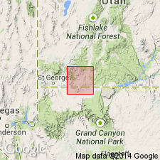
Named as a member (one of four) of the Chinle formation for the village of Springdale, T41S, R10 1/2W, Washington Co, UT in the Great Basin province. No type locality designated. Consists of light red, medium- to coarse-grained sandstone in lenses 3 to 30 ft thick and a small amount of mud shale and limestone conglomerate. Locally called the "big ledge" because it forms a prominent cliff and platform. Is laminated, ripple-marked and cross-bedded; forms ledges and lenses, most less than 300 ft long and 30 ft thick. Beds of red and green shale occur between the larger sandstone masses and within these masses as pockets of mud lumps which produce a porous or pitted weathered surface. Best developed in southwest UT. Thins east along the Vermilion Cliffs; is absent beyond the Paria River. Measured sections. Overlies the newly named Petrified Forest Member of the Chinle. Underlies the upper sandstone of the Chinle.
Source: GNU records (USGS DDS-6; Denver GNULEX).
- Usage in publication:
-
- Springdale sandstone member*
- Modifications:
-
- Areal extent
- AAPG geologic province:
-
- Black Mesa basin
- Plateau sedimentary province
Summary:
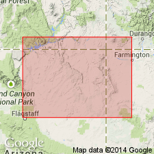
Pg. 3 (fig. 2), 16-17, 62, pls. 1, 2. Springdale sandstone member of Moenave formation of Glen Canyon group. Geographically extended into Arizona [Coconino and Navajo Counties]. In most parts of Navajo country, member is 100 to 150 feet thick, though thickness differs locally owing to lenticular nature of its sandstone units; 221 feet at Lees Ferry, 77 feet at Moenave. Overlies Dinosaur Canyon member, contact commonly gradational; underlies Kayenta formation and in many areas cannot be distinguished from it. In Echo Cliffs area, unit has been referred to as Wingate sandstone by several workers. Age is Late Triassic(?).
Source: Publication; US geologic names lexicon (USGS Bull. 1200, p. 3692-3693).
- Usage in publication:
-
- Springdale Sandstone Member
- Modifications:
-
- Revised
- AAPG geologic province:
-
- Great Basin province
- Plateau sedimentary province
Summary:
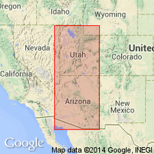
Revised in that Whitmore Point Member named as middle member of Moenave Formation. Within study area of southwest UT and northwest AZ [Great Basin and Plateau sedimentary provinces], Moenave, a formation within Glen Canyon Group, consists of (ascending) Dinosaur Canyon, Whitmore Point, and Springdale Sandstone Members. Whitmore Point is present west of a point about 10 mi east of Kanab, Kane Co, UT. Cross section; measured section at type Whitmore Point. Late Triassic? age.
Source: GNU records (USGS DDS-6; Denver GNULEX).
- Usage in publication:
-
- Springdale Sandstone Member*
- Modifications:
-
- Overview
- AAPG geologic province:
-
- Plateau sedimentary province
- Great Basin province
Summary:
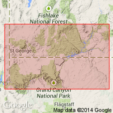
Is the upper member of Moenave Formation of Glen Canyon Group in southwestern UT and northwest AZ, Plateau sedimentary and Great Basin provinces. Intertongues with and is replaced by Kayenta Formation of Glen Canyon to east. Overlies Whitmore Point Member of Moenave. Tentatively assigned a Sinemurian and Pliensbachian or Early Jurassic age on basis of Early Jurassic palynomorphs identified in underlying Whitmore Point. [Age retained as Late Triassic? by USGS]. Correlation chart.
Source: GNU records (USGS DDS-6; Denver GNULEX).

- Usage in publication:
-
- Springdale Sandstone Member*
- Modifications:
-
- Areal extent
- AAPG geologic province:
-
- Great Basin province
Summary:
Mapped as the upper Member of the Moenave Formation with the underlying middle Member -the Whitmore Point Member of the Moenave --in east-central Lincoln Co., NV in the Great Basin province. Underlies lower member of Kayenta Formation. Consists of a basal 50 m of medium- to fine-grained, pink-gray, thin bedded sandstones that forms a flagstone talus. Basal part has some fish-scale impressions on bedding surfaces. Basal part forms steep slopes. The upper 20 m is a pink-gray sandstone that has mudstone pebbles and impressions of plant debris. Of Early Jurassic age.
Source: GNU records (USGS DDS-6; Denver GNULEX).
For more information, please contact Nancy Stamm, Geologic Names Committee Secretary.
Asterisk (*) indicates published by U.S. Geological Survey authors.
"No current usage" (†) implies that a name has been abandoned or has fallen into disuse. Former usage and, if known, replacement name given in parentheses ( ).
Slash (/) indicates name conflicts with nomenclatural guidelines (CSN, 1933; ACSN, 1961, 1970; NACSN, 1983, 2005, 2021). May be explained within brackets ([ ]).