

- Usage in publication:
-
- Spokane shales*
- Modifications:
-
- Original reference
- Dominant lithology:
-
- Shale
- AAPG geologic province:
-
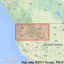
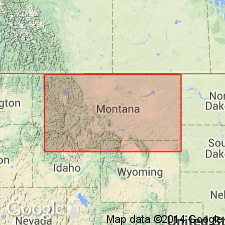
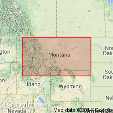
- Northern Rocky Mountain region
Summary:
Pg. 199-215. Spokane shales. Massive beds of deep-red siliceous shales, 1,500+ feet thick. Underlies Empire shales and overlie Greyson shales. Age is pre-Cambrian (Belt).
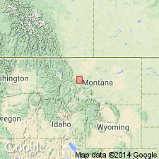
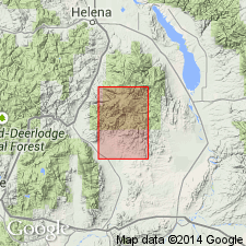
Type locality: in Spokane Hills, 15 mi east of Helena, Lewis and Clark Co., western central MT.
Source: US geologic names lexicon (USGS Bull. 896, p. 2041).

- Usage in publication:
-
- Spokane formation
- Modifications:
-
- Revised
- AAPG geologic province:
-
- Northern Rocky Mountain region
Summary:
Pg. 1897-1898. Spokane formation of Piegan group. Comprises argillaceous and arenaceous strata lying between calcareo-magnesian formations of Piegan group. Beds range from sandstones and soft shales to quartzites and argillites; dominantly red and green, though brown, buff, and gray also seen. Thickness 180 to 7,400 feet. Recognized in Glacier National Park; southward, in both Blackfoot Canyon and Meagher facies the formation thickens. In typical Meagher facies, it contains (ascending) Greyson, Prickly Peak (new), and Empire members. Age is pre-Cambrian (Belt).
Source: US geologic names lexicon (USGS Bull. 1200, p. 3686-3687).
- Usage in publication:
-
- Spokane formation*
- Modifications:
-
- Revised
- AAPG geologic province:
-
- Northern Rocky Mountain region
Summary:
Sheet 1. Spokane formation shown on map legend as part of Siyeh group. Age is Precambrian (Belt).
Source: US geologic names lexicon (USGS Bull. 1200, p. 3686-3687).
- Usage in publication:
-
- Spokane formation*
- Modifications:
-
- Areal extent
- AAPG geologic province:
-
- Northern Rocky Mountain region
Summary:
Pg. 450. Spokane formation. In area of Lewis overthrust, overrides Upper Cretaceous Adel Mountain volcanics (new). Age is pre-Cambrian (Belt).
Source: US geologic names lexicon (USGS Bull. 1200, p. 3686-3687).
- Usage in publication:
-
- Spokane formation*
- Modifications:
-
- Revised
- AAPG geologic province:
-
- Northern Rocky Mountain region
Summary:
Spokane formation. Name has been used over a wide area in Montana but in a strict sense can be used safely only in general vicinity of Helena. Provisionally included in Piegan group. Age is Precambrian (Belt).
Source: US geologic names lexicon (USGS Bull. 1200, p. 3686-3687).
- Usage in publication:
-
- Spokane shale*
- Modifications:
-
- Areal extent
- AAPG geologic province:
-
- Northern Rocky Mountain region
Summary:
Pg. 4 (table), 5-6, pls. 1, 2. Spokane shale. Thickness as much as 1,700 feet in southern Elkhorn Mountains, Jefferson and Broadwater Counties, northwestern Montana. Overlies Greyson shale with contact gradational; grades upward into Empire shale. Where Empire is absent, overlain by Flathead quartzite. Age is Precambrian (Belt).
Source: US geologic names lexicon (USGS Bull. 1200, p. 3686-3687).

- Usage in publication:
-
- Spokane formation*
- Modifications:
-
- Overview
- AAPG geologic province:
-
- Northern Rocky Mountain region
Summary:
Spokane formation of Missoula group. The USGS currently [ca. 1960] classifies the Spokane as a formation in the Missoula group on the basis of a study now in progress.
Source: US geologic names lexicon (USGS Bull. 1200, p. 3686-3687).

- Usage in publication:
-
- Spokane Formation*
- Modifications:
-
- Areal extent
- AAPG geologic province:
-
- Northern Rocky Mountain region
Summary:
Spokane Formation of Ravalli Group of Belt Supergroup. Geographically extended replacing Grinnell Formation (Grinnell Argillite) in northwestern Montana; †Grinnell now abandoned. Age is Precambrian Y.
Source: Changes in stratigraphic nomenclature, 1972 (USGS Bull. 1394-A, p. A44-A45).

- Usage in publication:
-
- Spokane Formation*
- Modifications:
-
- Revised
- AAPG geologic province:
-
- Northern Rocky Mountain region
Summary:
Spokane Formation of Ravalli Group of Belt Supergroup. Spokane Formation transferred from Missoula Group to Ravalli Group. Age is Precambrian Y.
Source: Changes in stratigraphic nomenclature, 1972 (USGS Bull. 1394-A, Ravalli entry p. A38-A39).
- Usage in publication:
-
- Spokane Formation
- Modifications:
-
- Not used
- AAPG geologic province:
-
- Northern Rocky Mountain region
Summary:
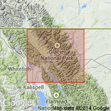
Spokane Formation. Restricted from Glacier National Park, Glacier and Flathead Counties, northwestern Montana. Confined to west-central part of Montana (Helena embayment), where it is mostly interlaminated siltite and argillite and contains only limited amounts of very fine grained subfeldspathic arenite. In Glacier National Park, Spokane is replaced with Grinnell Formation (after usage of Ross, 1959) which includes abundant beds of white quartz arenite, particularly in upper part; total arenite contact is locally as much as 60 percent.
Source: Publication.
For more information, please contact Nancy Stamm, Geologic Names Committee Secretary.
Asterisk (*) indicates published by U.S. Geological Survey authors.
"No current usage" (†) implies that a name has been abandoned or has fallen into disuse. Former usage and, if known, replacement name given in parentheses ( ).
Slash (/) indicates name conflicts with nomenclatural guidelines (CSN, 1933; ACSN, 1961, 1970; NACSN, 1983, 2005, 2021). May be explained within brackets ([ ]).