

- Usage in publication:
-
- Snowslip Formation
- Modifications:
-
- Named
- Dominant lithology:
-
- Argillite
- Siltstone
- Quartzite
- Sand
- AAPG geologic province:
-
- Northern Rocky Mountain region
Summary:
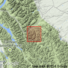
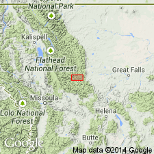
Named as one of the formations of the Precambrian Belt Supergroup. Type section designated on ridge between Snowslip Mountain and Mount Shields, lat 48 deg 16' 30" N, long 113 deg 31' W, Flathead Co, MT in the Northern Rocky Mountain region. Composed at type section of basal breccia of red argillite and green siltstone fragments in calcareous, very coarse grained sandstone matrix, and interbeds of red and lavender argillite which are overlain by sequence of alternating green, thin-bedded argillite and white and green, medium- to fine-grained, some cross-laminated quartzite beds. Includes minor sandstone that is very coarse to medium grained and pink to pale red. Stromatolite zone present in lower part. Is 1,606 ft thick at type where it conformably overlies Siyeh Formation (carbonate-rich rocks), and underlies Shepard Formation (calcareous shale and argillites).
Source: GNU records (USGS DDS-6; Denver GNULEX).
- Usage in publication:
-
- Snowslip Formation
- Modifications:
-
- Reference
- AAPG geologic province:
-
- Northern Rocky Mountain region
Summary:
Name has been applied to all rocks in the Precambrian Belt Supergroup above the carbonate (Siyeh Formation of Glacier National Park or Helena Formation of Helena area). These same rocks were designated Camp Creek Series by Walcott in 1906, but that name has been little used and is abandoned in favor of Missoula Group in this report. The Camp Creek section is designated a reference section [but section not described] for the Missoula. The reference section is located along crest of ridge parallel to and northwest of Camp Creek in secs 22, 28, and 33, T20N, R12W, Lewis and Clark Range, Powell Co, MT in Northern Rocky Mountain region where the following formations of Missoula are exposed (ascending order): Snowslip, Shepard, and Shields Formations, Bonner Quartzite, McNamara and Garnet Range Formations. Geologic map.
Source: GNU records (USGS DDS-6; Denver GNULEX).

- Usage in publication:
-
- Snowslip Formation*
- Modifications:
-
- Overview
- AAPG geologic province:
-
- Northern Rocky Mountain region
Summary:
Is the basal formation of the Missoula Group in the Northern Rocky Mountain region near the International border south to Helena and west to Butte. Rocks formerly assigned to Marsh Formation (abandoned) are part of the Snowslip, Shepard, and Mount Shields Formations of Missoula Group of Precambrian Belt Supergroup. Correlation with other Precambrian units in the Northern Rocky Mountain region and with the Purcell Supergroup in Alberta and British Columbia, Canada shown on figures 4, 5, 6, 7, and 13.
Source: GNU records (USGS DDS-6; Denver GNULEX).

- Usage in publication:
-
- Snowslip Formation*
- Modifications:
-
- Areal extent
- AAPG geologic province:
-
- Northern Rocky Mountain region
Summary:
Rocks formerly assigned to the red and tan siltstone member, basal member of Hoadley Formation (abandoned), by Deiss (1943) and by Mudge (1966), are reassigned to the Snowslip Formation of the Missoula Group of Belt Supergroup. Correlation chart. Most of the Snowslip in the Sun River Canyon area was metamorphosed by intrusion of a diorite sill in late Precambrian time. Ranges in thickness from 300 ft to 700 ft. Overlies Helena Dolomite of Belt; underlies Shepard Formation of Belt. Mapped in southwest corner of geologic map in Lewis and Clark Co, MT in the Northern Rocky Mountain region. Precambrian age.
Source: GNU records (USGS DDS-6; Denver GNULEX).
- Usage in publication:
-
- Snowslip Formation*
- Modifications:
-
- Reference
- Dominant lithology:
-
- Argillite
- Siltite
- AAPG geologic province:
-
- Northern Rocky Mountain region
Summary:
Is the basal unit in Missoula Group of Middle Proterozoic Belt Supergroup conformably above Helena Formation and below Shepard Formation. Purcell Lava emplaced partly subaqueous and partly subaerially in member 6 of Snowslip. Reference section 257+ m thick designated in east wall of Hole-in-the-Wall cirque, Glacier National Park, MT, Northern Rocky Mountain region, where divisible into members 1 (base) to 6 (top). Consists of grayish-green to greenish-gray siltite and argillite couplets. Some beds poorly sorted, syneresis and desiccation cracks, numerous thin mudchip breccia laminae, fluid-escape structures. Pink, red, cream stromatolitic limestone in member 2 at reference section. Pyritic flat-pebble conglomerate, poorly sorted lithic arenite, mud draped ripples, raindrop impressions, stromatolites. Lower contact--pink to gray oolitic limestone (Helena) with poorly sorted arenite (Snowslip). Upper contact--argillite (Snowslip) and calcareous siltite, argillite, dolarenite, limestone couplets (Shepard). Thickness 489.6 m at type; 636.3 m on west side Huckleberry Ridge. Marine peritidal deposit. Polarity reversal at or near base. Equivalent to Van Creek and Nichol Creek Formations of B.C. Glauconite in Shepard dated at 1,170 +/-20 Ma (Rb/Sr). U/Pb date on Zr from metabentonite in Helena about 1,350 Ma. Paleomagnetic pole position data suggests 1,375 Ma. Deposited between 1,350 and 1,170 Ma ago. Stratigraphic chart.
Source: GNU records (USGS DDS-6; Denver GNULEX).
For more information, please contact Nancy Stamm, Geologic Names Committee Secretary.
Asterisk (*) indicates published by U.S. Geological Survey authors.
"No current usage" (†) implies that a name has been abandoned or has fallen into disuse. Former usage and, if known, replacement name given in parentheses ( ).
Slash (/) indicates name conflicts with nomenclatural guidelines (CSN, 1933; ACSN, 1961, 1970; NACSN, 1983, 2005, 2021). May be explained within brackets ([ ]).