

- Usage in publication:
-
- Sloway formation*
- Modifications:
-
- Named
- Dominant lithology:
-
- Quartzite
- Argillite
- AAPG geologic province:
-
- Northern Rocky Mountain region
Summary:
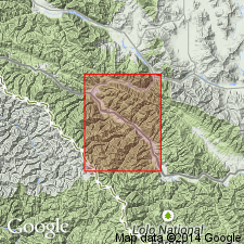
Named one of five mapped units and as one of four newly named formations of Precambrian Missoula group of Belt series for exposures near mouth of Sloway Gulch, secs 14, 15, and 16, T17N, R27W, Mineral Co, MT in the Northern Rocky Mountain region. Type section designated partial sections exposed in secs 7 and 18, T16N, R26W, secs 29, 33, 34, T17N, R26W, and secs 3, 4, 10, 11, 14 and 23, T16N, R26W. Overlies Lupine formation (new) of Missoula group gradationally; contact marked by decrease in thickness of bedding and increase in amount of red-purple argillite from Lupine. Conformably underlies Bouchard formation (new) of Missoula; contact represents change from quartzitic rocks of Sloway to gray micaceous quartzite of Bouchard. Divisible into: 1) lower thin-bedded (1-6 in), slightly sericitic, light-brown quartzite interbedded with reddish-purple argillite less than 1 in thick, with mud cracks and halite; 2) middle vitreous, pink or white quartzite in beds 1-3 ft thick interbedded with micaceous quartzite and siliceous argillite with numerous mud cracks; many quartzite beds coarse grained, sugary, ripple marked; and 3) upper quartzose to micaceous, reddish-purple or green argillite with thinly interlaminated light- and dark-green argillite zones; some micaceous quartzite; numerous scour and fill, mud cracks, ripple marks. No complete section found; estimated 5,000 ft thick. Geologic map; mapped in south-central and east part of map.
Source: GNU records (USGS DDS-6; Denver GNULEX).

- Usage in publication:
-
- Sloway Formation†
- Modifications:
-
- Abandoned
Summary:
Abandoned and replaced by Precambrian McNamara Formation of Missoula Group of Belt Supergroup in the Northern Rocky Mountain region of southwest MT.
Source: GNU records (USGS DDS-6; Denver GNULEX).
For more information, please contact Nancy Stamm, Geologic Names Committee Secretary.
Asterisk (*) indicates published by U.S. Geological Survey authors.
"No current usage" (†) implies that a name has been abandoned or has fallen into disuse. Former usage and, if known, replacement name given in parentheses ( ).
Slash (/) indicates name conflicts with nomenclatural guidelines (CSN, 1933; ACSN, 1961, 1970; NACSN, 1983, 2005, 2021). May be explained within brackets ([ ]).