

- Usage in publication:
-
- Slocum alluvium*
- Modifications:
-
- Named
- Dominant lithology:
-
- Sand
- AAPG geologic province:
-
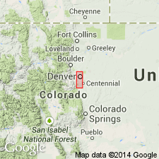
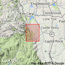
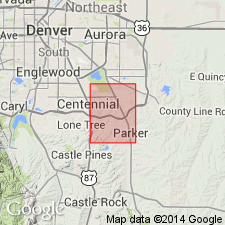
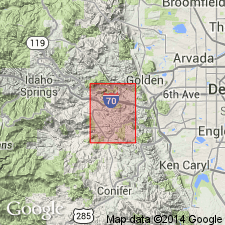
- Denver basin
Summary:
Named for exposures along one face of a limestone quarry on Slocum Ranch in SW1/4 NW1/4 sec 35, T6S, R69W, Kassler quad, Douglas Co, CO in the Denver basin, the type locality. Consists of 10 to 90 ft of moderate reddish-brown, well-stratified, clayey coarse sand with lenticular beds of pebbles and silt. Lies 150 ft below Verdos alluvium (new) and 100 ft above modern streams. Is older than Louviers alluvium (new). Interpreted to be Illinoian or Sangamon, or Pleistocene age. Has a molluscan fauna.
Source: GNU records (USGS DDS-6; Denver GNULEX).

- Usage in publication:
-
- Slocum alluvium*
- Modifications:
-
- Mapped 1:24k (Jefferson quad, Jefferson Co, CO)
- Dominant lithology:
-
- Gravel
- Sand
Summary:
Is Pleistocene (lower Wisconsin) formation mapped in east-central Jefferson, west Arapahoe, and northwest Douglas Cos, CO (Denver basin). Is older than "older loess" map unit (lower Wisconsin); younger than Verdos alluvium (Kansan or Yarmouth). Is probably most widespread surficial deposit in quad; west of South Platte River, alluvium is well exposed on broad surfaces that slope toward major streams; east of river, these broad surfaces are rounded by a mantle of loess and windblown sand and alluvium crops out along sides of valleys. Slocum is distinguished by its moderate-reddish-brown color, coarse texture, good stratification, and deep weathering; its bright color makes it easy to recognize at a distance. Predominant grain size ranges from 0.5-2 inches, but all deposits are poorly sorted and contain much silt and clay; alluvium is coarser near mountains and coarser and more angular in lower part of unit. Upper 4 or 5 ft is generally brown or yellowish-brown silty sand. Principal components of alluvium are reworked Verdos alluvium and crystalline rocks from mountains as well as Fountain and Lykins formations which provide reddish-brown color of alluvium. Fossil mollusks are abundant (listed). Thickness ranges from 15-100 ft.
Source: GNU records (USGS DDS-6; Denver GNULEX).
- Usage in publication:
-
- Slocum alluvium*
- Modifications:
-
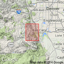
- Mapped 1:24k (Kassler quad, Douglas and Jefferson Cos, CO)
- Dominant lithology:
-
- Sand
- Pebbles
- Silt
- AAPG geologic province:
-
- Denver basin
Summary:
Is Pleistocene formation mapped in northwestern Douglas and southeastern Jefferson Co, CO (Denver basin). Unconformably overlies Verdos alluvium (Pleistocene); unconformably underlies older loess unit. Unit described (p.20) as reddish brown, moderate reddish-brown, dark brown, grayish brown, or yellowish brown well-stratified deposit of firmly compacted coarse sand and boulders; grains sorted into lenses of pebbles, sand, or silt; clay matrix is most abundant in lower part; strongly developed soil formed on alluvium. Measured sections. Thickness is 10-90 ft. Widely distributed over eastern (plains) part of quad. Contains fossils of land mammals and land and fresh water mollusks (list of mollusks). Age considered to be late Illinoian or early Sangamon.
Source: GNU records (USGS DDS-6; Denver GNULEX).
- Usage in publication:
-
- Slocum Alluvium*
- Modifications:
-
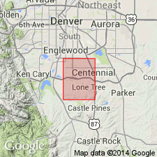
- Mapped 1:24k (Parker quad, Arapahoe and Douglas Cos, CO)
- Dominant lithology:
-
- Gravel
- Sand
- Silt
- Clay
- AAPG geologic province:
-
- Denver basin
Summary:
Is Pleistocene formation mapped in southwestern Arapahoe and northern Douglas Cos, CO (Denver basin). Conformably underlies upper part (older part) of Louviers Alluvium (Pleistocene); younger than Castle Rock Conglomerate (Oligocene). Divided into separately mapped lower (younger) and upper (older) parts; gravel at base of upper part is basis for subdivision. Unit described as grayish-red to dark-reddish-brown quartz-and-feldspar sand and silty clay; bouldery gravels at base of upper and lower parts. Grades roughly upward from gravel into sand, then into silt and silty clay. Well stratified. Biotite and fossil wood are common. Has strongly developed calcium-carbonate-rich zone near top of upper and lower parts. Upper surfaces occur from 50-200 feet above principal streams. Lower and upper parts each up to 65 ft thick.
Source: GNU records (USGS DDS-6; Denver GNULEX).

- Usage in publication:
-
- Slocum Alluvium*
- Modifications:
-
- Mapped 1:24k (Jefferson Co, CO)
- Dominant lithology:
-
- Silt
- Clay
- Gravel
- AAPG geologic province:
-
- Denver basin
Summary:
Is Pleistocene (Sangamon Interglaciation or Illinoian Glaciation) alluvium mapped in Jefferson Co, CO (Denver basin). Widespread occurrence over eastern two-thirds of quad. On Correlation of Map Units is shown to unconformably overlie Verdos Alluvium (Pleistocene--Yarmouth Interglaciation or Kansan Glaciation) and to unconformably underlie Louviers Alluvium (Pleistocene--Bull Lake Glaciation). Map unit described as moderate-reddish-brown pebbly silt and clay interlayered with gravel. Gravel contains larger and more abundant boulders near mountains than to east. Stones are altered by weathering and are coated by calcium carbonate. Thickness probably averages about 15 ft. Contains fossil mollusks. Upper part of deposits is overbank silt on which a very strong Brown soil of pre-Bull Lake (Sangamon?) age is developed. The B (clay-enriched) horizon of this soil commonly has a high swell potential. Lower of two terraces or pediments (locally separately mapped) lies about 100 ft above modern streams. Upper terrace or pediment (locally separately mapped) lies about 120 ft above modern streams.
Source: GNU records (USGS DDS-6; Denver GNULEX).
- Usage in publication:
-
- Slocum Alluvium*
- Modifications:
-
- Mapped 1:24k (Jefferson Co, CO)
- Dominant lithology:
-
- Sand
- Gravel
- Silt
- AAPG geologic province:
-
- Denver basin
Summary:
Is Pleistocene formation mapped in southeast part of quadrangle along Bear Creek in west-central Jefferson Co, CO (Denver basin). Map unit described as sand, gravel, and silt deposited by Bear Creek, and associated alluvial fan deposits and colluvium from valley side containing angular pebbles to boulders. Identified as Slocum by Scott (1963, p. 59).
Source: GNU records (USGS DDS-6; Denver GNULEX).
- Usage in publication:
-
- Slocum Alluvium*
- Modifications:
-
- Mapped 1:24k (Indian Hills quad, Jefferson Co, CO)
- Dominant lithology:
-
- Sand
- Gravel
- AAPG geologic province:
-
- Denver basin
Summary:
Is Pleistocene (Sangamon or Illinoian) formation mapped in central Jefferson Co, CO (Denver basin). Older than Louviers Alluvium (Pleistocene); younger than Verdos Alluvium (Pleistocene). Map unit described as moderate-reddish-brown to brown silty clayey coarse sand and granule sand in silty matrix. In most places west of Lyons Sandstone ridge , contains silty clayey sand and granules in upper 5-25 ft. Underlying alluvium generally contains gravel and cobble accumulations at least 5 ft thick. Along north side of Deer Creek consists of cobble and boulder gravel 10-15 ft thick. Grain size decreases eastward except along main channels such as Massey Draw. A strong pre-Bull Lake (Sangamon?) soil having a well-developed moderate-reddish-brown B horizon with strong columnar structure and clay-covered prisms in upper part is widely developed. Deposited as part of pediment cycle. Thickness variable; 45 ft thick where overlies Fountain Formation in places south of Deer Creek and as thin as 5 ft where overlies Fort Hays Limestone Member on barrier at Dutch Creek. Probably thickens to east.
Source: GNU records (USGS DDS-6; Denver GNULEX).
- Usage in publication:
-
- Slocum Alluvium*
- Modifications:
-
- Mapped 1:24k (Highlands Ranch quad, Arapahoe and Douglas Cos, CO)
- Dominant lithology:
-
- Clay
- Silt
- Sand
- Gravel
- AAPG geologic province:
-
- Denver basin
Summary:
Is Pleistocene formation mapped in northern Douglas Cos, CO (Denver basin). Is older than Broadway Alluvium (Pleistocene) and colluvium, eolian sand, and loess units (Pleistocene and Holocene); unconformably overlies Castle Rock Conglomerate (Oligocene). Unit described as grayish-brown to yellowish-brown, well-stratified, pebbly clay, silt, sand, and gravel. Deposits generally grade upward from gravel into sand, to silt, and to clay. A strongly developed calcium carbonate-enriched zone (relict soil) occurs in upper part of deposit. Small outcrop occurs along west-central edge of map. Thickness is 15-20 ft.
Source: GNU records (USGS DDS-6; Denver GNULEX).
- Usage in publication:
-
- Slocum Alluvium*
- Modifications:
-
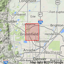
- Mapped 1:24k (Lafayette quad, Adams Boulder, and Jefferson Cos, CO)
- Dominant lithology:
-
- Gravel
- Sand
- Silt
- AAPG geologic province:
-
- Denver basin
Summary:
Is Pleistocene formation mapped in southeastern Boulder, northeastern Jefferson, and northwestern Adams Cos, CO (Denver basin). Unconformably overlies Verdos Alluvium (Pleistocene); unconformably underlies Louviers Alluvium (Pleistocene, Pinedale-Bull Lake interglaciation and Bull Lake glaciation age). Unit described as reddish-brown to light-brown poorly sorted sandy gravel to pebbly sand and silt. Gravel derived mostly by reworking of Verdos and Rocky Flats Alluviums. Deposited on pediments flanking Verdos; locally forms alluvial terraces. Most of original deposit eroded away. Upper part, in places, has strongly developed soil with reddish-brown B (clay-enriched) horizon and white Cca (calcium carbonate-enriched) horizon. Soil profile shown. Thickness usually less than 2 m. Correlated with either Illinoian Glaciation or Sangamon Interglaciation.
Source: GNU records (USGS DDS-6; Denver GNULEX).
- Usage in publication:
-
- Slocum Alluvium*
- Modifications:
-
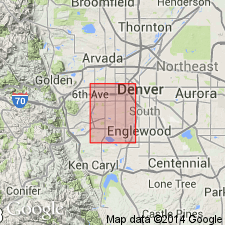
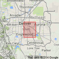
- Mapped 1:24k (Fort Logan quad, Arapahoe, Denver, and Jefferson Cos, CO)
- Dominant lithology:
-
- Clay
- Silt
- Sand
- Gravel
- AAPG geologic province:
-
- Denver basin
Summary:
Is Pleistocene formation mapped in western Arapahoe, western Denver, and eastern Jefferson Cos, CO (Denver basin). Unconformably overlies Verdos Alluvium (Pleistocene); unconformably underlies Louviers Alluvium (Pleistocene). Unit described as brown to reddish-brown, well-stratified, pebbly clay and silt interlayered with gravel, cobbles, and boulders. Deposits generally grade transitionally upward from gravel into sand, to silt, to clay. Strongly developed calcium carbonate-enrich zone (relict soil) occurs in upper part. Mapped in southern part of quad south of Bear Creek. Engineering properties discussed. Generally 15-20 ft thick, but in places up to 40 ft thick.
Source: GNU records (USGS DDS-6; Denver GNULEX).
- Usage in publication:
-
- Slocum Alluvium*
- Modifications:
-
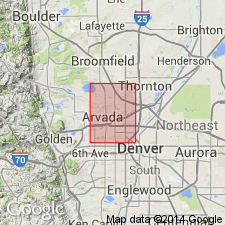
- Mapped 1:24k (Arvada quad, Adams, Denver, and Jefferson Cos, CO)
- Dominant lithology:
-
- Clay
- Silt
- Sand
- Gravel
- AAPG geologic province:
-
- Denver basin
Summary:
Is Pleistocene formation mapped in southwestern Adams and northeastern Jefferson Cos, CO (Denver basin). On Correlation of Map Units, Slocum is shown to unconformably overlie Verdos Alluvium (Pleistocene) and to unconformably underlie Louviers Alluvium (Pleistocene). Unit is described as brown to reddish-brown, well-stratified, pebbly clay and silt interlayered with gravel, cobbles, and boulders; deposits generally grade upward from gravel to sand, to silt, to clay. A strongly developed calcium carbonate-enriched zone (relict soil) occurs in upper part. Outcrops mainly along south side of Clear Creek, Little Dry Creek, and Big Dry Creek. Engineering properties discussed. Thickness is generally 15-20 ft, but may be up to 40 ft thick.
Source: GNU records (USGS DDS-6; Denver GNULEX).
- Usage in publication:
-
- Slocum Alluvium*
- Modifications:
-
- Mapped 1:24k (Commerce City quad, Adams and Denver Cos, CO)
- Dominant lithology:
-
- Clay
- Silt
- Sand
- Gravel
- AAPG geologic province:
-
- Denver basin
Summary:
Is Pleistocene formation mapped in northern Denver and western Adams Cos, CO (Denver basin). On Correlation of Map Units, Slocum is shown to unconformably overlie Verdos Alluvium (Pleistocene) and unconformably underlie Louviers Alluvium (Pleistocene). Unit is described as brown to reddish-brown, well-stratified pebbly clay, silt, sand, and gravel; contains a few scattered cobbles and boulders. Grades downward from clay to silt and sand to gravel. Strongly developed calcium carbonate-enriched zone (relict soil) in upper part. Outcrops chiefly on terrace south of Clear Creek and west of South Platte River in southwestern part of quad. Engineering properties discussed. Thickness generally is 10-15 ft.
Source: GNU records (USGS DDS-6; Denver GNULEX).
- Usage in publication:
-
- Slocum Alluvium*
- Modifications:
-
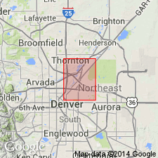
- Mapped 1:24k (Englewood quad, Adams, Arapahoe, and Denver Cos, CO)
- Dominant lithology:
-
- Silt
- Sand
- Gravel
- AAPG geologic province:
-
- Denver basin
Summary:
Is Pleistocene formation mapped in eastern Denver Co, CO (Denver basin). Shown on Correlation of Map Units to unconformably overlie Verdos Alluvium (Pleistocene) and unconformably underlie Louviers Alluvium (Pleistocene). Unit described as light-brown to light reddish-brown, clean pebbly sand interbedded with sandy silt to silty sand and pebble to cobble gravel. Upper half of unit is pebbly sandy silt strongly impregnated by calcium carbonate. Contains weathered biotite-bearing granitic clasts. Forms two small terrace or pediment remnants about 23 and 34 m above Cherry Creek, south of Sullivan in southeast part of quad. Lower alluvium and portions of upper alluvium are concealed beneath about 1.5-3 m of loess. Table of physical properties. Thickness is about 3-5 m.
Source: GNU records (USGS DDS-6; Denver GNULEX).
- Usage in publication:
-
- Slocum Alluvium*
- Modifications:
-
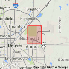
- Mapped 1:24k (Sable quad, Adams and Denver Cos, CO)
- Dominant lithology:
-
- Clay
- Silt
- Sand
- Gravel
- AAPG geologic province:
-
- Denver basin
Summary:
Is Pleistocene formation mapped in northeastern Denver and southwestern Adams, Cos, CO (Denver basin). On Correlation of Map Units, Slocum is shown to unconformably overlie Verdos Alluvium (Pleistocene) and to unconformably underlie colluvium, eolian sand, and loess units (all Pleistocene and Holocene). Unit is described as brown to reddish-brown, well-stratified pebbly clay, silt, sand, and gravel. Contains a few scattered cobbles and boulders. Outcrops on south side of Sand Creek in southwestern part of quad. Engineering properties discussed. Thickness is generally 10-15 ft.
Source: GNU records (USGS DDS-6; Denver GNULEX).
- Usage in publication:
-
- Slocum Alluvium*
- Modifications:
-
- Mapped 1:12k (Jefferson Co, CO)
- Dominant lithology:
-
- Gravel
- Sand
- AAPG geologic province:
-
- Denver basin
Summary:
Is middle Pleistocene formation mapped in northern Jefferson Co, CO (Denver basin). Correlation of Map Units shows unit is age equivalent to lowermost part of undivided terrace alluvium, colluvium, and landslide deposits units and unconformably overlies Verdos Alluvium (lower middle Pleistocene). Unit is poorly exposed; occurs in extreme northwestern, eastern and southeastern parts of map; forms small remnants of pediment? deposits about 10-20 m above Woman Creek in southeastern part of map; much of original deposit has been removed by erosion. Unit described as poorly sorted, clast-supported, cobbly pebble gravel that contains brown to reddish-brown sand matrix, sandy pebble gravel, and matrix-supported pebbly sand. Thickness probably about 2-3 m. Age is about 240 ka.
Source: GNU records (USGS DDS-6; Denver GNULEX).
For more information, please contact Nancy Stamm, Geologic Names Committee Secretary.
Asterisk (*) indicates published by U.S. Geological Survey authors.
"No current usage" (†) implies that a name has been abandoned or has fallen into disuse. Former usage and, if known, replacement name given in parentheses ( ).
Slash (/) indicates name conflicts with nomenclatural guidelines (CSN, 1933; ACSN, 1961, 1970; NACSN, 1983, 2005, 2021). May be explained within brackets ([ ]).