

- Usage in publication:
-
- Slade Formation*
- Modifications:
-
- Named
- Dominant lithology:
-
- Limestone
- AAPG geologic province:
-
- Appalachian basin
Summary:
The name Slade Formation is here given to Mississippian rocks of the Cumberland Escarpment outcrop belt in east-central and northeastern KY that were formerly named the Newman Limestone. The Slade is divided into a lower part that consists of thin- to thick-bedded carbonate units, commonly bounded by disconformities and subaerial-exposure surfaces, the Renfro, St. Louis, Ste. Genevieve, Warix Run, and Mill Knob Members; and an upper part that consists of thin- to thick-bedded carbonate units with interbedded shale, the Cave Branch Bed, and Armstrong Hill, Holly Fork, Rosslyn, Tygarts Creek, Ramey Creek, Maddox Branch, and Poppin Rock Members. The Slade extends northward to the northern boundary of KY. Maximum thickness is 100 m at the arbitrary southwestern limit of the formation, where equivalent units are the Muldraugh Member of the Borden Formation, and the Salem, Warsaw, St. Louis, Monteagle, Hartselle, and Bangor formations.
Source: GNU records (USGS DDS-6; Reston GNULEX).

- Usage in publication:
-
- Slade Formation
- Modifications:
-
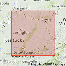
- Areal extent
- Overview
- AAPG geologic province:
-
- Appalachian basin
Summary:
Slade Formation in this study is divided into only two units: the lower Mount Vernon member and the overlying Poppin Rock Member. The Mount Vernon was informally named for exposures near Mount Vernon, KY, by Dever and others (1979: Ninth International Congress of Carboniferous Stratigraphy and Geology, Field Trip No. 4, p. 175-181). The Poppin Rock is undifferentiated from the Mount Vernon member in the northwestern quarters of the Catlettsburg and Grundy sections where the members are thin. In the extreme northwestern part of these sections, the Slade is absent. According to the cross sections, the Slade and its two members extend into TN, VA, and WV. Throughout the study area, the Slade ranges in thickness from 0 to 450 m. Overlies the Salem-Warsaw Formation and underlies the Bluefield Formation of the Pennington Group. According to the author, formal nomenclature presented in this report has been accepted by the Kentucky Stratigraphic Nomenclature Committee. Report includes correlation charts, cross sections, and measured sections.
Source: GNU records (USGS DDS-6; Reston GNULEX).
For more information, please contact Nancy Stamm, Geologic Names Committee Secretary.
Asterisk (*) indicates published by U.S. Geological Survey authors.
"No current usage" (†) implies that a name has been abandoned or has fallen into disuse. Former usage and, if known, replacement name given in parentheses ( ).
Slash (/) indicates name conflicts with nomenclatural guidelines (CSN, 1933; ACSN, 1961, 1970; NACSN, 1983, 2005, 2021). May be explained within brackets ([ ]).