

- Usage in publication:
-
- Siyeh limestone*
- Modifications:
-
- Original reference
- Dominant lithology:
-
- Limestone
- AAPG geologic province:
-
- Northern Rocky Mountain region
Summary:
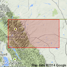
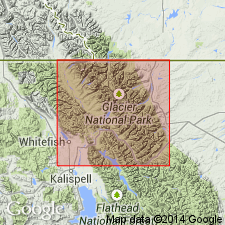
Pg. 316, 323. Siyeh limestone. Chiefly limestone but interbedded with argillite. The limestone usually very massive, of mural aspect, dark blue or grayish, weathering buff. Often characterized by peculiar internal structures and large concentric growths. Indistinctly fossiliferous. Thickness 4,000+/- feet. Forms mass of Mount Siyeh, at head of Canyon Creek, a tributary from the south, which enters Swift Current [Swiftcurrent] Creek at Altyn, Glacier National Park, Glacier County, northwestern Montana. Constitutes upper part of all principal summits of Lewis Range north of Mount Siyeh, including Mount Gould, Wilbur, Merritt, and Cleveland. Extends west into Livingston Range and forms massive peaks between Waterton and North Fork drainage lines. Is intruded by sheet of diorite 60 to 100 feet thick. Rests conformably on Grinnell argillite and overlain by sheet of extrusive igneous rocks. Age is pre-Cambrian (Belt).
Source: US geologic names lexicon (USGS Bull. 896, p. 2007).
- Usage in publication:
-
- Siyeh formation
- Modifications:
-
- Areal extent
- AAPG geologic province:
-
- Northern Rocky Mountain region
Summary:
Areally extended by mapping northward into BC in the Northern Rocky Mountain region as the fifth formation from the base (of 8) of the Lewis series. Conformably overlies Grinnell formation of the Lewis series. Underlies Purcell lava [first used?]. Consists of cliff-forming, thin- to thick-bedded, light- to dark-gray metargillite and quartzite interbedded at base with a few buff-weathering dolomite beds and in middle part with massive gray, buff-weathering limestone. The metargillite beds have abundant sun cracks, rain prints, and ripple marks. Molar-tooth structures are common. Is obviously color banded--buff and gray. Lime-carbonate lenses, pencils and other irregular shapes along bedding planes. Chemical analyses. Geologic maps. Assigned to the Middle Cambrian?.
Source: GNU records (USGS DDS-6; Denver GNULEX).
- Usage in publication:
-
- Siyeh formation
- Modifications:
-
- Revised
- AAPG geologic province:
-
- Northern Rocky Mountain region
Summary:
As a formation in Belt series is divided into (ascending): COLLLENIA SYMMETRICA zone, Goathaunt member (first used), COLLENIA? FREQUENS zone, and Granite Park member (first used) in Glacier and Waterton National Parks, MT and CN, respectively. [Not possible to determine exact areal extent], including Northern Rocky Mountain region. Contains fossil algae and locally associated oolites. Overlies Rising Bull member of Grinnell formation. Underlies Hole-in-the-Wall member (first used) of Boulder Pass formation (new). Ranges from 2,315 to 3,185 ft thick. Measured section in which this formation is described is composited from occurrences in eastern[?] Glacier National Park, MT in the Northern Rocky Mountain region, and Waterton Lakes National Park. Of Algonkian, Proterozoic age.
Source: GNU records (USGS DDS-6; Denver GNULEX).

- Usage in publication:
-
- Siyeh formation
- Modifications:
-
- Revised
- AAPG geologic province:
-
- Northern Rocky Mountain region
Summary:
Name applied to calcareous-magnesian rocks assigned basal part of Piegan group (new) of Belt series that overlie Rising Bull member of Grinnell formation of Ravalli group and that underlie Spokane formation of Piegan. Ranges from 2,900 to 4,000 ft thick in Lewis Range. Is 5,400 ft thick in Blackfoot facies. Type locality stated being at Mt. Siyeh, Glacier National Park, MT in the Northern Rocky Mountain region. Divided into (ascending): COLLENIA SYMMETRICA zone, Goathaunt member, COLLENIA FREQUENS zone, and Granite Park member. Areal extent not clearly stated. Correlation chart. Of Precambrian age.
Source: GNU records (USGS DDS-6; Denver GNULEX).
- Usage in publication:
-
- Siyeh Formation
- Modifications:
-
- Revised
- AAPG geologic province:
-
- Northern Rocky Mountain region
Summary:
Underlies a newly named unit, Snowslip Formation, of the Belt Supergroup, in the southwest Marias Pass area, Northern Rocky Mountain region, Flathead Co, MT. Assigned to the Precambrian.
Source: GNU records (USGS DDS-6; Denver GNULEX).
- Usage in publication:
-
- Siyeh Formation
- Modifications:
-
- Overview
- AAPG geologic province:
-
- Northern Rocky Mountain region
Summary:
Helena Formation (Precambrian) of Helena area, Siyeh Formation of Glacier National Park, and the Newland Limestone of the Bonner area, all of the Northern Rocky Mountain region, are thought to be lateral equivalents and part of the Precambrian Belt Supergroup.
Source: GNU records (USGS DDS-6; Denver GNULEX).

- Usage in publication:
-
- Siyeh Limestone†
- Modifications:
-
- Abandoned
Summary:
Abandoned in Montana in favor of the Precambrian Helena Dolomite or Helena Formation of Precambrian Belt Supergroup in the Northern Rocky Mountain region. Is equivalent to Kitchener Formation and Siyeh Limestone of Canadian part of Belt basin.
Source: GNU records (USGS DDS-6; Denver GNULEX).
For more information, please contact Nancy Stamm, Geologic Names Committee Secretary.
Asterisk (*) indicates published by U.S. Geological Survey authors.
"No current usage" (†) implies that a name has been abandoned or has fallen into disuse. Former usage and, if known, replacement name given in parentheses ( ).
Slash (/) indicates name conflicts with nomenclatural guidelines (CSN, 1933; ACSN, 1961, 1970; NACSN, 1983, 2005, 2021). May be explained within brackets ([ ]).