- Usage in publication:
-
- Sinawava Member*
- Modifications:
-
- Named
- Dominant lithology:
-
- Sandstone
- Mudstone
- AAPG geologic province:
-
- Great Basin province
Summary:
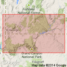
Named as basal slope-forming member of Temple Cap Sandstone of San Rafael Group. Name taken from Temple of Sinawava, Zion Canyon, about 1 km northwest of type section. Type measured in NW1/4 NW1/4 sec 2, T41S, R10W, Washington Co, UT, Great Basin province, where member is 6.1 m thick. It unconformably overlies Navajo Sandstone and intertongues with and underlies White Throne Member (new) of Temple Cap. Composed of a very light-gray to moderate-reddish-brown, mottled, very fine to fine-grained, scattered coarse and very coarse grains, moderately to poorly sorted, irregular to thin-bedded sandstone overlain by interbedded sandstone, silty sandstone, and mudstone. The sandstone is reddish brown, has scattered coarse grains, is moderately to poorly sorted, laminated to very thin-bedded. The mudstone is dark reddish brown, laminated to very thin-bedded. Basal contact named J-1 surface. Thins east from type to 2.4 m at Johnson Canyon (27 km east of Mount Carmel Junction), Kane Co, Plateau sedimentary province. Is 113.4 km thick west of type near Observation Point. Pinches out west of Carly Knoll. Correlates with lower part of Gypsum Spring Member of Twin Creek Limestone of WY and UT. Assigned a Middle Jurassic, early Bajocian age. Cross sections. Correlation chart.
Source: GNU records (USGS DDS-6; Denver GNULEX).
For more information, please contact Nancy Stamm, Geologic Names Committee Secretary.
Asterisk (*) indicates published by U.S. Geological Survey authors.
"No current usage" (†) implies that a name has been abandoned or has fallen into disuse. Former usage and, if known, replacement name given in parentheses ( ).
Slash (/) indicates name conflicts with nomenclatural guidelines (CSN, 1933; ACSN, 1961, 1970; NACSN, 1983, 2005, 2021). May be explained within brackets ([ ]).

