

- Usage in publication:
-
- Shinarump conglomerate*
- Modifications:
-
- Original reference
- Dominant lithology:
-
- Conglomerate
- AAPG geologic province:
-
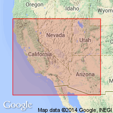
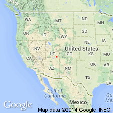
- Great Basin province
- Plateau sedimentary province
Summary:
Pg. 1-187. Shinarump conglomerate. Underlies Upper Trias marls [Chinle formation] and overlies Lower Trias marble [Moenkipi formation] in western Utah and northern Arizona. Age is Upper Triassic(?).
Type locality: Shinarump Cliffs, south of Vermilion Cliffs, southern part of Kane Co., UT.
Source: US geologic names lexicon (USGS Bull. 896, p. 1986-1987).
- Usage in publication:
-
- Shinarump conglomerate*
- Modifications:
-
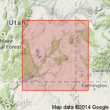
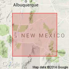
- Areal extent
- Overview
- AAPG geologic province:
-
- South Western Overthrust
- Plateau sedimentary province
Summary:
Pg. 247-248, 270-273, 284. Shinarump conglomerate. Yellow conglomerate with silicified wood very abundant. Thickness 100 feet in Pine Mountain, southern Utah; 50 feet between Paria settlement and Last Bluff, southern Utah. Overlain by variegated gypsiferous marl series of the Trias and underlain by chocolate and light-colored Trias shales. Occurs also in Virgen Range, Nevada, near Toquerville, Utah, and from Pine Valley Mountains to Le Verken Creek, Utah. Age is Upper Triassic(?)..
[All UT localites, except for Paria, in Washington Co.; Paria is in Kane Co. Virgen Range, now Virgin Mountains, in Clark Co., NV.]
Source: US geologic names lexicon (USGS Bull. 896, p. 1986-1987).
- Usage in publication:
-
- Shinarump conglomerate*
- Modifications:
-
- Revised
- AAPG geologic province:
-
- Plateau sedimentary province
Summary:
Shinarump conglomerate. A fine conglomerate not easily recognized, toward north about 20 feet [thick]; to south increases to 200 feet. Caps Shinarump Cliffs [southern part of Kane County, Utah]. Overlain and underlain by badland sandstones, with much gypsum; often argillaceous, sometimes indurated sandstones. Included in †Shinarump group [later abandoned]. Age is Upper Triassic(?).
Source: US geologic names lexicon (USGS Bull. 896, p. 1986-1987).
- Usage in publication:
-
- Shinarump conglomerate*
- Modifications:
-
- Revised
- AAPG geologic province:
-
- Paradox basin
- San Juan basin
- Plateau sedimentary province
Summary:
Revised in that the rocks unconformably above the Shinarump are named Chinle formation. Is mapped (geologic map) as a thin strip: 1) east of the Little Colorado River, Coconino and Navajo Cos, AZ; 2) between Quermo, Apache Co, AZ north to T3N, R6W; 3) Nazlini Creek area, Apache Co, AZ; 4) along Comb Ridge from Navajo Co across Apache Co into San Juan Co, UT; 5) east of Nokai Creek, San Juan Co, UT. These localities are in parts of the Plateau sedimentary province, Black Mesa and Paradox basins. Is a cliff-maker; caps erosion remnants. Ranges from 40 to 75 ft thick; averages 50 ft thick. Unconformably overlies De Chelly sandstone (new). Is a lenticular unit; lenses of conglomerate overlap lenses of coarse or fine sand; is cross-bedded; has lenses of chocolate-colored shale. Varies from conglomerate with pebbles as much as 3 inches in diameter to coarse grit to fine sandstone. Largest pebbles seen were quartzite 5 to 7 inches in diameter. Ninety-five percent of the pebbles are quartz, quartzite, chert, chalcedony. Petrified wood universally present. Depositional environment not resolved. Assigned to the Late Triassic.
Source: GNU records (USGS DDS-6; Denver GNULEX).
- Usage in publication:
-
- Shinarump member*
- Modifications:
-
- Revised
- AAPG geologic province:
-
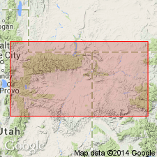
- Paradox basin
Summary:
Reduced in stratigraphic rank from Shinarump conglomerate to Shinarump member (one of seven members) of Upper Triassic Chinle formation. Name Shinarump restricted only to the former lower sandstone and conglomerate unit. The overlying Monitor Butte member was the former middle claystone and clayey sandstone unit of the Shinarump. Upper contact considered transitional at many places. The youngest or upper sandstone and conglomerate of the Shinarump is renamed Moss Back member of the Chinle in this repot. Shinarump is generally not more than 50 ft thick, though it can range from 0-225 ft thick. Northern limit generally extends through Elk Ridge northeast to Capitol Reef. Is absent in San Juan River area between Bluff and Clay Hills. As revised is a yellow-gray and yellow-orange, medium- to coarse-grained sandstone of subangular clear quartz with lenses of conglomeratic sandstone and conglomerate with granules and pebbles of quartz, quartzite, and chert. Distinguishable from other conglomerates in Chinle by grain size and pebble types. Limestone and siltstone common in Moss Back are rare in Shinarump. Usually overlies Moenkopi formation or Temple Mountain member of Chinle. Usage in northeast UT and northwest CO considered tenuous. Cross sections. Of Late Triassic age.
Source: GNU records (USGS DDS-6; Denver GNULEX).
- Usage in publication:
-
- Shinarump member
- Modifications:
-
- Contact revised
- AAPG geologic province:
-
- Black Mesa basin
Summary:
Upper contact revised in northeast AZ in the Black Mesa basin between Holbrook, Navajo Co, east to Petrified Forest National Monument and to Concho and St. Johns. In these areas, Shinarump member of Upper Triassic Chinle formation locally underlies and intertongues with the newly named Mesa Redondo member of the Chinle. The Shinarump in these areas is represented by isolated remnants of a channel deposit.
Source: GNU records (USGS DDS-6; Denver GNULEX).
- Usage in publication:
-
- Shinarump Member*
- Modifications:
-
- Overview
- AAPG geologic province:
-
- Paradox basin
Summary:
Used as basal member of the Upper Triassic Chinle Formation in the Paradox basin. Is older than, not correlative with, the Gartra Member of northeast UT and northwest CO. Gartra is reassigned from the Stanaker Formation to the Chinle Formation in this report.
Source: GNU records (USGS DDS-6; Denver GNULEX).
- Usage in publication:
-
- Shinarump Member*
- Modifications:
-
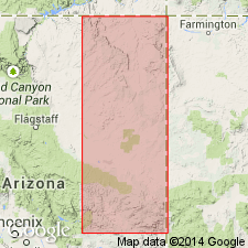
- Overview
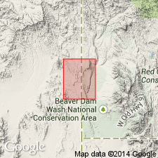
- Areal extent
- AAPG geologic province:
-
- San Juan basin
- Paradox basin
- Black Mesa basin
- Plateau sedimentary province
- Great Basin province
Summary:
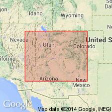
Is a gray to orange, fine- to coarse-grained, friable, resistant sandstone with lenses of conglomeratic sandstone and conglomerate deposited by a complex stream system in Late Triassic time that is assigned to Upper Triassic Chinle Formation. Occurs over an area of about 140,000 sq mi of the Colorado Plateau in southern UT, Paradox basin, Plateau sedimentary and Great Basin provinces, and Wasatch uplift; in northern AZ, Plateau sedimentary province, and Black Mesa basin; in northwest NM, San Juan basin; and in southeast NV, Great Basin province. Areal extent map. Absent locally in mapped area. Occurs as isolated lenses in parts of NM. Thickness variable--30 to 250 ft thick. Lower contact with Moenkopi Formation is erosional. Channels, a few hundred ft wide cut 25 to 75 ft deep into Moenkopi, are filled with Shinarump. Locally rests on unnamed mottled strata of Chinle. Upper contact placed at top of highest cross-stratified sandstone. Upper contact gradational with claystone, siltstone, or clayey sandstone of Monitor Butte Member or another member of Chinle. Has some volcanic debris. Forms vertical cliffs. Underlies broad benches. Dip directions predominately to northwest. Pebble studies. Stratigraphic diagrams. Measured sections. Plant fossils, phytosaur remains. Source areas discussed.
Source: GNU records (USGS DDS-6; Denver GNULEX).
- Usage in publication:
-
- Shinarump Member*
- Modifications:
-
- Overview
- AAPG geologic province:
-
- Paradox basin
Summary:
Is the basal member (of 6 members) of Chinle Formation. Study area is in the White and Red Canyons of San Juan Co, UT in the Paradox basin. The medium- to coarse-grained to conglomeratic sandstones show cut-and-fill structures, lenticular scour surfaces, and large scale lateral accretion bedding. Was deposited under conditions of rising baselevel in lowest portions of paleovalleys cut in Late Triassic time into the underlying Moenkopi Formation. Transition upward from conglomeratic to medium-grained deposits indicates change from braided stream deposits with transverse bars to deposition in a more sinuous system with sand waves and point bars. Gradationally underlies Monitor Butte Member of Chinle.
Source: GNU records (USGS DDS-6; Denver GNULEX).
- Usage in publication:
-
- Shinarump Formation
- Modifications:
-
- Areal extent
- Revised
- AAPG geologic province:
-
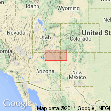
- Orogrande basin
- San Juan basin
Summary:
Two names, the Santa Rosa and Shinarump Formations, lower formations of the Chinle Group, have been applied to the silica pebble conglomerate and siltstone interval in central NM that lies disconformably on the Moenkopi Formation. The upper contact of both formations is revised in that they underlie the newly named San Pedro Arroyo Formation of the Chinle Group. The study area lies between the Colorado Plateau where the name Shinarump Formation has been used [by this author] and east-central NM where the name Santa Rosa Formation has been used. Author recognizes that either name could be chosen. He prefers to use Shinarump along the Colorado Plateau edge in Valencia Co. in the San Juan basin and along the east edge of the Rio Grande rift near Carthage Co. in the Orogrande basin. The Shinarump in these areas is thin (less than 6 m), discontinuous, trough cross-bedded, silica pebble conglomerate. Eastward in Lincoln Co., NM in the Orogrande basin where the name Santa Rosa is preferred, the interval is thicker (13-26m), more persistent, has silica pebble conglomerate and micaceous subarkose; the lithology resembles the Tecolotito Member of the Santa Rosa to the north. Cross sections. Stratigraphic charts. Of Carnian, Late Triassic age.
Source: GNU records (USGS DDS-6; Denver GNULEX).
- Usage in publication:
-
- Shinarump Member*
- Modifications:
-
- Overview
- AAPG geologic province:
-
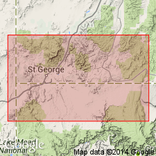
- Great Basin province
Summary:
Mapped as lower of two members of Chinle Formation. Exposed along west edge of quad, Lincoln Co, NV, Great Basin province where it forms two or three prominent ledges, hogbacks, or cuestas. Shinarump is commonly a conglomerate in other areas, however, here it is mostly a grayish orange to moderate yellowish brown coarse gritty sandstone with few pebbles of chert, quartzite, limestone, and petrified wood; basal few meters commonly include some conglomerate. Cross bedding is common. Thickness is 30-80 m; commonly about 50 m. Younger than upper red member of Moenkopi Formation; conformably underlies Petrified Forest Member of Chinle. Late Triassic age.
Source: GNU records (USGS DDS-6; Denver GNULEX).
For more information, please contact Nancy Stamm, Geologic Names Committee Secretary.
Asterisk (*) indicates published by U.S. Geological Survey authors.
"No current usage" (†) implies that a name has been abandoned or has fallen into disuse. Former usage and, if known, replacement name given in parentheses ( ).
Slash (/) indicates name conflicts with nomenclatural guidelines (CSN, 1933; ACSN, 1961, 1970; NACSN, 1983, 2005, 2021). May be explained within brackets ([ ]).