The National Geologic Map Database is migrating to a new infrastructure. We apologize for any service disruptions during this process.
|
|---|


- Usage in publication:
-
- Sheppard quartzite*
- Modifications:
-
- Original reference
- Dominant lithology:
-
- Quartzite
- AAPG geologic province:
-
- Northern Rocky Mountain region
Summary:
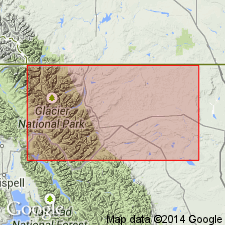
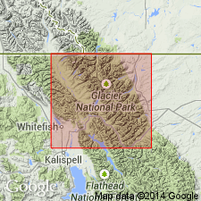
Pg. 316, 324. Sheppard quartzite. Yellow ferruginous quartzite, 700+/- feet thick. Rests on extrusive diabase flow, which overlies Siyeh limestone. Is older than Kintla argillite. Forms crest of Lewis Range in vicinity of Mount Cleveland and Sheppard [Shepard] Glacier, Glacier National Park, Glacier County, northwestern Montana, between Belly River and central Flattop Mountain. Age is pre-Cambrian (Belt).
[GNC remark (ca. 1936, US geologic names lexicon, USGS Bull. 896, p. 1980): The U.S. Geographic Names Board has approved Shepard (instead of Sheppard), March, 1929.]
Source: US geologic names lexicon (USGS Bull. 896, p. 1980).
- Usage in publication:
-
- Sheppard formation
- Modifications:
-
- Areal extent
- AAPG geologic province:
-
- Northern Rocky Mountain region
Summary:
Areally extended by mapping northward into BC in the Northern Rocky Mountain region as the seventh formation from the base (of 8) of the Lewis series. Overlies Purcell lava [first used?] of the Lewis series. Conformably underlies Kintla formation of Lewis series. A typical section, about 600 ft thick just north of the Boundary Monument on the Great Divide, described as having a basal red quartzite and siliceous argillite 20 ft thick overlain by gray, buff-weathering, thin-bedded, siliceous dolomite. One section has a 30 ft thick intercalated lava flow. Has ripple marks and sun cracks. Geologic map. Assigned to the Middle Cambrian?.
Source: GNU records (USGS DDS-6; Denver GNULEX).
- Usage in publication:
-
- Sheppard member
- Modifications:
-
- Revised
- AAPG geologic province:
-
- Northern Rocky Mountain region
Summary:
Formerly of formation rank (Willis, 1902). Assigned as [no explanation given] middle member of Boulder Pass formation of Belt series in a section composited from Glacier National Park, MT, Northern Rocky Mountain region, and Waterton Lakes National Park, AT and BC, CN. Overlies Purcell lava. Underlies Kintla member of Boulder Pass formation. Does not contain fossil algae. [Not possible to determine exact areal extent.] Described as a unit 520 to 650 ft thick composed of green, brown, or reddish, thin-bedded, siliceous argillite and meta-argillite, interbedded with quartzite, and gray weathering to ocher dolomite interbedded with thin lenses of quartzite. Argillite sequence commonly ripple marked. Of Algonkian, Proterozoic age.
Source: GNU records (USGS DDS-6; Denver GNULEX).

- Usage in publication:
-
- Shepard formation
- Modifications:
-
- Revised
- AAPG geologic province:
-
- Northern Rocky Mountain region
Summary:
Shepard formation. Consists of argillaceous and siliceous dolomites and magnesian limestones in thin strata but thick beds; dark gray, green gray, or brown. Interbeds of greenish-white magnesian quartzites basally. Ripple marks, mud cracks, channel fillings, and edgewise mud breccias characteristic. Represents final stage of Piegan sedimentation. Thickness 585 to 1,500 feet. Younger than Spokane formation, older than Miller Peak formation. Age is pre-Cambrian (Belt). Type locality given.
Type locality: Cliffs of Lewis Range near Sheppard [Shepard] Glacier, Glacier National Park, Glacier Co., northwestern MT. Well exposed on Mount Carthew, Boulder, and Swiftcurrent Peaks, mountains near Logan Pass, and in valley of Middle Fork of Flathead River.
Source: US geologic names lexicon (USGS Bull. 1200, p. 3571-3572).
- Usage in publication:
-
- Shepard Formation
- Modifications:
-
- Revised
- AAPG geologic province:
-
- Northern Rocky Mountain region
Summary:
Underlies the newly named Shields Formation of Kintla Group (raised in stratigraphic rank) of Belt Supergroup in southwest Marias Pass area, Northern Rocky Mountain region, Flathead Co, MT. Assigned to the Precambrian.
Source: GNU records (USGS DDS-6; Denver GNULEX).
- Usage in publication:
-
- Shepard Formation
- Modifications:
-
- Overview
- AAPG geologic province:
-
- Northern Rocky Mountain region
Summary:
Name has been applied to all rocks in the Precambrian Belt Supergroup above the carbonate (Siyeh Formation of Glacier National Park or Helena Formation of Helena area). These same rocks were designated Camp Creek Series by Walcott in 1906, but that name has been little used and is abandoned in favor of Missoula Group in this report. The Camp Creek section is designated a reference section [but section not described] for the Missoula. The reference section is located along crest of the ridge parallel to and northwest of Camp Creek in secs 22, 28, and 33, T20N, R12W, Lewis and Clark Range, Powell Co, MT in the Northern Rocky Mountain region where the following formations of Missoula are exposed (ascending order): Snowslip, Shepard, and Shields Formations, Bonner Quartzite, McNamara and Garnet Range Formations. Geologic map.
Source: GNU records (USGS DDS-6; Denver GNULEX).

- Usage in publication:
-
- Shepard Formation*
- Modifications:
-
- Overview
- AAPG geologic province:
-
- Northern Rocky Mountain region
Summary:
Rocks formerly assigned to Marsh Formation (abandoned) are part of the Snowslip, Shepard, and Mount Shields Formations of Missoula Group of Precambrian Belt Supergroup in the Northern Rocky Mountain region. See figs 4 and 5 for correlation with other formations of the Belt in the Northern Rocky Mountain region, and with the Purcell Supergroup in Alberta and British Columbia, Canada.
Source: GNU records (USGS DDS-6; Denver GNULEX).

- Usage in publication:
-
- Shepard Formation*
- Modifications:
-
- Revised
- Areal extent
- AAPG geologic province:
-
- Northern Rocky Mountain region
Summary:
Revised in that Shepard Formation, basal formation of Missoula Group of Belt Supergroup, underlies the renamed Mount Shields Formation (formerly called Shields Formation) of Belt. Contact with Mount Shields gradational. Contact with underlying Snowslip Formation of Belt also gradational. Mapped at southwest edge of map. Geologic map. Ranges in thickness from about 815 ft to 225 ft thick. Measured section. Replaces former use of tan siltstone member of Hoadley Formation (abandoned) of Deiss (1943) and Mudge (1966) in Sun River Canyon area, T20 and 21N, R9W, Lewis and Clark and Teton Cos, MT in the Northern Rocky Mountain region. Of Precambrian age.
Source: GNU records (USGS DDS-6; Denver GNULEX).
For more information, please contact Nancy Stamm, Geologic Names Committee Secretary.
Asterisk (*) indicates published by U.S. Geological Survey authors.
"No current usage" (†) implies that a name has been abandoned or has fallen into disuse. Former usage and, if known, replacement name given in parentheses ( ).
Slash (/) indicates name conflicts with nomenclatural guidelines (CSN, 1933; ACSN, 1961, 1970; NACSN, 1983, 2005, 2021). May be explained within brackets ([ ]).