The National Geologic Map Database is migrating to a new infrastructure. We apologize for any service disruptions during this process.
|
|---|


- Usage in publication:
-
- Sheep Mountain andesite*
- Modifications:
-
- Redescribed
- Dominant lithology:
-
- Andesite
- AAPG geologic province:
-
- San Juan Mountains province
- San Luis basin
Summary:
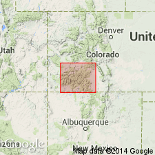
[Credited to Larsen.] Sheep Mountain andesite. Present in southwestern Colorado. Overlies Treasure Mountain quartz latite rather regularly, but where it overlies Conejos andesite it was deposited on a surface made up of mountains and deep canyons. The formation is present in 3 parts of the mountains and differs considerably in the 3 areas. One is a volcanic cone in drainage of Lost Trail Creek near center of San Cristobal quadrangle, [in Hinsdale County]; one is about Sheep Mountain in northwestern part of Summitville quadrangle, [in Mineral County]; and the third and by far the largest is in Del Norte and Saguache quadrangles [in Saguache and Rio Grande Counties]. Most of Lost Trail Creek area is largely chaotic breccia of light-colored andesite-latite with much glass in ground-mass. These commonly show irregular relations and are in part intrusive and in part effusive. The predominant rock of both the massive rock and the breccia is a dark-colored hornblende-pyroxene andesite somewhat like the rock of Sheep Mountain area except that it has smaller phenocrysts and has hornblende in most of the bodies. The body about Sheep Mountain is a low dome composed of dark flows and chaotic breccia and brecciated flows of pyroxene andesite with conspicuous tabular feldspar. Little tuff breccia is present. The bodies of Sheep Mountain in northeastern part of San Juan Mountains probably represent remnants of several volcanic piles. The rocks are all lighter-colored than those of the other two domes and are latite andesites. The rocks of Del Norte quadrangle and adjoining areas are much alike and are chiefly in thick flows extruded upon a mountainous topography with deep canyons. The common rock is rather dense and light gray to purple drab in color. It is made up nearly half of phenocrysts up to 3 cm or more across. White calcic andesine is chief phenocryst, but prisms of black hornblende, flakes of biotite, and grains of green augite are present in moderate amount. The groundmass is fine-textured and made up of small plagioclase laths in a sponge-like intergrowth of orthoclase and quartz. [Age is Miocene.]
[Typographical error (US geologic names lexicon, USGS Bull. 896, p. 1219): a 1933 date of publication listed; should be 1935.]
Source: US geologic names lexicon (USGS Bull. 896, p. 1973-1974).
- Usage in publication:
-
- Sheep Mountain Formation*
- Modifications:
-
- Revised
- AAPG geologic province:
-
- San Juan Mountains province
Summary:
No longer part of Potosi Volcanic Group; term Potosi abandoned. Report area is in San Juan Mountain province.
Source: GNU records (USGS DDS-6; Denver GNULEX).
For more information, please contact Nancy Stamm, Geologic Names Committee Secretary.
Asterisk (*) indicates published by U.S. Geological Survey authors.
"No current usage" (†) implies that a name has been abandoned or has fallen into disuse. Former usage and, if known, replacement name given in parentheses ( ).
Slash (/) indicates name conflicts with nomenclatural guidelines (CSN, 1933; ACSN, 1961, 1970; NACSN, 1983, 2005, 2021). May be explained within brackets ([ ]).