

- Usage in publication:
-
- Sewanee conglomerate
- Modifications:
-
- Named
- Dominant lithology:
-
- Conglomerate
- Sandstone
- AAPG geologic province:
-
- Appalachian basin
Summary:
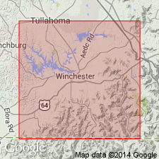
Named for Sewanee, Franklin Co., eastern TN. At Sewanee, conglomerate is a heavy-bedded sandstone abounding in white quartz pebbles of various shapes, varying in size from buckshot to that of pigeon's eggs or larger, scattered through it like plums in a pudding; pebbles are so numerous in places that rock is quarried for pebble gravel. Base of conglomerate is hard iron rock, a ferruginous conglomerate 3 to 24 in thick. Thickness of formation is 25 to 100 ft, averages about 60 ft. Caps Sewanee Plateau and overlies shales, with an occasional bed of clay and a few inches of coal at some points on the mountain. [Age is Pennsylvanian.]
Source: GNU records (USGS DDS-6; Reston GNULEX).

- Usage in publication:
-
- Sewanee conglomerate
- Modifications:
-
- Revised
- AAPG geologic province:
-
- Appalachian basin
Summary:
Assigned as basal formation in Crab Orchard Mountains group (new). Consists of medium- to coarse-grained, cross-bedded, massive, extremely conglomeratic sandstone in most areas. Thickness is as much as 160 ft, averages about 80 ft. In northwestern part of plateau, merges into Fentress formation. Overlies Signal Point shale (new) of Gizzard group; underlies Whitwell shale (revised). Sandstone that was previously called Bon Air [Bonair] at Bon Air, White Co., is equivalent to Sewanee; Sewanee has priority and name Bon Air is discontinued. Age is Pennsylvanian (Pottsville series). Report includes geologic maps, cross sections, stratigraphic sections, and correlation chart.
Source: GNU records (USGS DDS-6; Reston GNULEX).
- Usage in publication:
-
- Sewanee Member*
- Modifications:
-
- Revised
- Overview
- AAPG geologic province:
-
- Appalachian basin
Summary:
New nomenclature defined for rocks of Early Pennsylvanian age in northwest GA. Johnson's (1946) nomenclature based on miscorrelation with rock units of TN. Sewanee Member of Crab Orchard Mountains Formation of this report is Johnson's Bonair Sandstone. Johnson's Sewanee Member of Lookout Sandstone is Warren Point Member of Gizzard Formation of this report. Thickness 150 to 200 ft thick in GA and is surface rock on most of Lookout Mountain, GA. On Lookout Mountain in AL, it is coarse-grained sandstone as much as 150 ft thick with conglomeratic basal part that averages 60 ft in thickness. Underlies Whitwell Shale Member of Crab Orchard Mountains Formation. Overlies Signal Point Shale Member of Gizzard Formation.
Source: GNU records (USGS DDS-6; Reston GNULEX).

- Usage in publication:
-
- Sewanee Conglomerate
- Modifications:
-
- Areal extent
- AAPG geologic province:
-
- Appalachian basin
Summary:
(East-central sheet; not separately mapped.) Sewanee Conglomerate of Crab Orchard Mountains Group. Gray to brown, fine- to coarse-grained conglomeratic sandstone and sandstone. Thickness as much as 200 feet, average about 100 feet. Is basal formation of Crab Orchard Mountains Group. Lies below Whitwell Shale of Crab Orchard Mountains Group and above Signal Point Shale of Gizzard Group. Age is Pennsylvanian.
Source: Publication.

- Usage in publication:
-
- Sewanee Sandstone
- Modifications:
-
- Revised
- Areal extent
- AAPG geologic province:
-
- Appalachian basin
Summary:
Sewanee Sandstone is extended into KY and designated a formal formation of the Breathitt Group in this report. Shown on cross sections in TN, KY, WV, and VA. Occurs above the Dark Ridge Member of the Bottom Creek formation and below the Hensley Member of the Alvy Creek formation. In the south-central part of the study area, where the Bottom Creek is absent, the Sewanee Sandstone overlies the Warren Point Sandstone and the two are combined as the Warren Point-Sewanee Sandstones, equivalent to and formally replacing the Middlesboro Member of the Lee Formation of Englund (1964). The eastern occurrence of the Sewanee is equivalent to the middle quartzose sandstones of the New River Formation as mapped in VA and WV. Unit reaches a maximum of 180 m. It pinches out to the northwest and also thins to the southeast, where it interbeds with the Bottom Creek and Alvy Creek formations. Forms a northeast-southwest belt approximately 50 mi wide. According to the author, formal nomenclature presented in this report for units occurring in KY has been accepted by the Kentucky Stratigraphic Nomenclature Committee. Units that occur largely outside KY are considered informal. Report includes correlation charts and cross sections.
Source: GNU records (USGS DDS-6; Reston GNULEX).

- Usage in publication:
-
- Sewanee Conglomerate
- Modifications:
-
- Overview
- AAPG geologic province:
-
- Appalachian basin
Summary:
Sewanee Conglomerate at base of Crab Orchard Mountains Group mapped in Roane Co., eastern TN. Consists of medium- to medium light gray, fine- to coarse grained, medium- to thick- and very thick bedded, cross-bedded, sparsely to strongly conglomeratic sandstone. Locally contains a thin, silty shale interval near middle. Thickness ranges from 130 to 240 ft. Overlies Gizzard Group (undivided) and underlies Whitwell Shale. Age is Early Pennsylvanian.
Source: GNU records (USGS DDS-6; Reston GNULEX).

- Usage in publication:
-
- Sewanee Conglomerate*, Formation*
- Modifications:
-
- Revised
- Areal extent
- AAPG geologic province:
-
- Appalachian basin
Summary:
Used as Sewanee Conglomerate or Formation of Crab Orchard Mountains Group in TN only. Should not be used in GA. Lookout Formation or Sandstone of GA is equivalent to Gizzard Group and overlying Sewanee in adjacent TN.
Source: GNU records (USGS DDS-6; Reston GNULEX).
For more information, please contact Nancy Stamm, Geologic Names Committee Secretary.
Asterisk (*) indicates published by U.S. Geological Survey authors.
"No current usage" (†) implies that a name has been abandoned or has fallen into disuse. Former usage and, if known, replacement name given in parentheses ( ).
Slash (/) indicates name conflicts with nomenclatural guidelines (CSN, 1933; ACSN, 1961, 1970; NACSN, 1983, 2005, 2021). May be explained within brackets ([ ]).