The National Geologic Map Database is migrating to a new infrastructure. We apologize for any service disruptions during this process.
|
|---|


- Usage in publication:
-
- Seboomook slate
- Modifications:
-
- Original reference
- Biostratigraphic dating
- Dominant lithology:
-
- Slate
- Sandstone
- AAPG geologic province:
-
- New England province
Summary:
Pg. 374-375. Seboomook slate. Apparently underlies Moose River sandstone (of Oriskany age) on northwest side of that formation, and contains MONOGRAPTUS, which fixes its age as Silurian. Outcrops limited to lake shore, rapids of streams, and a few cuts along roads of Great Northern Paper Company. In most outcrops the rock is a dark-bluish slate, often with well-developed cleavage. Fresh pyrite cubes are common on unweathered surfaces, while weathered surfaces are iron-stained from decomposed pyrite. Some localities show interbedded sandstone layers which often contain clay balls closely resembling the slate in composition. Age is Silurian, based on graptolites.
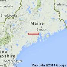
Best exposure of formation is at Seboomook Dam, on West Branch of Penobscot River [in extreme eastern part of Somerset Co.], western ME (Moosehead Lake region).
Source: US geologic names lexicon (USGS Bull. 896, p. 1948).
- Usage in publication:
-
- Seboomook formation
- Modifications:
-
- Areal extent
- AAPG geologic province:
-
- New England province
Summary:
Pg. 2 (table), 3-4. Seboomook formation. Formation geographically extended into East Megantic area, Quebec, Canada, where it occurs as a northeasterly trending band, consists chiefly of slates with minor metasandstones. Stratigraphically equivalent to Compton formation. Underlies Frontenac formation.
[See also Lexicon of Canadian Geologic Units (http://cgkn1.cgkn.net/weblex/weblex_search_e.pl).]
Source: US geologic names lexicon (USGS Bull. 1200, p. 3510); Lexicon of Canadian Geologic Units.
- Usage in publication:
-
- Seboomook formation*
- Modifications:
-
- Revised
- AAPG geologic province:
-
- New England province
Summary:
Pg. 6, 7-9, map. Seboomook formation. In Beck Pond area, formation consists of main body of gray slate, Bear Pond limestone member (new), and a granite talus member. Top of unit eroded; thickness not measured. Nonconformable on granitic basement complex of pre-Silurian age; locally, unconformably overlies Beck Pond limestone (new). Basal part of formation is of New Scotland (low Lower Devonian), but middle and upper parts to southeast of Beck Pond area are Oriskany (high Lower Devonian). Age is Early Devonian.
Source: US geologic names lexicon (USGS Bull. 1200, p. 3510).
- Usage in publication:
-
- Seboomook formation*
- Modifications:
-
- Principal reference
- Revised
- Age modified
- Redescribed
- Dominant lithology:
-
- Sandstone
- Slate
- Greenstone
- Volcanics
- AAPG geologic province:
-
- New England province
Summary:
Pg. 156 (fig. 16), 169-170, pl. 34. Perkins (1925, p. 374-375) applied name Seboomook slate to interbedded dark sandstone and slate exposed northwest of Moose River group. It is now termed Seboomook formation because dark sandstone makes up large part of it at many places, including Seboomook Dam locality. Also includes cyclicly layered slate, dark sandstone, and dark volcanic rocks exposed southeast and southwest of Tarrantine formation in trough of Moose River synclinorium. Volcanic unit within formation is Camera Hill greenstone member (new). Cyclic layering resembles varves, and sandstone layers grade upward into the slate layers. Weathered surfaces are gray, fresh surfaces are blue gray. The sandstone is lighter than the slate. Layers are fractions of an inch to several feet thick. Sandstone resembles that of Tarrantine formation. Thickness as much as 20,000 feet; is 10,000 feet at type section. Age is revised from Silurian (Perkins, 1925) to Devonian, although a small part may possibly be Silurian. Presence of brachiopod BEACHIA indicates bulk is of Oriskany age. Uppermost part could be Oriskany or early Onondaga; many species are same as in Tarrantine. At Beck Pond locality, slate and limestone lentil in lower part contain New Scotland age fossils. Perkins (1925, p. 375) cited Silurian graptolite MONOGRAPTUS from the Seboomook, but the specimens have been mislaid and author did not obtain additional material. The presence of the Hardwood Mountain formation of Late Silurian age beneath seemingly restricts the downward range of the formation into the Silurian, although a small part of it may possibly be Silurian. Report includes geologic map and correlation chart.
Type section: on the road and shore at the east end of Seboomook Lake (North East Carry and Seboomook Lake quadrangles) and on the Penobscot River (North East Carry quadrangle) for about a mile downstream from Seboomook Dam. Although incomplete, this is the thickest and best exposed structurally uncomplicated section of the formation known in this region. Named from Seboomook Dam (North East Carry quadrangle).
Source: Publication; GNU records (USGS DDS-6; Reston GNULEX).
- Usage in publication:
-
- Seboomook Formation
- Modifications:
-
- Revised
- Age modified
- AAPG geologic province:
-
- New England province
Summary:
The "Hafey Mountain sequence" of Boudette and others (1976), underlying a narrow belt between Hafey Mountain and Rocky Mountain, is here named the Hafey Mountain Member of the Seboomook Formation. The member lies within the slate-graywacke sequence of the Seboomook at an unknown but apparently significant distance above the base of the formation. The quartz arenite (quartzite) of the Hafey Mountain is described by Boudette and others (1976) as resistant, massive, locally conglomeratic, orthoquartzite interbedded with minor laminated sandstone and gray siltstone. The orthoquartzite is brownish-gray, granular, and laced with quartz veins. Age is Early Devonian.
Source: GNU records (USGS DDS-6; Reston GNULEX).
- Usage in publication:
-
- Seboomook Group
- Modifications:
-
- Revised
- Age modified
- AAPG geologic province:
-
- New England province
Summary:
Seboomook Formation is here raised in rank to Seboomook Group. Type section of Boucot (1961) is not representative of outcrop belt as a whole. Rocks of original Seboomook type section are therefore here designated Northeast Carry Formation. The new unit is predominantly greenish gray to medium dark gray, poorly sorted very fine to fine-grained sandstone with cyclically interbedded medium dark to dark gray metasiltstones or claystone slates and is estimated to be 4300 m thick at the type section. Seboomook Group also includes Ironbound Mountain (of Marvinney, in prep) and Carrabassett Formations in west-central Maine; Day Mountain, Temple Stream, and Mount Blue Formations (all here raised in rank) and Carrabassett, and Hildreths Formations in southwestern Maine. Group also includes several unnamed lithofacies. Undivided in north-central Maine. Contacts vary. Unit youngs and thickens toward northwest. Thickness ranges from 670 to 6500 m. Age is Early Devonian (late Gedinnian to early and middle Emsian).
Source: GNU records (USGS DDS-6; Reston GNULEX).

- Usage in publication:
-
- Seboomook Formation*
- Modifications:
-
- Revised
- AAPG geologic province:
-
- New England province
Summary:
Reduced in rank to formation. Includes (ascending) the Mount Blue, Temple Stream, and Day Mountain Members of Pankiwskyj (1979).
Source: GNU records (USGS DDS-6; Reston GNULEX).
- Usage in publication:
-
- Seboomook Group*
- Modifications:
-
- Overview
- AAPG geologic province:
-
- New England province
Summary:
Seboomook Group (Pollock, 1987) in this area includes most formations composing Lower Devonian clastic wedge deposited in Kearsarge-Central Maine basin (e.g., Carrabassett Formation) as well as in anticlinorial belt and Connecticut Valley-Gaspe basin (e.g., Seboomook Formation of Boucot, 1961). Report area includes unnamed rocks of Seboomook Group at Harrington Lake. Overlain by Matagamon Sandstone. Age is Devonian (Siegenian).
Source: GNU records (USGS DDS-6; Reston GNULEX).

- Usage in publication:
-
- Seboomook Group*
- Modifications:
-
- Revised
- Biostratigraphic dating
- AAPG geologic province:
-
- New England province
Summary:
Raised to group rank following the usage of Pollock (1987). In Piermont sequence of Piermont-Frontenac allochthon, contains newly defined Ironbound Mountain Formation (northwest of Thrasher Peaks and Foster Hill faults). Includes an upper unnamed shale and sandstone unit, greenstone at Camera Hill (previously mapped as Camera Hill Greenstone Member of Seboomook Formation by Boucot (1961)), and a lower well-bedded shale and sandstone unit in the Bronson Hill-Boundary Mountains anticlinorium. In central Maine trough, includes Day Mountain, Temple Stream, Mount Blue Formations (all three previously members of Seboomook Formation), and Hildreths and Carrabassett Formations. Type section of the Seboomook Formation (designated by Boucot (1961)) is now assigned to Northeast Carry Formation, also of Seboomook Group but is outside of this map area. Age of Seboomook Group is Early Devonian. Its upper unnamed shale and sandstone formation in Attean 15-min quad overlies Ironbound Mountain Formation; contains late Siegenian (Oriskanian) brachiopods, crinoid columnals, TENTACULITES, and bryozoans (Albee and Boudette, 1972). Complex shelly fauna in unnamed shale and sandstone at several localities in Long Pond, Spencer Lake, and Pierce Pond quads, near upper contact of formation, yield mainly upper Siegenian (Oriskanian) ages. At one locality at lower contact, near Beck Pond in Spencer Lake quad, fossils yield somewhat older Siegenian (late Helderbergian) age.
Source: GNU records (USGS DDS-6; Reston GNULEX).
For more information, please contact Nancy Stamm, Geologic Names Committee Secretary.
Asterisk (*) indicates published by U.S. Geological Survey authors.
"No current usage" (†) implies that a name has been abandoned or has fallen into disuse. Former usage and, if known, replacement name given in parentheses ( ).
Slash (/) indicates name conflicts with nomenclatural guidelines (CSN, 1933; ACSN, 1961, 1970; NACSN, 1983, 2005, 2021). May be explained within brackets ([ ]).