The National Geologic Map Database is migrating to a new infrastructure. We apologize for any service disruptions during this process.
|
|---|


- Usage in publication:
-
- Sappington sandstone
- Modifications:
-
- Original reference
- Dominant lithology:
-
- Sandstone
- AAPG geologic province:
-
- Montana folded belt
Summary:
Pg. 14-16. Sappington sandstone proposed for 60 feet of yellow sandstone lying above CYRTOSPIRIFER zone of Three Forks shale. Contains lower Carboniferous SYRINGOTHYRIS fauna (Kinderhook). Underlies Madison formation. Formerly included in Three Forks shale.
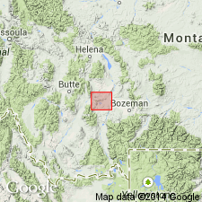
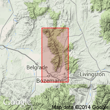
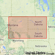
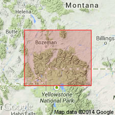
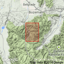
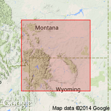
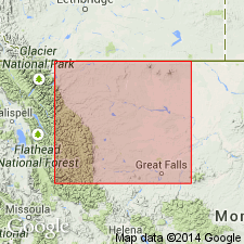
Type locality: near village of Sappington, in NW/4 sec. 36, T. 2 N., R. 1 W., [approx. Lat. 45 deg. 53 min. 02 sec. N., Long. 111 deg. 40 min. 45 sec. W., on eastern side of Milligan Canyon, Milligan Canyon 7.5-min quadrangle], Jefferson Co., southwestern MT. Named from Sappington which is in Gallatin Co.
[Additional locality information from USGS GNIS database, ACME Mapper 2.0, Montana State Univ. Graphical Locator, accessed October 28, 2011.]
Source: US geologic names lexicon (USGS Bull. 1200, p. 3474-3475).
- Usage in publication:
-
- Sappington sandstone member
- Modifications:
-
- Revised
- AAPG geologic province:
-
- Montana folded belt
Summary:
Sappington sandstone considered to be local member at top of Three Forks in Three Forks area of MT, Montana folded belt province. Authors refer to Sappington as "sandy facies" of Three Forks. Normal shale facies of Three Forks is interbedded with sandy facies and sandy facies grades laterally into typical shale of Three Forks. Contains distinctive fauna characterized by SYRINGOTHYRIS. Measured section at Logan, Gallatin Co, MT; uppermost sandy part is 23 ft thick. Correlation chart. Conformably underlies Lodgepole limestone of Madison group. Late Devonian age.
Source: GNU records (USGS DDS-6; Denver GNULEX).
- Usage in publication:
-
- Sappington sandstone
- Modifications:
-
- Overview
- AAPG geologic province:
-
- Montana folded belt
Summary:
Type locality (T2N, R1W) measured north of Sappington, Gallatin Co, MT in Montana folded belt province. Is 100 ft thick at type where it is composed of gray-orange to yellow-brown, massive, hard, very fine to fine-grained quartz sandstone and green-gray slightly calcareous shale. The sandstone can be arenaceous and shaly, and may have calcite and iron-oxide cement. Unconformably overlies Three-forks shale and unconformably underlies Madison group. Is unfossiliferous at type Madison. Is assigned to Early Mississippian. Thought to be correlative of newly named Leatham formation in Cache Co, UT on Wasatch uplift.
Source: GNU records (USGS DDS-6; Denver GNULEX).
- Usage in publication:
-
- Sappington formation
- Modifications:
-
- Areal extent
- AAPG geologic province:
-
- Montana folded belt
Summary:
Pg. 1388-1390 (table 1), 1397-1399. Sappington formation. In vicinity of Sacajawea Peak, Montana, formation comprises (ascending) black fissile conodont-bearing shale, 8 to 16 feet; pale-brown to yellow-brown thin- to medium-bedded fine-grained calcareous siltstone and sandstone noticeably more sandy in upper part, 62 feet; dark-brown to black silty shale or siltstone, 2 to 3 feet. Cooper and Sloss (1943, Jour. Paleo., v. 17) call the upper part basal Lodgepole black shale. Age is Devonian(?).
Source: US geologic names lexicon (USGS Bull. 1200, p. 3475).
- Usage in publication:
-
- Sappington member*
- Modifications:
-
- Age modified
- AAPG geologic province:
-
- Montana folded belt
Summary:
In the Logan area, Gallatin Co, MT in the Montana folded belt province, the Three Forks formation is Late Devonian and Early Mississippian age. The Early Mississippian fossils are in the Sappington. [Lower age limit of Sappington not discussed.]
Source: GNU records (USGS DDS-6; Denver GNULEX).
- Usage in publication:
-
- Sappington formation
- Modifications:
-
- Areal extent
- Revised
- AAPG geologic province:
-
- Montana folded belt
Summary:
Upper black shale removed from Sappington and assigned to overlying Lodgepole formation as shale appears in places to grade upward into Lodgepole and is perfectly conformable with basal Lodgepole crinoidal limestone. Also, shale is considered to be of Mississippian age by most workers. Disconformably overlies Three Forks formation. Thickness is variable but is generally thin north and south of Three Forks-northern Bridger Range area; absent in eastern part of study area which includes southern part of Montana folded belt province. Thickness as shown on isopach map ranges up to 100 ft. Several measured sections in cross sections. Correlation chart. Most of unit is latest Devonian age and substantially younger than Three Forks.
Source: GNU records (USGS DDS-6; Denver GNULEX).
- Usage in publication:
-
- Sappington Formation
- Modifications:
-
- Overview
- AAPG geologic province:
-
- Montana folded belt
Summary:
Within mapped area, thickness ranges from 23-60 ft. Quad is in Montana folded belt province. Overlies Three Forks Shale; underlies Lodgepole Limestone. Mapped undivided with Maywood Formation, Jefferson Limestone and Three Forks. Devonian-Mississippian faunal boundary probably lies within unit.
Source: GNU records (USGS DDS-6; Denver GNULEX).
- Usage in publication:
-
- Sappington Member*
- Modifications:
-
- Redefined
- Reference
- AAPG geologic province:
-
- Montana folded belt
- Snake River basin
- Sweetgrass arch
Summary:
Pg. N2 (fig. 1), N8 (fig. 3), N14+; 1962, Billings Geol. Soc. Gdbk., 13th Ann. Field Conf., p. 47-50. Sappington Member of Three Forks Formation. Name shortened from Sappington Sandstone Member because sandstone is a relatively minor constituent. Consists of (ascending): (1) shale, 1 to 13 feet; (2) silty argillaceous limestone or argillaceous calcareous siltstone, 3 to 7 feet; (3) interbedded calcareous siltstone, shaly siltstone, and shale, 15 to 25 feet; (4) slightly calcareous shale containing thin interbeds, laminae, and lenses of calcareous siltstone, 8 to 28 feet; and (5) massive coarse-grained limonitic calcareous siltstone that locally grades in part to very fine sandstone, 22 to 34 feet. Total thickness 57 feet at Logan, 75 to 100 feet west of Logan, and 70 feet north of Logan in northern Big Belt Mountains. Is unconformably overlain by the Lower Mississippian "dark shale unit" or, where absent, Lodgepole Formation. Separated from underlying Trident Member of Three Forks by a regional disconformity; the several feet of siltstone and dark shale below this disconformity, previously included in the Sappington, are here included in the Trident. In subsurface, correlative with the Exshaw and lower part of the Bakken. Fossils. Age is Late Devonian to Early Mississippian.
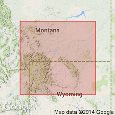
Reference section (= type section of Three Forks): on north bank of Gallatin River at Logan, in SW/4 SE/4 sec. 25, T. 2 N., R. 2 E., [Logan 7.5-min quadrangle], Gallatin Co., MT.
Source: Publication; Changes in stratigraphic nomenclature, 1964 (USGS Bull. 1224-A, p. A13).
- Usage in publication:
-
- Sappington Member*
- Modifications:
-
- Areal extent
- Biostratigraphic dating
- AAPG geologic province:
-
- Montana folded belt
Summary:
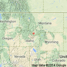
As the upper member of the Three Forks Formation is restricted to southwest MT in Montana folded belt province. Underlies the upper tongue of the newly named Cottonwood Canyon Member which is assigned to the Lodgepole Limestone in southern MT. Is a regressive marine deposit of latest Devonian (conodont zones) and earliest Mississippian age. Upper age limit uncertain. Correlates with the lower tongue of the Cottonwood Canyon Member and lower part of Madison Limestone in northern and west-central WY.
Source: GNU records (USGS DDS-6; Denver GNULEX).
- Usage in publication:
-
- Sappington Member*
- Modifications:
-
- Overview
- AAPG geologic province:
-
- Montana folded belt
- Sweetgrass arch
Summary:
Is a member of Three Forks Formation in southern Sweetgrass arch (parts of Teton and Cascade Cos) and in eastern Montana folded belt province (Lewis and Clark Co). Is continuous with Exshaw Formation, a Canadian unit extended into the Sweetgrass arch, MT and adopted in this report. Correlates with Bakken Formation of Williston basin in MT and ND. Is of Devonian and Mississippian age.
Source: GNU records (USGS DDS-6; Denver GNULEX).
- Usage in publication:
-
- Sappington Member*
- Modifications:
-
- Age modified
- Biostratigraphic dating
- AAPG geologic province:
-
- Sweetgrass arch
- Montana folded belt
- Snake River basin
Summary:
Evidence for Mississippian age of Sappington Member of Three Forks Formation has not been found. Age designation used in this report is Late Devonian and Mississippian?. This designation is a change from the previous designation of Late Devonian and Early Mississippian. The member near the town of Monarch, Little Belt Mountains, Cascade Co, MT on Sweetgrass arch, is 4 m thick; overlies Logan Gulch Member of Three Forks Formation; underlies Paine Member of Lodgepole Limestone; and is in Upper POLYGNATHUS STYRIACUS, Middle BISPATHODUS COSTATUS, and SIPHONODELLA PRAESULCATA conodont zones. In Long Canyon on west side of Beaverhead Mountains, Clark Co, ID in Snake River basin, the Sappington is 40 m thick; unconformably overlies Birdbear Member of Jefferson Formation; unconformably underlies McGowan Creek Formation; and is in Upper POLYNATHUS STYRIACUS conodont zone. At both localities, Sappington is of Famennian age. Both sections illustrated. Isopach map; member ranges from 0-30 m thick; member extends from northeast ID in Snake River basin north into western MT across Montana folded belt province to Sweetgrass arch.
Source: GNU records (USGS DDS-6; Denver GNULEX).
- Usage in publication:
-
- Sappington Member*
- Modifications:
-
- Areal extent
- AAPG geologic province:
-
- Montana folded belt
Summary:
As upper member [Upper Devonian] of Three Forks Formation is identified in the Bell-McKenzie Divide section (T11S, R10W), Beaverhead Co, MT in the Montana folded belt province. Underlies Paine Limestone (raised in rank), basal formation of Tendoy Group (new).
Source: GNU records (USGS DDS-6; Denver GNULEX).
- Usage in publication:
-
- Sappington Member*
- Modifications:
-
- Overview
- AAPG geologic province:
-
- Montana folded belt
- Snake River basin
Summary:
At Milligan Canyon section, near Logan, Gallatin Co, MT, Montana folded belt province, correlation chart (fig. 4) shows upper Sappington (Three Forks Formation) extending to top of upper SIPHONODELLA PRAESULCATA zone (uppermost Famennian, Upper Devonian). Here, upper Sappington conformably underlies post-Devonian rocks; middle Sappington unconformably overlies basal Sappington. Southwest from Milligan Canyon at Ashbough Canyon in Blacktail Mountains, Beaverhead Co, MT, upper Sappington not present. Here, middle Sappington is within S. PRAESULCATA zone; unconformably overlies basal Sappington; unconformably underlies post-Devonian rocks. Farther southwest at Long Canyon in Beaverhead Mountains, Clark Co, ID, and at Black Canyon in Lemhi Range, Butte Co, ID, Snake River basin, only basal Sappington present. Here basal Sappington is within S. EXPANSA zone; unconformably overlies Trident Member of Three Forks; unconformably underlies post-Devonian rocks. Age of uppermost Sappington remains equivocal, though "As a working hypothesis ... should be considered as solely Devonian, wherever contrary fossil evidence does not exist." Paleogeographic maps.
Source: GNU records (USGS DDS-6; Denver GNULEX).
- Usage in publication:
-
- Sappington Member*
- Modifications:
-
- Overview
- Age modified
- AAPG geologic province:
-
- Wind River basin
- Bighorn basin
Summary:
Upper member of Three Forks Formation; assigned to base of author's stratigraphic sequence 4 (Kinderhookian-lower Meramecian). Occurs in Wind River Mountains, Absaroka Range, and Beartooth Mountains in Wind River and Bighorn basins and westward in WY and MT. Is at least partially equivalent to unnamed basal clastic unit which is time transgressive and which is also at least partially equivalent to Cottonwood Canyon Member of Madison or Lodgepole, Englewood, Bakken Paine Member of Lodgepole, Exshaw, Leatham, and lower part of Guernsey Formations, as well as other units. Sappington and equivalents are disconformable above equivalents of Upper Devonian part of Three Forks in northwest part of study area and above older rocks throughout remainder of area. Basal deposits of sequence 4 were laid down during an early stage of the Ancestral Front Range and Pathfinder uplifts and are overlain conformably (fig. 35) by carbonate rocks deposited during Kinderhookian transgression onto the Wyoming shelf. Maughan (1963, USGS Prof. Paper 475-C) assigned basal clastic unit in Laramie Range to the Mississippian and reported that contact with overlying limestone is gradational and intertonguing. Assigned Kinderhookian age. Devonian age assigned to Sappington by Sandberg, Klapper (1967) was based primarily on lack of diagnostic Mississippian conodont forms (except for those they reported as resulting from "stratigraphic leakage" from overlying unit).
Source: GNU records (USGS DDS-6; Denver GNULEX).
For more information, please contact Nancy Stamm, Geologic Names Committee Secretary.
Asterisk (*) indicates published by U.S. Geological Survey authors.
"No current usage" (†) implies that a name has been abandoned or has fallen into disuse. Former usage and, if known, replacement name given in parentheses ( ).
Slash (/) indicates name conflicts with nomenclatural guidelines (CSN, 1933; ACSN, 1961, 1970; NACSN, 1983, 2005, 2021). May be explained within brackets ([ ]).