The National Geologic Map Database is migrating to a new infrastructure. We apologize for any service disruptions during this process.
|
|---|


- Usage in publication:
-
- San Vicente Member
- Modifications:
-
- First used
- Dominant lithology:
-
- Chalk
- Limestone
- AAPG geologic province:
-
- Permian basin
Summary:
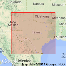
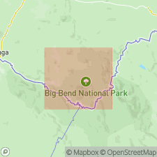
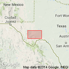
First used as top member of Boquillas Formation (revised) of Terlingua Group (revised) of Gulfian Series in San Vicente-Hot Springs area, Big Bend National Park, Brewster Co, TX in the Permian basin. Type not designated; derivation of name not stated. Overlies Ernst Member (new) of Boquillas with contact at erosion surface; beds below and above diastem noted to be difficult to distinguish unless fossiliferous. Includes Udden's (1907) lower Terlingua Beds and Adkins' (1933) Austin-age chalk unit. Is gray to buff argillaceous, flaggy limestone. Is normally 330 to 400 ft thick; locally thins to 130 ft. Fossils noted. INOCERAMUS UNDULATOPLICATUS zone is noted to be useful in locating the top of the unit; occurs abundantly in chalky limestone ledge 15-20 ft below top of member. Correlates with lower Austin Chalk in central TX. Age is early Coniacian (Late Cretaceous).
Source: GNU records (USGS DDS-6; Denver GNULEX).
- Usage in publication:
-
- San Vicente Member
- Modifications:
-
- Named
- Dominant lithology:
-
- Limestone
- Marl
- Chalk
- AAPG geologic province:
-
- Permian basin
Summary:
Named upper member of two in Boquillas Formation (revised), Terlingua Group (revised), Gulfian Series. Named from old village of San Vicente, Big Bend National Park, Brewster Co, TX (Permian basin). Type locality about 2 mi northeast of old village, immediately east of USGS benchmark elevation 1,881. Type section about 1 mi east of abandoned village, 331.5 ft thick. Mostly 350-400 ft thick in Big Bend National Park, thins locally to 130 ft. Gray, thin- to medium-bedded, chalky and argillaceous limestone flags interbedded with gray or yellowish-gray platy marl or soft gray marl; some limestone layers as thick as 12-18 in, most are 2-6 in thick. Contains more, thicker marl intervals and more chalk than underlying Ernst Member (new); flagstone decreases upward. Chalky ledge 15-20 ft below upper contact with Pen Formation (new) contains abundant INOCERAMUS UNDULATOPLICATUS. Fossil ammonites, pelecypods, echinoids, foraminifers identified. Fossils indicate Austin age. Correlates (table 2) with lower part of Austin Chalk (without EXOGYRA PONDEROSA) in Rio Grande embayment of southwest TX; with (ascending) Atco Chalk, Vinson Chalk, and Jonah Limestone in central TX; with (ascending) Ector Chalk, Bonham Clay, and Blossom Sandstone in northeast TX. Correlates (pl. VIII) with upper part of Sawmill Mountain, and all of Fizzle Flat Members of Boquillas Formation in Agua Fria area, northwest of Park. Coniacian and Santonian, Late Cretaceous age.
Source: GNU records (USGS DDS-6; Denver GNULEX).
- Usage in publication:
-
- San Vicente Member
- Modifications:
-
- Overview
- AAPG geologic province:
-
- Permian basin
Summary:
Is upper member of two named in Boquillas Formation by Maxwell and others (1967). Presents detailed information regarding location of type locality as follows: Planetable section, 2.4 road mi south of intersection of Panther Junction to Rio Grande Village Park Road 1 and San Vicente Village to Rio Grande Village River Road, and 0.25 mi south of U.S. Geological Survey benchmark elevation 1881 ft, starting at the River Road, extending 2240 ft due east, and about 2 mi northeast of the old village of San Vicente, Big Bend National Park, Brewster Co, TX (southern part of Permian basin). Original discussion, written section description, and graphic section (from pl. VII, no. 23) are reproduced in this published note. New location maps presented in fig 2. Is correlated with Lower Austin Group: Atco, Vinson, and Jonah units of Durham (1956). Age is Coniacian-Santonian, Late Cretaceous.
Source: GNU records (USGS DDS-6; Denver GNULEX).
- Usage in publication:
-
- San Vicente Member
- Modifications:
-
- Mapped 1:250k
- Dominant lithology:
-
- Limestone
- Marl
- AAPG geologic province:
-
- Permian basin
Summary:
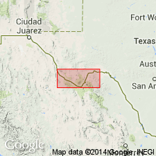
San Vicente Member of Boquillas Formation. Not separately mapped (Boquillas Formation, undivided, mapped in Presidio and Brewster Counties, Texas). Consists of thin- to medium-bedded, chalky, argillaceous, limestone flags interbedded with gray to yellowish-gray platy marl and soft gray marl; marine megafossils and microfossils abundant. Thickness 130 to 400 feet in Big Bend National Park, 274 feet in Black Gap area, crops out widely. Equivalent to lower part of Austin Chalk, mapped in eastern part of sheet. Overlies Ernst Member, lower member of Boquillas Formation. Underlies Pen Formation. Age is Late Cretaceous.
Source: Publication; supplemental information from GNU records (USGS DDS-6; Denver GNULEX).
- Usage in publication:
-
- San Vicente Member
- Modifications:
-
- Mapped 1:250k
- AAPG geologic province:
-
- Permian basin
Summary:
Is upper member of two in Boquillas Formation as mapped south of Del Norte Mountains in Brewster Co, TX (southern part of Permian basin). San Vicente Member not separately mapped. Overlies Ernst Member of Boquillas. Overlain by Gulfian rocks undivided. Consists of thin- to medium-bedded, chalky, argillaceous limestone flags, interbedded with gray to yellowish-gray platy marl and soft gray marl; marine megafossils and microfossils abundant. Is not recognized in southeastern part of map area (southern Terrell Co, TX) where top part of Boquillas is eroded. Age is Late Cretaceous.
Source: GNU records (USGS DDS-6; Denver GNULEX).
For more information, please contact Nancy Stamm, Geologic Names Committee Secretary.
Asterisk (*) indicates published by U.S. Geological Survey authors.
"No current usage" (†) implies that a name has been abandoned or has fallen into disuse. Former usage and, if known, replacement name given in parentheses ( ).
Slash (/) indicates name conflicts with nomenclatural guidelines (CSN, 1933; ACSN, 1961, 1970; NACSN, 1983, 2005, 2021). May be explained within brackets ([ ]).