The National Geologic Map Database is migrating to a new infrastructure. We apologize for any service disruptions during this process.
|
|---|


- Usage in publication:
-
- Salmon Creek Bed
- Modifications:
-
- Named
- Dominant lithology:
-
- Dolostone
- AAPG geologic province:
-
- Appalachian basin
Summary:
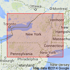
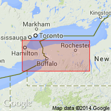
A phosphatic and quartz pebble-bearing dolostone bed at the base of the Irondequoit Limestone is here designated the Salmon Creek Bed for exposures along Salmon Creek West in the town of Williamson, Wayne Co., NY. Unit has been traced westward to Lockport where it occurs at the base of the Rockway Member of the Irondequoit. Eastward it is assigned to the Dawes Formation as it correlates with the conglomeratic basal bed of that formation. At the type section it consists of 7 to 15 cm of buff-weathering, light greenish gray, pyritic, bioturbated, very fine grained dolostone with small pebbles of quartz and phosphate. Unit records a brief but widespread shallowing event that terminated deposition of the underlying Williamson and equivalent Willowvale Shales. Age is Silurian (late Llandoverian-early Wenlockian).
Source: GNU records (USGS DDS-6; Reston GNULEX).
- Usage in publication:
-
- Salmon Creek Phosphate Bed*
- Modifications:
-
- Revised
- AAPG geologic province:
-
- Appalachian basin
Summary:
The Salmon Creek Phosphate Bed is the basal bed of the Rockway Dolomite (herein raised in rank from a member of the Irondequoit Limestone). Consists of buff-weathering, light greenish-gray, pyritic, bioturbated dolomicrite that contains small pebbles of quartz and phosphate. Thickness is 0.25 to 0.5 feet. Well exposed in the Genesee River Gorge in Rochester, NY, and in a cut on the Lockport Glen Railroad, Lockport, NY. Unconformably overlies the Williamson Shale and conformably underlies the remainder of the Rockway Dolomite. Unit can be traced eastward into the basal hematitic ore bed of the Dawes Formation. Westward, in the Niagara region of Ontario, CAN, the Williamson Shale appears to pinch out, and as a result, the Second Creek Phosphate Bed merges with the Salmon Creek to form a complex phosphatic zone at the top of the Merritton Limestone. The Salmon Creek is of Early Silurian (latest Llandoverian and earliest Wenlockian) age based on conodonts. [Report uses Early and Late Silurian time scale of Harland and others (1982).]
Source: GNU records (USGS DDS-6; Reston GNULEX).
For more information, please contact Nancy Stamm, Geologic Names Committee Secretary.
Asterisk (*) indicates published by U.S. Geological Survey authors.
"No current usage" (†) implies that a name has been abandoned or has fallen into disuse. Former usage and, if known, replacement name given in parentheses ( ).
Slash (/) indicates name conflicts with nomenclatural guidelines (CSN, 1933; ACSN, 1961, 1970; NACSN, 1983, 2005, 2021). May be explained within brackets ([ ]).