The National Geologic Map Database is migrating to a new infrastructure. We apologize for any service disruptions during this process.
|
|---|


- Usage in publication:
-
- Rocky Flats alluvium*
- Modifications:
-
- Named
- Dominant lithology:
-
- Sand
- AAPG geologic province:
-
- Denver basin
Summary:
Named for exposures in a gravel pit at east edge of Rocky Flats in NW1/4 SW1/4 sec 23, T2S, R70W, Golden quad, Jefferson Co, CO in the Denver basin, where unit is "typically exposed." Is a sheet 10 to 40 ft thick of reddish-brown, poorly sorted, stony, coarse sand. Overlies Mesozoic bedrock about 1600 ft below level of a subsummit surface on the Front Range and 100 ft above the next younger alluvium, the Verdos alluvium (new). Interpreted to be of Nebraskan or Aftonian or Pleistocene age because of its relation to the Verdos.
Source: GNU records (USGS DDS-6; Denver GNULEX).

- Usage in publication:
-
- Rocky Flats alluvium*
- Modifications:
-
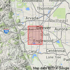
- Mapped 1:24k (Littleton quad, Arapahoe, Douglas, and Jefferson Cos, CO)
- Dominant lithology:
-
- Gravel
- Sand
- Silt
- Clay
- AAPG geologic province:
-
- Denver basin
Summary:
Is Pleistocene (Nebraskan or Aftonian) formation mapped in east-central Jefferson Co (Denver basin). Occurs only as one small deposit is southwest corner of quad where it overlies Fountain formation on a high remnant of a pediment in center of sec 21, T6S, R69W. Is older than Verdos alluvium (Pleistocene, Kansan or Yarmouth); younger than Dawson arkose (Upper Cretaceous and Paleocene). Unit is primarily a reddish-brown bouldery pebble alluvium, but also contains some sand, silt, and clay in upper part. An Aftonian? soil was developed on Rocky Flats. Thickness is about 25 ft.
Source: GNU records (USGS DDS-6; Denver GNULEX).
- Usage in publication:
-
- Rocky Flats alluvium*
- Modifications:
-
- Mapped 1:24k (Kassler quad, Douglas and Jefferson Cos, CO)
- Dominant lithology:
-
- Boulders
- Cobbles
- Pebbles
- Sand
- Clay
- AAPG geologic province:
-
- Denver basin
Summary:
Is Pleistocene formation mapped in northwestern Douglas and southeastern Jefferson Cos, CO (Denver basin). Is preserved as rocky knobs and slopes paved with rock in eastern half of quad. Described (p.13) as reddish-brown coarse-grained, poorly stratified deposit of locally derived rocks; is composed of boulders, cobbles, pebbles, and sand bound together by clay; boulders exceeding 3 ft in maximum dimension are common. Measured section (including type). Is oldest Pleistocene unit; unconformably overlies older rocks; unconformably underlies Verdos alluvium (Pleistocene). Age considered to be Nebraskan or Aftonian because is older, though not much older, than Verdos alluvium (Kansan or Yarmouth). Thickness is 10-40 ft.
Source: GNU records (USGS DDS-6; Denver GNULEX).

- Usage in publication:
-
- Rocky Flats Alluvium*
- Modifications:
-
- Mapped 1:24k (Morrison quad, Jefferson Co, CO)
- Dominant lithology:
-
- Gravel
- Silt
- Clay
- AAPG geologic province:
-
- Denver basin
Summary:
Is Pleistocene (Aftonian Interglaciation or Nebraskan Glaciation) alluvium mapped in Jefferson Co, CO (Denver basin). On Correlation of Map Units is shown to conformably overlie Pleistocene rock slide unit and to unconformably underlie Verdos Alluvium (Pleistocene--Yarmouth interglaciation or Kansan glaciation). Map unit described as reddish-brown pebbly silt and clay interlayered with gravel. Gravel in Rocky Flats Alluvium from Green Mountain is finer than from mountains to west. Stones deeply weathered, and, in upper part of deposit, coated by calcium carbonate. Very strong Brown soil of pre-Bull Lake (Aftonian?) age developed in upper part. Pediment lies about 350 ft above modern streams. Inferred Rocky Flats erosion channel preserved in Mount Vernon Canyon and in windgap through Dakota hogback west of Green Mountain; most exposures occur in northeastern part of quad. Thickness of alluvium 10-15 ft.
Source: GNU records (USGS DDS-6; Denver GNULEX).
- Usage in publication:
-
- Rocky Flats Alluvium*
- Modifications:
-
- Mapped 1:24k (Indian Hills quad, Jefferson Co, CO)
- Dominant lithology:
-
- Gravel
- AAPG geologic province:
-
- Denver basin
Summary:
Is Pleistocene (Aftonian or Nebraskan) formation mapped in central Jefferson Co, CO (Denver basin). Older than older colluvium? (Pleistocene) map unit and Verdos Alluvium (Pleistocene); younger than Tertiary gravel map unit. Map unit described as reddish-brown bouldery cobble gravel in clayey sandy pebble-gravel matrix. Very strongly developed pre-Bull Lake (Aftonian?) soil contains hard, blocky, plastic B horizon. No calcium-carbonate zone seen. Found only on two high remnants of pediment cut on Fountain Formation south of Deer Creek. 8-15 ft thick.
Source: GNU records (USGS DDS-6; Denver GNULEX).
- Usage in publication:
-
- Rocky Flats Alluvium*
- Modifications:
-
- Mapped 1:24k (Lafayette quad, Adams Boulder, and Jefferson Cos, CO)
- Dominant lithology:
-
- Gravel
- Sand
- AAPG geologic province:
-
- Denver basin
Summary:
Is Pleistocene formation mapped in northwestern Adams Co, CO (Denver basin). Unconformably overlies Denver Formation (Upper Cretaceous and Paleocene); unconformably underlies Verdos Alluvium (Pleistocene). Exposed in Federal Heights area in southeast part of quad where remnant is about 90 m above Big Dry Creek; small isolated exposures in center of northeast part of quad. Unit described as reddish-brown sandy gravel to pebbly sand. Contains partly eroded Cca (calcium carbonate-enriched) horizon in upper part. Soil profile shown. Thickness less than 3 m. Correlated with either Nebraskan Glaciation or Aftonian Interglaciation.
Source: GNU records (USGS DDS-6; Denver GNULEX).
- Usage in publication:
-
- Rocky Flats Alluvium*
- Modifications:
-
- Mapped 1:24k (Fort Logan quad, Arapahoe, Denver, and Jefferson Cos, CO)
- Dominant lithology:
-
- Sand
- Gravel
- AAPG geologic province:
-
- Denver basin
Summary:
Is Pleistocene formation mapped in eastern Jefferson Co, CO (Denver basin). Shown on Correlation of Map Units to unconformably overlie Denver (Upper Cretaceous and Paleocene) and Arapahoe (Upper Cretaceous) Formations, undivided and to unconformably underlie Verdos Alluvium (Pleistocene). Unit described as reddish-brown to light-brown, poorly sorted, coarse sand and gravel, cobbles, and scattered boulders. Strongly developed calcium carbonate-enriched zone (relict soil), 2-4 ft thick, occurs near top of alluvium. Mapped in northwestern corner of quad. Engineering properties discussed. Commonly 10-20 ft thick.
Source: GNU records (USGS DDS-6; Denver GNULEX).
- Usage in publication:
-
- Rocky Flats Alluvium*
- Modifications:
-
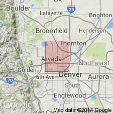
- Mapped 1:24k (Arvada quad, Adams, Denver, and Jefferson Cos, CO)
- Dominant lithology:
-
- Sand
- Gravel
- AAPG geologic province:
-
- Denver basin
Summary:
Is Pleistocene formation mapped in southwestern Adams and northeastern Jefferson Cos, CO (Denver basin). On Correlation of Map Units, Rocky Flats is shown to unconformably overlie Denver (Paleocene and Upper Cretaceous) and Arapahoe (Upper Cretaceous) Formations (mapped undivided) and to unconformably underlie Verdos Alluvium (Pleistocene). Unit is described as reddish-brown to light-brown poorly sorted coarse sand and gravel, cobbles, and scattered boulders. A strongly developed calcium carbonate-enriched zone (relict soil), 2-4 ft thick occurs near top. Outcrops in northwestern, west-central, and southwestern parts of quad. Engineering properties discussed. Thickness is 10-20 ft.
Source: GNU records (USGS DDS-6; Denver GNULEX).
- Usage in publication:
-
- Rocky Flats Alluvium*
- Modifications:
-
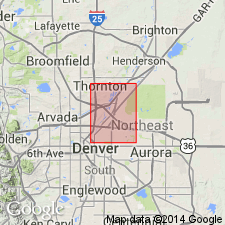
- Mapped 1:24k (Commerce City quad, Adams and Denver Cos, CO)
- Dominant lithology:
-
- Sand
- Gravel
- Clay
- Silt
- AAPG geologic province:
-
- Denver basin
Summary:
Is Pleistocene formation mapped in western Adams Co, CO (Denver basin). On Correlation of Map Units, Rocky Flats is shown to unconformably overlie Denver (Paleocene and Upper Cretaceous) and Arapahoe (Upper Cretaceous) Formations (mapped undivided) and unconformably underlie Verdos Alluvium (Pleistocene). Unit is described as reddish-brown to light-brown poorly sorted coarse sand and gravel containing lenses of clay and silt, cobbles, and scattered boulders. Has a strongly developed calcium carbonate-enriched zone 2-4 ft thick near top. Outcrops near northwestern corner of quad. Engineering properties discussed. Thickness is commonly 10-20 ft.
Source: GNU records (USGS DDS-6; Denver GNULEX).
- Usage in publication:
-
- Rocky Flats Alluvium*
- Modifications:
-
- Age modified
- AAPG geologic province:
-
- Denver basin
Summary:
Fossils including EQUUS (DOLICHOHIPPUS) sp. and gomphothere tooth (STEGOMASTODON ELEGANS) indicate a late Blancan age (early Pleistocene) rather than Aftonian or Nebraskan as previously thought. Geologic map; stratigraphic chart; measured section. Study area is in northeast CO, Denver basin.
Source: GNU records (USGS DDS-6; Denver GNULEX).
- Usage in publication:
-
- Rocky Flats Alluvium*
- Modifications:
-
- Mapped 1:12k (Jefferson Co, CO)
- Dominant lithology:
-
- Gravel
- Sand
- Clay
- AAPG geologic province:
-
- Denver basin
Summary:
Is lower Pleistocene formation mapped in northern Jefferson Co, CO (Denver basin). Correlation of Map Units shows unit unconformably overlying Arapahoe Formation (Upper Cretaceous) and unconformably underlying Verdos Alluvium (lower middle Pleistocene). In western part of map area, map unit described as commonly consisting of poorly sorted, clast-supported, slightly bouldery, cobble and pebble gravel that contains light-brown to light-red, clayey sand matrix; also contains beds and lenses of clast- and matrix-supported sandy pebble gravel, pebbly silty sand, and cobbly and pebbly sandy clay; quartzite boulders as large as 50X70X120 cm. In eastern part of map area, unit commonly consists of thin (5-90 cm) beds and lenses of poorly sorted, clast- and matrix-supported, white to pink, sandy pebble gravel, pebbly sand, and silty sands. Unit forms large fan-shaped pediment deposit that locally includes thick channel-fill deposits. In eastern map area, top of pediment deposit is about 45-70 m above Rock, Walnut, and Woman Creeks. In western map area top of unit contains thick (80-150 cm), clay-rich, Bt horizon that overlies and locally contains a discontinuous, stage III-IV K horizon up to 50 cm thick. In eastern map area, Bt horizon is thin (about 30 cm) and overlies a strongly developed stage III-IV K horizon that is greater than 135 cm thick. Thickness of unit commonly 1-10 m, but locally greater than 30 m.
Source: GNU records (USGS DDS-6; Denver GNULEX).
For more information, please contact Nancy Stamm, Geologic Names Committee Secretary.
Asterisk (*) indicates published by U.S. Geological Survey authors.
"No current usage" (†) implies that a name has been abandoned or has fallen into disuse. Former usage and, if known, replacement name given in parentheses ( ).
Slash (/) indicates name conflicts with nomenclatural guidelines (CSN, 1933; ACSN, 1961, 1970; NACSN, 1983, 2005, 2021). May be explained within brackets ([ ]).