The National Geologic Map Database is migrating to a new infrastructure. We apologize for any service disruptions during this process.
|
|---|


- Usage in publication:
-
- Rock Springs formation*
- Modifications:
-
- Revised
- AAPG geologic province:
-
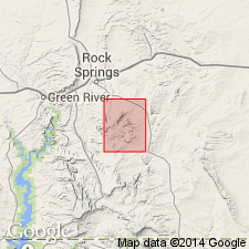
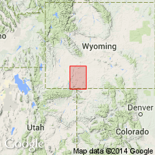
- Green River basin
Summary:
Rock Springs coal group given rank of formation and assigned as one of five formations to the Mesaverde group in report area of Sweetwater Co, WY in the Greater Green River basin. Overlies Blair formation (newly assigned to Mesaverde). Underlies the newly named Ericson sandstone of the Mesaverde. Tongues out southward into the Mancos shale. Cross section. Not shown on geologic map. Stratigraphic table. Of Late Cretaceous age.
Source: GNU records (USGS DDS-6; Denver GNULEX).
- Usage in publication:
-
- Rock Springs formation
- Modifications:
-
- Overview
- Revised
- AAPG geologic province:
-
- Green River basin
Summary:
Is revised to include the newly named Black Butte tongue on the east flank of the Rock Springs uplift in the Greater Green River basin, WY. In northern part of uplift, the Rock Springs formation is 1,680 ft thick and consists of thick coal beds alternating with buff to light-gray sandstones and carbonaceous shales. To the south, the formation grades into drab marine shale and sandy shale 860 ft thick; white sandstone that marks base of the formation in northern coal-bearing area is not present here. [Apparently Hale considered the Rock Springs formation on the southeast flank of the uplift to consist entirely of the Black Butte tongue, as his thickness here for both the Rock Springs and the Black Butte is 860 ft. Thus, he clearly did not include his Chimney Rock tongue in the Rock Springs formation.] Rock Springs formation overlies Chimney Rock tongue (new of Blair formation; underlies Ericson formation. Coal-bearing part represents deposition under continental swampy conditions. Black Butte tongue represents shallow-water, near-shore marine deposition. Rock Springs is considered equivalent to upper part of Mancos shale as evident from Vermillion Creek section. Age is Late Cretaceous.
Source: GNU records (USGS DDS-6; Denver GNULEX).
- Usage in publication:
-
- Rock Springs formation
- Modifications:
-
- Revised
- AAPG geologic province:
-
- Green River basin
Summary:
Black Butte tongue reassigned as a tongue of the Mancos shale on the Rock Springs uplift, Sweetwater Co, WY in Greater Green River basin. Chimney Rock tongue (formerly of the Blair formation) reassigned as a tongue at the base of the Rock Springs formation on the Rock Springs uplift, Sweetwater Co, WY. Age is Late Cretaceous.
Source: GNU records (USGS DDS-6; Denver GNULEX).

- Usage in publication:
-
- Rock Springs Formation*
- Modifications:
-
- Overview
- AAPG geologic province:
-
- Green River basin
Summary:
Is the second from base of four formations of Mesaverde Group on the Rock Springs uplift, Greater Green River basin, WY. Is of early Campanian age. Correlation with other units of the same Late Cretaceous age in south-central WY shown on Table 1.
Source: GNU records (USGS DDS-6; Denver GNULEX).
- Usage in publication:
-
- Rock Springs Formation*
- Modifications:
-
- Biostratigraphic dating
- AAPG geologic province:
-
- Green River basin
Summary:
Palynostratigraphic zone AQUILAPOLLENITES QUADRILOBUS Interval Zone is within Rock Springs in southwestern WY [Greater Green River basin]. A. QUADRILOBUS Zone is assigned early middle Campanian through late (but not latest) Campanian age (79 to 73 Ma). A. QUADRILOBUS is probably equivalent to interval including zones of ammonites BACULITES PERPLEXUS through B. CUNEATUS.
Source: GNU records (USGS DDS-6; Denver GNULEX).
For more information, please contact Nancy Stamm, Geologic Names Committee Secretary.
Asterisk (*) indicates published by U.S. Geological Survey authors.
"No current usage" (†) implies that a name has been abandoned or has fallen into disuse. Former usage and, if known, replacement name given in parentheses ( ).
Slash (/) indicates name conflicts with nomenclatural guidelines (CSN, 1933; ACSN, 1961, 1970; NACSN, 1983, 2005, 2021). May be explained within brackets ([ ]).