

- Usage in publication:
-
- Rico formation*
- Modifications:
-
- Incidental mention
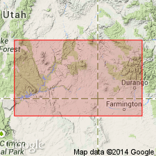
- Areal extent
- AAPG geologic province:
-
- Paradox basin
Summary:
[Credited to Whitman Cross.] In Rico quadrangle and invertebrate fauna has been found in lower 200 to 300 feet of "Red Beds," which is assigned by G.H. Girty to Permo-Carboniferous, in the sense of a transition series. The complex of strata characterized by this fauna will be described as Rico formation. In absence of fossil evidence the red strata between the Rico Permo-Carboniferous and the overlying beds containing Triassic remains are grouped with latter, here named Dolores formation.
Source: US geologic names lexicon (USGS Bull. 896, p. 1811-1812).
- Usage in publication:
-
- Rico formation*
- Modifications:
-
- Incidental mention
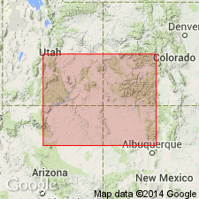
- Areal extent
- AAPG geologic province:
-
- San Juan basin
Summary:
Pg. 8. From section displayed in Animas Valley and at Rico we can assume presence of other sedimentary formations below Dolores formation (oldest exposed) in La Plata dome. These embrace Rico and Hermosa (Carboniferous), the Ouray (Devonian), and the Ignacio (Cambrian), all in apparent structural conformity.
Source: US geologic names lexicon (USGS Bull. 896, Hermosa entry p. 945).
- Usage in publication:
-
- Rico formation*
- Modifications:
-
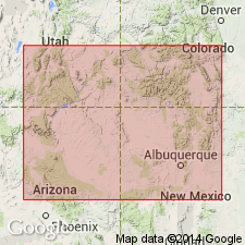
- Areal extent
- Dominant lithology:
-
- Sandstone
- Shale
- Limestone
- AAPG geologic province:
-
- San Juan basin
Summary:
Pg. 59. It is here proposed to apply the name Rico to a formation assumed to be about 300 feet thick, occurring between the Hermosa formation or characteristic Pennsylvanian Carboniferous and strata assigned at present to Trias of San Juan region --the Dolores formation. The Rico is composed of sandstones and conglomerates with intercalated shales and sandy fossiliferous limestones. In Rico region is conformable on Hermosa and is followed by the Dolores with seemingly perfect parallelism of stratification. The boundary between Rico and Dolores formations is at present entirely artificial, being based upon highest known occurrence of Rico fossils. [In 1905 the Dolores formation as first defined was divided into Cutler formation below and Dolores formation (restricted) above. (See under Cutler formation and Dolores formation.) The formation that overlies Rico formation is therefore now called Cutler formation, instead of Dolores.]
Source: US geologic names lexicon (USGS Bull. 896, p. 1811-1812).
- Usage in publication:
-
- Rico formation*
- Modifications:
-
- Principal reference
- AAPG geologic province:
-
- San Juan basin
- San Juan Mountains province
Summary:
[Credits Whitman Cross.] Rico formation. Consists of 300 feet of sandstones and conglomerates with intercalated sandy shales and thin fossiliferous sandy limestones; color chocolate or dark maroon. Rests conformably on Hermosa formation. Conformably overlain by Cutler formation, which comprises lower 1,600 feet of Dolores formation as originally defined. Base of Rico formation can usually be very accurately located in field by its lowest fossil-bearing stratum. The boundary between Rico and Cutler formations is, however, quite arbitrary, being based on highest known occurrence of Rico fossils. The former is made to include only that part of the section characterized by the Permo-Pennsylvanian fauna, while the Cutler comprises the apparently unfossiliferous "Red Beds" of this region, extending to horizon at which Triassic fossils are known to occur. The formation was named by A.C. Spencer.
[GNC remark (ca. 1936, US geologic names lexicon, USGS Bull. 896, p. 1811-1812): Where the limestones of Rico formation are absent in southeastern Utah, the red beds corresponding to Rico formation are now included in Cutler formation. (See USGS Bull. 863, 1935, by C.H. Dane.)]
Source: US geologic names lexicon (USGS Bull. 896, p. 1811-1812).

- Usage in publication:
-
- Rico formation*
- Modifications:
-
- Overview
- AAPG geologic province:
-
- Paradox basin
- San Juan basin
- San Juan Mountains province
Summary:
Rico formation. Recognized in southwestern Colorado, southeastern Utah, and northwestern New Mexico. Age is considered Permian.
Named from exposures in Rico Mountains, [Dolores Co.], southwestern CO.
Source: US geologic names lexicon (USGS Bull. 896, p. 1811-1812).
- Usage in publication:
-
- Rico Formation
- Modifications:
-
- Revised
- AAPG geologic province:
-
- Paradox basin
Wengerd, S.A., 1950, Photogeologic characteristics of Paleozoic rocks in the Monument upwarp, Utah: American Society of Photogrammetry, Photogrammetric Engineering, v. 16, no. 5, p. 770-781., December
Summary:
Pg. 773 (fig. 2), 775. Rico Formation. Reddish shale, sandy shale, gray sandstone, and reddish gray sandstone. Greater part of formation weathers to form slopes ranging from 30 to 40 degrees in steepness, broken by low walls caused by vertical slabbing of the more durable limestone and sandstone. Top of formation is readily mapped owing to presence of McKim limestone member, 3 to 20 feet thick, which lies below the base of Halgaito member of Cutler formation. Predominance of slope on the Rico results in abundant talus which locally covers thinner prominent ledges that might be mapped on aerial photographs.
Source: Publication.
- Usage in publication:
-
- Rico member
- Modifications:
-
- Revised
- AAPG geologic province:
-
- San Juan basin
- Paradox basin
Summary:
Pg. 2174-2175. Rico member of Cutler formation. Rico, transitional between Hermosa marine strata below and Cutler continental strata above is here considered basal member of Cutler. It is not a mappable unit of any stratigraphic constancy over a wide area and probably should not be called a formation. Age is Late Pennsylvanian to Early Permian (Virgil to Hueco).
Source: Publication; US geologic names lexicon (USGS Bull. 1200, p. 3267-3268).
- Usage in publication:
-
- Rico transition facies
- Modifications:
-
- Revised
- AAPG geologic province:
-
- Paradox basin
Summary:
Pg. 2054, 2056 (fig. 3). New terminology shows Rico transition facies at base of Cutler group. Transitional between Hermosa group below and Halgaito formation. [Age is Pennsylvanian and Permian.]
Source: US geologic names lexicon (USGS Bull. 1200, p. 3267-3268).
- Usage in publication:
-
- Rico Formation†
- Modifications:
-
- Abandoned
Summary:
Author traces the history of the application of the name Rico formation or Rico facies from the time of its naming (Cross, 1899) to the present. Neither of its contacts is distinctive. The formation is not distinctly mappable. Rico is a transitional unit encompassing those rocks between the marine Hermosa Group and the nonmarine Cutler Group. Name has been applied to rocks of various ages--of Des Moines age in San Juan Mountains, of successively younger ages to the west, Missouri and Virgil age in the Barker Creek field, of Missouri to Permian age at Cataract Canyon. Author recommends that the Honaker Trail Formation of the Hermosa Group be redefined to include rocks called Rico in the San Juan region but to exclude the unrelated Permian carbonates of the north (named Elephant Canyon Formation in this report).
Source: GNU records (USGS DDS-6; Denver GNULEX).
- Usage in publication:
-
- Rico Formation*
- Modifications:
-
- Age modified
- AAPG geologic province:
-
- Paradox basin
Summary:
Rico Formation. Age modified from Pennsylvanian and Permian(?) --to-- Pennsylvanian and Permian. Present in Utah, Arizona, and New Mexico.
Source: Changes in stratigraphic nomenclature, 1965 (USGS Bull. 1244-A, p. A20).
- Usage in publication:
-
- Rico Formation*
- Modifications:
-
- Revised
- AAPG geologic province:
-
- Paradox basin
Summary:
Pg. 23-33. Rico Formation. Includes 9 prominent ledge-forming beds separated by several feet of red beds, in descending order: (1) A limestone (informal, unranked) 0 to 5 feet, forms top [of formation] in Lime Ridge area; (2) McKim limestone (informal, unranked) 3 to 20 feet, forms top [of formation] on west side of Raplee Ridge and in area west of Mexican Hat; (3) Baby oil sand (informal, unranked) 4 to 13 feet; (4) Goodridge oil sand (informal, unranked) 5 to 23 feet, exposed at bridge over San Juan River at Mexican Hat; (5) unnamed bed (= Shafer Limestone of Wengerd, 1955, Four Corners Geol. Soc. Gdbk., fig. 8; Wengerd and Matheny, 1958, AAPG Bull., v. 42, no. 9, fig. 5) 4 to 19 feet, forms rim at head of Honaker Trail and underlies Goosenecks overlook; (6) Third oil sand (informal, unranked) 3 to 8 feet; (7) Mendenhall oil sand (informal, unranked) 19 to 36 feet; (8) unnamed bed 8 to 27 feet; and (9) Little Loop oil sand (informal, unranked) 20 to 28 feet, forms base. Underlies Halgaito Member of Cutler Formation; overlies Hermosa Formation. Fossils. Age is considered Pennsylvanian and Permian.
Source: Publication.
- Usage in publication:
-
- Rico Formation
- Modifications:
-
- Not used
Summary:
Type section of Elephant Canyon Formation near confluence of Green and Colorado Rivers, San Juan Co, UT in the Paradox basin, restudied. Basal Elephant Canyon contact previously considered to be an angular unconformity that separated it from the underlying Honaker Trail Formation [,upper formation of Hermosa Group]. Authors of this report traced individual beds in both formations and collected fossils (fusulinids) from both. They conclude: 1) there is no major break--no angular unconformity--within the sequence; 2) scour-surfaces are present in both formations; 3) the lower 450 ft of the original Elephant Canyon is Virgilian, not Wolfcampian, and thus no great time gap present between the Honaker Trail Formation of Missourian age and Wolfcampian rocks of the original upper Elephant Canyon. Fossils listed. Columnar sections. Name Elephant Canyon abandoned. Upper contact for upper member of Honaker Trail raised to top of a limestone 25+ ft thick about 560 ft above former top of Honaker Trail. Upper 590+ ft of former Elephant Canyon is reassigned as the informal "lower Cutler beds," rather than Rico Formation, because of distance between type Elephant Canyon and Rico. Cedar Mesa Sandstone overlies the "lower Cutler beds."
Source: GNU records (USGS DDS-6; Denver GNULEX).
- Usage in publication:
-
- Rico Formation*
- Modifications:
-
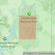
- Areal extent
- AAPG geologic province:
-
- San Juan basin
Summary:
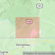
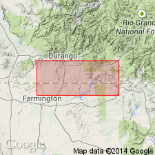
Pg. A5 (fig. 3), A28, A30, A31 (fig. 15, isopach map), pl. 1 (geol. map). Rico Formation [of Wengerd and Matheny, 1958]. Conglomeratic sandstone and arkose interbedded with greenish-, reddish-, and brownish-gray shale and sandy fossiliferous limestone. Thickness up to 240 feet west of Reservation. [Not separately mapped (pl. 1, geol. map).] Considered a transitional unit between overlying Cutler Group (or Cutler Formation) and underlying Hermosa Group (or Hermosa Formation). Correlative with lower part of Abo Formation. Fossils. Age is Late(?) Pennsylvanian to Early Permian (Virgilian? to Wolfcampian).
Recognized in subsurface, has a characteristic geophysical log response, and in outcrop of Four Corners region of southwestern Colorado, northwestern New Mexico, northeastern Arizona, and southeastern Utah.
Source: Publication.
For more information, please contact Nancy Stamm, Geologic Names Committee Secretary.
Asterisk (*) indicates published by U.S. Geological Survey authors.
"No current usage" (†) implies that a name has been abandoned or has fallen into disuse. Former usage and, if known, replacement name given in parentheses ( ).
Slash (/) indicates name conflicts with nomenclatural guidelines (CSN, 1933; ACSN, 1961, 1970; NACSN, 1983, 2005, 2021). May be explained within brackets ([ ]).