

- Usage in publication:
-
- Purgatoire formation*
- Modifications:
-
- Named
- Dominant lithology:
-
- Sandstone
- Shale
- Coal
- AAPG geologic province:
-
- Las Vegas-Raton basin
- Denver basin
Summary:
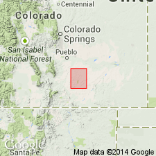
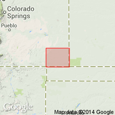
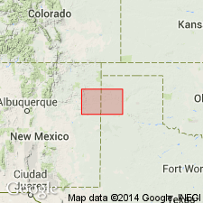
Named for Purgatoire Canyon, Mesa de Maya quad, Las Animas Co, CO in the Las Vegas-Raton basin. Rocks assigned to Purgatoire in this report were considered part of the Dakota sandstone in earlier reports. Removed from Dakota because they are older than Dakota. No type locality designated. Overlies Morrison formation; conformably underlies Dakota sandstone (restricted). Lower two-thirds consists of buff, cross-bedded sandstone that has some quartz pebbles. Upper one-third is black shale and thin white platy sandstone. One 4 inch-thick coal bed identified in Christian Canyon. Three measured sections--two in Huerfano Canyon and one in Apishapa Canyon described. Is 210 to 220 ft thick in Huerfano Canyon and 202 ft thick in Apishapa Canyon. Is generally exposed in the walls of the deeper canyons in the report area in Las Animas and Huerfano Cos of the Las Vegas-Raton basin and in Pueblo Co in the Denver basin. Marine fossils (listed) of Comanche or Early Cretaceous age. Geologic map.
Source: GNU records (USGS DDS-6; Denver GNULEX).
- Usage in publication:
-
- Purgatoire formation*
- Modifications:
-
- Revised
- Areal extent
- AAPG geologic province:
-
- Denver basin
Summary:
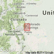
Name extended areally to El Paso Co, CO, Denver basin, where it is mapped in two areas at southwest and northwest part of quad. Divided in mapped area (geologic map) into two newly named members, the Lytle sandstone member (at base) and the Glencairn shale member (at top). Rocks mapped as Purgatoire in this report were mapped as part of Dakota sandstone in earlier reports. Has a maximum thickness of nearly 300 ft in area with massive sandstone (Lytle) in lower part and purple-black shale (Glencairn) in upper part. No fossils found in Lytle. Fossils (LINGULA) of Comanche, Washita, or Early Cretaceous age found in Glencairn. Stratigraphic tables. Overlies Morrison formation. Underlies Dakota sandstone.
Source: GNU records (USGS DDS-6; Denver GNULEX).
- Usage in publication:
-
- Purgatoire formation*
- Modifications:
-
- Revised
- AAPG geologic province:
-
- Palo Duro basin
Summary:
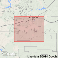
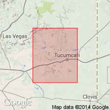
Divided into (ascending): Tucumcari shale member (restricted), Mesa Rica sandstone member (first used), and Pajarito shale member (first used). Tucumcari restricted to the lower part of the former Tucumcari--the fossiliferous (fossils listed) gray shale, buff calcareous sandstone with argillaceous limestone nodules. The former upper part of Tucumcari is redesignated Mesa Rica sandstone member. Unconformably overlies Chinle, Wingate?, or Morrison formation. Underlies? Graneros shale (Dakota sandstone not recognized). Of Early Cretaceous age. Geologic map; cross sections. Report area lies in the Palo Duro basin of eastern NM.
Source: GNU records (USGS DDS-6; Denver GNULEX).
- Usage in publication:
-
- Purgatoire formation*
- Modifications:
-
- Areal extent
- AAPG geologic province:
-
- Denver basin
- Las Vegas-Raton basin
Summary:
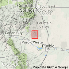
Lytle sandstone member (at base) and Glencairn shale member (at top) recognized in study area, Fremont and Pueblo Cos of Denver basin, and Huerfano Co of Las Vegas-Raton basin. Fossils from upper part of Glencairn shale member are of marine origin, and indicate an Early Cretaceous age.
Source: GNU records (USGS DDS-6; Denver GNULEX).
- Usage in publication:
-
- Purgatoire formation*
- Modifications:
-
- Areal extent
- AAPG geologic province:
-
- Anadarko basin
Summary:
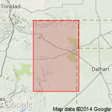
Used as a term applied to beds between Morrison formation and Dakota sandstone in Baca Co, CO in the Anadarko basin. Was included for many years as part of Dakota, and is still referred to by some as "lower Dakota." Lower sandstone and overlying shale were designated Cheyenne sandstone and Kiowa shale by some early workers; both are designated members of Purgatoire in this report; both are traceable in the subsurface to their type localities in Kiowa Co, KS and to the type Purgatoire in Las Animas Co, CO. Is equivalent to the Lytle and Glencairn members of Purgatoire of the CO Front Range. Cross section. Geologic map. Early Cretaceous age.
Source: GNU records (USGS DDS-6; Denver GNULEX).
- Usage in publication:
-
- Purgatoire formation
- Modifications:
-
- Overview
- AAPG geologic province:
-
- Sierra Grande uplift
Summary:
Assigned as lower formation of Dakota group on the Sierra Grande uplift. Divided into a lower member of massive sandstone that forms discontinuous cliffs, and an upper member of slope-forming, light- to dark-gray, silty mudstone. Rests unconformably on Morrison formation; underlies a sandstone assigned to Dakota formation. Fossils found in mudstone. Assigned to the Cretaceous.
Source: GNU records (USGS DDS-6; Denver GNULEX).
- Usage in publication:
-
- Purgatoire formation*
- Modifications:
-
- Areal extent
- AAPG geologic province:
-
- Sierra Grande uplift
- Palo Duro basin
Summary:
Use of Purgatoire formation in Tucumcari-Sabinoso area, Guadalupe, Harding, San Miguel, and Quay Cos, northeast NM in the Palo Duro basin and on the Sierra Grande uplift abandoned [should read "areally restricted"]. Members formerly assigned to Purgatoire raised in rank to (ascending order): Tucumcari shale, Mesa Rica sandstone, Pajarito shale of Early Cretaceous age.
Source: GNU records (USGS DDS-6; Denver GNULEX).
- Usage in publication:
-
- Purgatoire Formation*
- Modifications:
-
- Areal extent
- AAPG geologic province:
-
- Denver basin
Summary:
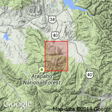
Mapped with overlying Dakota Sandstone in the northeast and north-central parts of the quad in the Webster Park graben, Eightmile Park, and along the east border of the quad in Fremont Co, CO in the Denver basin. Two members recognized but not mapped. The Lytle Sandstone Member at the base contains white, fine- to coarse-grained sandstone, variegated clay, and pebbly beds 120 ft thick. The Glencairn Shale Member at the top is an olive-brown, thin-bedded sandstone, gray and black shale and clay 80 ft thick. Dakota unconformably overlies Morrison Formation. Of Early Cretaceous age.
Source: GNU records (USGS DDS-6; Denver GNULEX).
- Usage in publication:
-
- Purgatoire Formation
- Modifications:
-
- Areal extent
- Overview
- Dominant lithology:
-
- Shale
- Sandstone
- Limestone
- Conglomerate
- AAPG geologic province:
-
- Sierra Grande uplift
- Palo Duro basin
Summary:
Is Lower Cretaceous formation mapped with Dakota Sandstone undivided in southern Harding and adjacent southeastern Union Cos, NM (Sierra Grande uplift) and in eastern San Miguel and northwest Quay Cos, NM (Palo Duro basin). Is not mapped as far east as TX Panhandle. Consists, from top down, of Pajarito Shale [unranked], gray to green, locally sandstone at top, thickness 50 to 60 ft; Mesa Rica Sandstone [unranked], fine- to coarse-grained, becomes finer grained upward, cross-bedded, white to gray, locally reddish, thickness 50 to 100 ft; and Tucumcari Shale [unranked], from top down, shale, limestone, sandstone, and conglomerate; shale, black, contains both Kiamichi and Duck Creek faunas; limestone, argillaceous; basal sand and conglomerate unconformably rest on Morrison Formation (Upper Jurassic), thickness up to 20 ft; thickness of Tucumcari Shale up to 60 ft.
Source: GNU records (USGS DDS-6; Denver GNULEX).
- Usage in publication:
-
- Purgatoire Formation*
- Modifications:
-
- Overview
- Biostratigraphic dating
- AAPG geologic province:
-
- Anadarko basin
Summary:
Glencairn Shale Member of Purgatoire is areally extended to Baca Co, CO in Anadarko basin. Follows recommendation by Scott (1970) that Glencairn nomenclature replace Kiowa in southeastern CO. Outcrops along Horse Creek were mapped by McLaughlin (1954, pl. 1) as Dakota Sandstone; Scott (1968) later assigned them to undifferentiated Dakota Sandstone and Purgatoire Formation. Measured section on south side of Horse Creek 3 1/2 mi south of Two Buttes in SE1/4 sec 19, T29S, R44W. Unusual ammonites include GOODHALLITES (known only from upper Albian rocks) and IDIOHAMITES (known only from upper Albian to Cenomanian rocks). Age is Early Cretaceous (late Albian).
Source: GNU records (USGS DDS-6; Denver GNULEX).
- Usage in publication:
-
- Purgatoire Formation†
- Modifications:
-
- Abandoned
Summary:
Lytle Sandstone Member and the overlying Glencairn Shale Member (of Purgatoire Formation) raised to formation rank. Lytle is designated Lytle Sandstone. Glencairn is modified to Glencairn Formation because of its diverse lithology. Term Purgatoire abandoned. Both Lytle and Glencairn are mappable at 1:24,000, and they are separated by a disconformity--the most significant break in the Lower Cretaceous. Authors believe there is no reason to retain them as member rank or to raise the Purgatoire to group rank.
Source: GNU records (USGS DDS-6; Denver GNULEX).
For more information, please contact Nancy Stamm, Geologic Names Committee Secretary.
Asterisk (*) indicates published by U.S. Geological Survey authors.
"No current usage" (†) implies that a name has been abandoned or has fallen into disuse. Former usage and, if known, replacement name given in parentheses ( ).
Slash (/) indicates name conflicts with nomenclatural guidelines (CSN, 1933; ACSN, 1961, 1970; NACSN, 1983, 2005, 2021). May be explained within brackets ([ ]).