

- Usage in publication:
-
- Pride Mountain formation*
- Modifications:
-
- Named
- Dominant lithology:
-
- Shale
- Limestone
- Sandstone
- Siltstone
- AAPG geologic province:
-
- Black Warrior basin
Summary:
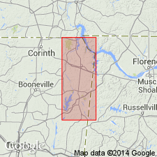
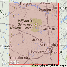
At its type locality, the Pride Mountain formation consists of relatively thick units of shale that alternate with thinner units of limestone, sandstone, and siltstone. It has a maximum thickness of about 325 ft in Tishomingo Co., MS, and thins eastward to about 150 ft in eastern Lawrence Co., AL. In Colbert Co., AL, and Tishomingo Co., MS, the formation is divisible into several members based on alternation of sandy beds with beds of calcareous shale and limestone (ascending): Alsobrook, Tanyard Branch, Wagnon, Southward Spring sandstone, Sandfall, Mynot sandstone, and Green Hill members. The Southward Spring sandstone member is not present at type locality. The Pride Mountain underlies the Hartselle sandstone and overlies the Tuscumbia limestone. Unit is considered of Late Mississippian age.
Source: GNU records (USGS DDS-6; Reston GNULEX).
- Usage in publication:
-
- Pride Mountain Formation
- Modifications:
-
- Overview
- AAPG geologic province:
-
- Warrior basin
Summary:
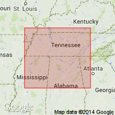
Present report uses classification of Welch (1958, 1959) for formations comprising Chesterian Series in northwestern AL and northeastern MS. Pride Mountain Formation is lowermost unit of the Chesterian Series and includes all strata above the Tuscumbia Formation and below the Hartselle Formation. Members of Pride Mountain (Alsobrook, Tanyard Branch, Wagnon, Southward Spring Sandstone, Sandfall, Mynot Sandstone, and Green Hill) are discussed at length though unit is shown as undifferentiated on the stratigraphic chart, the geologic map, and the cross section. Unit occurs at the surface of Tishomingo Co., MS, and Colbert Co., AL. Unit grades eastward into the Monteagle Limestone of northeastern AL, northward into the Monteagle and Ste. Genevieve Limestones of TN, and westward into an undifferentiated shale sequence called Floyd Shale by Mankin (1986). Unit is truncated by the erosional surface at the base of the Tuscaloosa Group in northernmost Tishomingo Co. and to the west in Prentiss Co. Pride Mountain attains a maximum thickness of 350 ft in the subsurface of southern Tishomingo Co.
Source: GNU records (USGS DDS-6; Reston GNULEX).

- Usage in publication:
-
- Pride Mountain Formation
- Modifications:
-
- Overview
- AAPG geologic province:
-
- Black Warrior basin
- Appalachian basin
Summary:
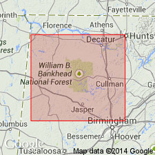
Pride Mountain Formation in western AL is a medium- to dark-gray fissile clay shale containing abundant siderite nodules and occasional pyrite. Shale is interbedded locally with blocky dusky-red and green mudstone, calcareous clay shale, shaly argillaceous limestone that contains abundant bryozoans and brachiopods, and one to three units of a variable combination of sandstone and limestone. Basal beds are commonly composed of oolites and/or shaly limestone. Unit is present in the western part of the Appalachian Plateaus and the southern part of the western Valley and Ridge. Thickness ranges from 0 to over 480 ft. Members are not discussed in text nor shown on correlation chart. Age is Late Mississippian (Meramecian and Chesterian).
Source: GNU records (USGS DDS-6; Reston GNULEX).
- Usage in publication:
-
- Pride Mountain Formation
- Modifications:
-
- Overview
- Revised
- AAPG geologic province:
-
- Black Warrior basin
Summary:
In the subsurface, the Pride Mountain contains two major mappable sandstone members, the Lewis and the Evans. The Evans undergoes a facies change in southeastern Monroe and northern Lowndes Cos., MS, and becomes the lowest resistive black shale unit of the Neal Black Shale. The Lewis is continuous across the entire northern shelf of the basin and does not undergo a downdip facies change. Johnson (1988) recognized four coarsening- and shallowing-upward siliciclastic "cycles." He correlated his first (oldest) cycle with the Lewis and his third cycle with the Evans.
Source: GNU records (USGS DDS-6; Reston GNULEX).
- Usage in publication:
-
- Pride Mountain Formation
- Modifications:
-
- Biostratigraphic dating
- AAPG geologic province:
-
- Appalachian basin
Summary:
Presence of the conodonts CAVUSGNATHUS NAVICULUS (Hinde) and IDIOSPRIONIODUS Grunnel in the upper Tuscumbia at Hoover quarry, in Allsboro, and at the Vann quarry in Trussville, AL, indicates a Chesterian age. Therefore, the Meramecian-Chesterian boundary is within the uppermost Tuscumbia Limestone and does not coincide with the lithostratigraphic boundary of the Tuscumbia and Pride Mountain as previously thought. At the Asphalt Rock quarry, Tuscumbia, the chronostratigraphic boundary may occur 5 m above the lithostratigraphic boundary.
Source: GNU records (USGS DDS-6; Reston GNULEX).
- Usage in publication:
-
- Pride Mountain Formation
- Modifications:
-
- Overview
- AAPG geologic province:
-
- Black Warrior basin
Summary:
Upper Mississippian Lewis cycle of the Pride Mountain Formation has long been recognized as a major producer of oil, gas and other petroleum resources. Lewis, which forms base of the Chesterian, is widespread and heterogeneous and contains a basal limestone, a lower shale facies, the Lewis sandstone, and upper shale facies, and the Lewis limestone. Strata equivalent to the Lewis is contained in the Floyd Shale to the southwest. Thickness of the Lewis cycle ranges from less than 50 ft in the eastern part of the study area to more than 100 ft in the southwestern part. Investigation of depositional environment is major purpose of this study as Lewis represents a wide spectrum of marginal- and open-marine environments.
Source: GNU records (USGS DDS-6; Reston GNULEX).
For more information, please contact Nancy Stamm, Geologic Names Committee Secretary.
Asterisk (*) indicates published by U.S. Geological Survey authors.
"No current usage" (†) implies that a name has been abandoned or has fallen into disuse. Former usage and, if known, replacement name given in parentheses ( ).
Slash (/) indicates name conflicts with nomenclatural guidelines (CSN, 1933; ACSN, 1961, 1970; NACSN, 1983, 2005, 2021). May be explained within brackets ([ ]).