

- Usage in publication:
-
- Prichard slate*
- Modifications:
-
- Original reference
- Dominant lithology:
-
- Slate
- Sandstone
- AAPG geologic province:
-
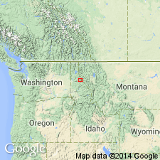
- Northern Rocky Mountain region
Summary:
Pg. 277-285. Prichard slate. Mostly blue-black, blue-gray to light-gray slate, generally distinctly banded; considerable interbedded gray sandstone; upper part characterized by rapid alternations of argillaceous and arenaceous layers and by shallow-water features. Thickness 8,000+ feet. Base not exposed. Underlies Burke formation. Occupies almost entire drainage basin of Prichard Creek, Coeur d'Alene district, [Shoshone County], northeast Idaho. Description of general geology of region is based almost wholly on work of F.C. Calkins. Age is pre-Cambrian (Belt).
Source: US geologic names lexicon (USGS Bull. 896, p. 1729-1730).
- Usage in publication:
-
- Prichard slate*
- Modifications:
-
- Principal reference
- Dominant lithology:
-
- Argillite
- AAPG geologic province:
-
- Northern Rocky Mountain region
Summary:
Pg. 23-24, 29-32, pl. 11. Prichard slate. Mostly argillite, blue-black to blue-gray, commonly showing distinct and regular banding. Considerable interbedded gray indurated sandstone. Upper part characterized by numerous alternations of argillaceous and arenaceous layers, and by shallow-water features. Thickness about 8,000+ feet. Base not exposed. Underlies Burke formation. Age is pre-Cambrian (Belt).
Named from Prichard Creek, which drains a large part of the most extensive area occupied by this formation within the Coeur d'Alene district, [Shoshone Co.], northeast ID.
Source: Publication; US geologic names lexicon (USGS Bull. 1200, p. 3135-3136).
- Usage in publication:
-
- Prichard formation*
- Modifications:
-
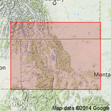
- Areal extent
- AAPG geologic province:
-
- Northern Rocky Mountain region
Summary:
Prichard formation. Exposed at intervals from northwest corner of Montana to vicinity of Plilipsburg, Montana. Age is Precambrian (Belt).
Source: US geologic names lexicon (USGS Bull. 1200, p. 3135-3136).
- Usage in publication:
-
- Prichard formation*
- Modifications:
-
- Areal extent
- AAPG geologic province:
-
- Northern Rocky Mountain region
Summary:
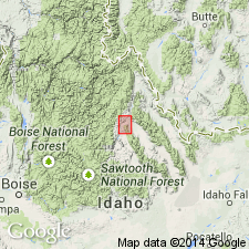
Pg. 728, pl. 57. Prichard formation. In Murray area, Idaho, formation divided into two mappable units. Lower unit consists of about 75 to 80 percent dark-gray argillite and 20 to 25 percent light-brownish-gray fine-grained impure quartzites. Base of unit not exposed in area, but observed thickness in Bear Gulch about 9,000 feet. Upper unit forms transition zone between lower part and overlying Burke formation. Contains quartzite and argillite in roughly a 2 to 1 ratio. Quartzite ranges from thin bedded, impure, and greenish gray near base to thick bedded, pure, and light gray to white near top. Argillite is thinly laminated; dark-gray fine-grained material alternates with light-gray coarser grained material. Thickness of unit on ridge running northwest from Goose Peak about 1,800 feet. Age is Precambrian.
Source: US geologic names lexicon (USGS Bull. 1200, p. 3135-3136).
- Usage in publication:
-
- Prichard formation*
- Modifications:
-
- Areal extent
- AAPG geologic province:
-
- Northern Rocky Mountain region
Summary:
Pg. 578-579, pl. 48. Prichard formation. Described in western Mineral County, Montana. Contact with Burke and Revett formations undifferentiated is gradational. From junction of Clark Fork and Flathead Rivers southwest to Paradise Ferry across Clark Fork River, an airline distance of 5.5 miles, an almost continuous section of the Prichard is exposed in Canyon walls of Clark Fork River and in railroad cuts and roadcuts along the canyons. Discounting unidentified faults, this section is nearly 17,000 feet thick. A few apparently minor faults were identified northeast of the ferry, and top of the section is truncated by a major fault. Age is Precambrian (Belt).
Source: US geologic names lexicon (USGS Bull. 1200, p. 3135-3136).
- Usage in publication:
-
- Prichard Formation
- Modifications:
-
- Overview
- AAPG geologic province:
-
- Northern Rocky Mountain region
Summary:
Coarse-grained arkose and conglomerate assigned to the newly named LaHood Formation of Belt Series cropout in a narrow zone that extends from the northern part of Bridger Range west to the Highland Mountains, or from Gallatin Co to Madison Co, MT in the Northern Rocky Mountain region. Areal extent map of La Hood. Geologic maps. Cross sections. Correlation chart. Prichard of the Belt Series is present in the Highland Mountains and Phillipsburg area, Granite Co, MT in the Northern Rocky Mountain region where it overlies and intertongues with the La Hood. Prichard is overlain by Ravalli Group of the Belt Series. To the southeast of the Highland Mountains Prichard is replaced by the Chamberlain Shale and Newland Limestone. Of Late Precambrian age.
Source: GNU records (USGS DDS-6; Denver GNULEX).

- Usage in publication:
-
- Prichard Formation*
- Modifications:
-
- Overview
- AAPG geologic province:
-
- Northern Rocky Mountain region
Summary:
Used in the western parts of the Belt basin (eastern WA, ID, and MT, Northern Rocky Mountain region). Stratigraphic position and correlation with other Precambrian formations of the Belt Supergroup of the U.S. in the Sweetgrass arch, and the Purcell Supergroup of Alberta and British Columbia, Canada shown on figures 4, 5, 7, and 13. Is older than the Ravalli Group of the Belt Supergroup.
Source: GNU records (USGS DDS-6; Denver GNULEX).
- Usage in publication:
-
- Prichard Formation*
- Modifications:
-
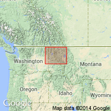
- Areal extent
- Dominant lithology:
-
- Schist
- Gneiss
- Quartzite
- AAPG geologic province:
-
- Northern Rocky Mountain region
Summary:
Mapped as the basal unit of the Precambrian Belt Supergroup in the ID portion of the map westward near Spokane, WA, both in the Northern Rocky Mountain region. Is highly metamorphosed in Coeur d'Alene area and southeast part of map in ID, and in WA east of Spokane where formation is mapped as an undivided unit with locally a mappable upper porphyroblastic gneiss and a lower quartzite. The undivided metamorphic rocks are mostly mica schist, quartz-plagioclase-biotite gneiss, and quartzite. The porphyroblastic unit was named Newman Lake Gneiss by Weiss (1968). The Hauser Lake Gneiss of Weiss is included in the undivided Prichard. [No explanation given for non-use of Hauser Lake and Newman Lake Gneisses, nor of their status as formal units.] Elsewhere in map area, Prichard divided into a lower part of medium- to light-gray siltite with some argillite 7,500 ft thick (base not exposed) and an upper part of gray argillite, siltite, and quartzite 2,500 to 3,500 ft thick. Underlies Burke Formation of Belt Supergroup.
Source: GNU records (USGS DDS-6; Denver GNULEX).
- Usage in publication:
-
- Prichard Formation*
- Modifications:
-
- Age modified
- AAPG geologic province:
-
- Northern Rocky Mountain region
Summary:
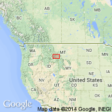
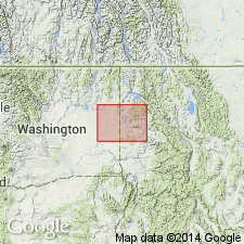
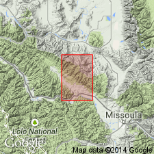
Is the lowest formation, one of eleven formations mapped of the Belt Supergroup in the report area. Age changed from Precambrian to Precambrian Y, the age term used for rocks that range in age from 1,600 to 800 m.y. old. Only the upper part at least 7,000 ft thick is exposed. Mapped in northwest part of quad in Sanders and Missoula Cos, MT in the Northern Rocky Mountain region where it underlies the lower part of the Burke Formation of the Belt Supergroup.
Source: GNU records (USGS DDS-6; Denver GNULEX).
- Usage in publication:
-
- Prichard Formation*
- Modifications:
-
- Age modified
- AAPG geologic province:
-
- Northern Rocky Mountain region
Summary:
Shown on correlation chart as of Proterozoic Y age (previously Precambrian Y), the age designation for rocks that are 1,600 to 900 m.y. old. Used as a name in MT and ID, Northern Rocky Mountain region.
Source: GNU records (USGS DDS-6; Denver GNULEX).
- Usage in publication:
-
- Prichard Formation*
- Modifications:
-
- Overview
- AAPG geologic province:
-
- Northern Rocky Mountain region
Summary:
This is a summary report on lowest formation of the Belt Supergroup. Composed of interlaminated and very thinly interbedded siltite and light to dark gray, weathers brown argillite. Quartzite is minor constituent. Was metamorphosed to biotite zone of greenschist facies. Is 6,000 m thick. Base not exposed; upper contact transitional with Burke Formation (placed 550 m lower than Ransome's contact) which represents a significant change in deposition. Deposited on lower slope to intertidal zone. Intruded by gabbroic, dioritic, and diabase sills nearly 400 m thick. Deposited by major river system on continental crust. Environment of deposition ranges from lower slope to intertidal zone. Is not younger than 1,330 m.y. and no older than 1,700 m.y. Assigned to the Middle Proterozoic. Located in the Northern Rocky Mountain region. Measured sections. Columnar section.
Source: GNU records (USGS DDS-6; Denver GNULEX).
- Usage in publication:
-
- Prichard Formation*
- Modifications:
-
- Overview
- AAPG geologic province:
-
- Northern Rocky Mountain region
Summary:
A regional study of Prichard. Name applied to Belt Supergroup rocks below Ravalli Group. Base concealed everywhere. Crops out between Glacier National Park on east, Spokane on west, and from International border south nearly to Idaho batholith, Stevens and Pond Orielle Cos, WA, Spokane Co, WA, Bonner and Boundary Cos, ID, Sanders, Lincoln, Flathead Cos, MT, all in Northern Rocky Mountain region. Areal extent map. Prichard contains laminated carbon-rich argillites, thick marine turbidites and iron sulfide whereas rest of Belt contains abundant shallow-water marine and subaerial deposits, and has iron oxide. Regionally metamorphosed to greenschist facies and is within the biotite or garnet zone everywhere except Glacier Park where it is muscovite-chlorite. Is more than 6 km thick. Divided into 9 members (A-H), 4 unlettered members, transition zone. Upper contact is at top of uppermost interlaminated gray argillite and siltite, a contact difficult to locate consistently. Equivalent to Aldridge Formation of CN. Is younger than 1576 Ma the age of pre-Belt basement, and older than 1330 +/-45 Ma the age of metamorphic biotite at top of formation. Middle part cut by sills dated (U-Pb) as 1433 +/-30 Ma. Deposited in basin connected to sea by a river the size of Mississippi that drained the North American, Siberian, and other shield areas. Chemical analyses.
Source: GNU records (USGS DDS-6; Denver GNULEX).
- Usage in publication:
-
- Prichard Formation*
- Modifications:
-
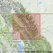
- Areal extent
- AAPG geologic province:
-
- Northern Rocky Mountain region
Summary:
Prichard Formation of Belt Supergroup. Recognized on west side of Glacier National Park; not separately mapped. Siltite and argillite. [Thickness 1,500+ m.] Disconformably underlies Appekunny Formation of Belt Supergroup. Age is Middle Proterozoic.
Source: Publication.
For more information, please contact Nancy Stamm, Geologic Names Committee Secretary.
Asterisk (*) indicates published by U.S. Geological Survey authors.
"No current usage" (†) implies that a name has been abandoned or has fallen into disuse. Former usage and, if known, replacement name given in parentheses ( ).
Slash (/) indicates name conflicts with nomenclatural guidelines (CSN, 1933; ACSN, 1961, 1970; NACSN, 1983, 2005, 2021). May be explained within brackets ([ ]).