

- Usage in publication:
-
- Pottsville seral conglomerate (Millstone Grit, No. XII)
- Modifications:
-
- Original reference
- Dominant lithology:
-
- Conglomerate
- Sandstone
- AAPG geologic province:
-
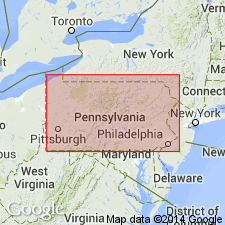
- Appalachian basin
Summary:
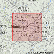
Pg. 221-227. Pottsville seral conglomerate (Millstone Grit, No. XII), 59 feet thick in Boyd's Hill gas well at Pittsburgh, Pennsylvania. Overlies Mauch Chunk Umbral Red shale and underlies Lower Productive Coal Measures. [Age is Early Pennsylvanian.]
[Type locality not stated. Named from Pottsville, Schuylkill Co., PA.]
Source: US geologic names lexicon (USGS Bull. 896, p. 1720-1721).
- Usage in publication:
-
- Pottsville (Seral) conglomerate (Millstone Grit No. XII)
- Modifications:
-
- Original reference
- AAPG geologic province:
-
- Appalachian basin
Summary:
Pg. 520, 535. Pottsville (Seral) conglomerate (Millstone Grit No. XII). Pottsville is new name proposed by present [Pennsylvania] State Geologist [J.P. Lesley]. Underlies Allegheny River Coal Measures and overlies Mauch Chunk red shale. Divided into Piedmont sandstone (160 feet thick) at top, Kanawha River Coal Series, and, at base, the Conglomerate proper (80 feet thick). [Age is Early Pennsylvanian.]
[Named from Pottsville, Schuylkill Co., PA.]
Source: US geologic names lexicon (USGS Bull. 896, p. 1720-1721).
- Usage in publication:
-
- Pottsville conglomerate (Seral)
- Modifications:
-
- Original reference
- AAPG geologic province:
-
- Appalachian basin
Summary:
Pg. xxxiii. Pottsville conglomerate (Seral). Extends from base of Lower Productive Coal Measures to top of Mauch Chunk shale. Is No. XII of Rogers. [Age is Early Pennsylvanian.]
Source: US geologic names lexicon (USGS Bull. 896, p. 1720-1721).

- Usage in publication:
-
- Pottsville formation*
- Pottsville group*
- Modifications:
-
- Overview
- AAPG geologic province:
-
- Appalachian basin
Summary:
Pottsville formation; also Pottsville group. Recognized in Pennsylvania; southern Ohio, Indiana, and Illinois; Kentucky, Tennessee, northeastern Mississippi, Alabama, West Virginia, Virginia, and Maryland. The USGS classifies the Pottsville in most areas as a formation. Where divided into two or more named and mapped major units, it classifies it as a group and the named subdivisions as formations. The present Pennsylvania Geol. Survey classifies the Pottsville as a series. In anthracite coal field of northeastern Pennsylvania (the typical Pottsville region) the Pottsville formation is 1,200 feet thick, and three paleobotanic subdivisions of it have been recognized by David White and other geologists. For convenience these are called upper Pottsville, middle Pottsville, and lower Pottsville. The upper Pottsville extends from base of Buck Mountain (or Twin) coal down to base of sandstones considered = Sharon conglomerate member of western Pennsylvania, and includes, toward middle, Lykens No. 1 coal. The middle Pottsville extends downward from base of the sandstones which are correlated with Sharon conglomerate, and includes Lykens Nos. 2 and 3 coals and underlying rocks. The lower Pottsville includes in upper part Lykens Nos. 4, 5, and 6 coals and toward middle the Lykens Valley coal bed. The formation thins to northeast, and is only about 200 feet thick in Wilkes-Barre region. Age is [Early] Pennsylvanian.
Original references: J.P. Lesley, 1876, Pennsylvania 2nd Geol. Survey Rpt. L, App. E, p. 221-227; 1877, Pennsylvania 2nd Geol. Survey Rpt. HHH, p. xxiii; C.A. Ashburner, 1877, Amer. Phil. Soc. Proc., v. 16, p. 520, 535; David White, 1900, USGS 20th Ann. Rpt., p. 749-953.
Source: US geologic names lexicons (USGS Bull. 896, p. 1720-1721; USGS Bull. 1200, p. 3118-3119); GNC PA Corr. Chart, sheet 1, Apr. 5, 1928.
- Usage in publication:
-
- Pottsville Formation*
- Modifications:
-
- Biostratigraphic dating
- AAPG geologic province:
-
- Appalachian basin
Summary:
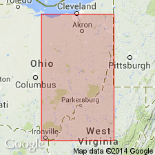
Miospore and plant megafossil assemblages indicate that the Pottsville Formation of AL is of Early Pennsylvanian (late Namurian to Westphalian A) age. In the Warrior, Cahaba, and Coosa fields, unit is informally divided into a non-productive lower part and a productive upper part, based on minable coal beds. In the Plateau coal field, unit is correlated with the Gizzard and Crab Orchard Mountains Formations. The 4,500 ft of Pottsville at Warrior coal field correlate with a 400-ft section of the lower to middle part of the New River Formation at the Pennsylvanian stratotype in WV.
Source: GNU records (USGS DDS-6; Reston GNULEX).
- Usage in publication:
-
- Pottsville Formation
- Modifications:
-
- Age modified
- AAPG geologic province:
-
- Appalachian basin
Summary:
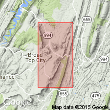
A newly discovered fossil zone at the base of the Pottsville in the Broad Top basin of south-central PA proves that the basal Pottsville in that area is considerably older than previously believed. The 1.3-m interval contains both marine invertebrates and plant fossils of middle Morrowan age and is equivalent to the Schuylkill Member of the Pottsville of eastern PA and the upper New River Formation of southern WV. It antedates all Pennsylvanian units of western PA, northern WV, and northeastern OH.
Source: GNU records (USGS DDS-6; Reston GNULEX).
- Usage in publication:
-
- Pottsville Formation
- Modifications:
-
- Areal extent
- AAPG geologic province:
-
- Appalachian basin
GNU Staff, 1993, GNU Staff remark by E.D. Koozmin. Pottsville Formation.: U.S. Geological Survey Digital Data Series, DDS-6, 1 CD-ROM., release 3
Summary:
This remark deals with recognition of Pottsville in WV. Notes in the Geologic Names Committee files suggested that it should be restricted from WV. Per oral communication between Ken Englund (USGS Coal Branch) and Claire Davidson (GNU reviewer) on 9/16/81, Pottsville Formation should not be used; rocks are called Kanawha Formation or New River Formation if on strike to MD or along PA borders, or Pocahontas Formation, which pinches out in middle of WV. These three formations are not to be assigned to Pottsville Group. Englund gave a reference for all three formations as Englund and others (1977, A field guide to proposed Pennsylvanian System stratotype, West Virginia, Pre-meeting Filed Trip, AAPG Annual Meeting, Washington D.C., June 10-12, 1977, 80 p.). However, in discussion with Chuck Rice (USGS Branch of Eastern Regional Geology) on 10/25/93, (who was in turn discussing this matter with geologists from the West Virginia Geological Survey) GNU has decided that Pottsville Formation should be allowed for use in northeastern WV. There has been no detailed mapping to substantiate Englund's above suggestion, nor has anyone determined to which of the three alternative formations Pottsville-equivalent strata have been assigned. The State of West Virginia uses Pottsville Formation in northeastern WV. The USGS should also use it in this area; the term Pottsville Group, undivided, should not be used in that area.
Source: GNU records (USGS DDS-6; Reston GNULEX).

- Usage in publication:
-
- Pottsville Formation*, Group*
- Modifications:
-
- Areal extent
- AAPG geologic province:
-
- Appalachian basin
Summary:
Pottsville Formation or Group is commonly identified as lowest division of Pennsylvanian System in Appalachian basin. Defined in PA and OH to include beds to top of Homewood Sandstone (PA) or Homewood Sandstone Member (OH) or base of Brookville coal. Pottsville Formation is used in northeastern WV only where unable to identify Pocahontas, New River, or Kanawha Formations; in WV, extended to top of Roaring Creek sandstone (probably higher than Homewood).
Source: GNU records (USGS DDS-6; Reston GNULEX).
- Usage in publication:
-
- Pottsville Group*
- Modifications:
-
- Revised
- Overview
- AAPG geologic province:
-
- Appalachian basin
Summary:
Core drilling in poorly exposed Lower and Middle Pennsylvanian strata of Pottsville and Allegheny Groups in northeastern OH has led to better understanding of key Pennsylvanian marine units and has identified previously unknown marine and marine-influenced strata in lower part of Pottsville Group. Geologic column for Lower and Middle Pennsylvanian rocks of Bownocker and Dean (1929) needs revision. Currently, Ohio Geological Survey considers all stratigraphic terms below "group" status as informal. In addition, some named units such as most coal beds and sandstone beds cannot be correlated from northeastern to central and southern parts of OH. Three marine units are widely traceable in Pottsville of northeastern OH (ascending): Lowellville, Lower Mercer, and Upper Mercer limestones; a fourth, Boggs limestone and ore, is recognized mainly in central OH. Drilling identified two other units, designated unit A and unit B for this report. The revised column for the Pottsville Group in northeastern OH is (ascending): Sharon coal, marine unit A, Lowellville marine unit, Quakertown coal, marine unit B, Lower Mercer coal zone, Lower Mercer marine unit, Upper Mercer coal zone, and Upper Mercer marine unit. Authors suggest that well-defined local names be applied to these stratigraphic units rather than names projected from other parts of Appalachian basin.
Source: GNU records (USGS DDS-6; Reston GNULEX).

- Usage in publication:
-
- Pottsville Formation
- Modifications:
-
- Not used
- AAPG geologic province:
-
- Illinois basin
Summary:
Rocks previously mapped as Pottsville Formation in this area by Rubey (1952) are now assigned to Tradewater Formation [following usage of Weibel and others (1991, Geologic map of the Waltersburg quadrangle, Pope County, Illinois: Illinois Geologic Quadrangle Map IGQ-8)].
Source: GNU records (USGS DDS-6; Reston GNULEX).
For more information, please contact Nancy Stamm, Geologic Names Committee Secretary.
Asterisk (*) indicates published by U.S. Geological Survey authors.
"No current usage" (†) implies that a name has been abandoned or has fallen into disuse. Former usage and, if known, replacement name given in parentheses ( ).
Slash (/) indicates name conflicts with nomenclatural guidelines (CSN, 1933; ACSN, 1961, 1970; NACSN, 1983, 2005, 2021). May be explained within brackets ([ ]).