The National Geologic Map Database is migrating to a new infrastructure. We apologize for any service disruptions during this process.
|
|---|


- Usage in publication:
-
- Potosi rhyolitic series*
- Modifications:
-
- Original reference
- Dominant lithology:
-
- Rhyolite
- AAPG geologic province:
-
- San Juan Mountains province
Summary:
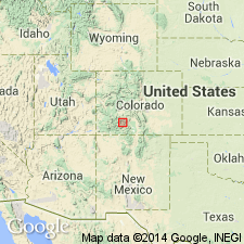
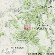
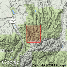
[Credited to Whitman Cross.] Potosi rhyolitic series. Alternation of rhyolite flows and tuffs, former predominating near base; some of thin upper flows are glassy; a thin augite andesite sheet occurs between rhyolite flows in lower part; at base few to 100+ feet of coarse-grained tuff or flow breccia, gray or light red. Thickness 1,800+ feet. Overlies Intermediate series [later named Silverton volcanic series]. Mapped in northeastern part of quadrangle, Ouray and San Miguel Counties. [Age is Miocene.]
[Named from Potosi Peak, where upper several hundred ft is present. Potosi Peak is in Ironton 7.5-min quadrangle, Ouray Co., southwestern CO. (Additional locality information from USGS GNIS database, USGS historical topographic map collection TopoView; accessed February 27, 2013.)]
Source: US geologic names lexicon (USGS Bull. 896, p. 1715).
- Usage in publication:
-
- Potosi volcanic series*
- Modifications:
-
- Revised
- Dominant lithology:
-
- Quartz latite
- Rhyolite
- AAPG geologic province:
-
- Paradox basin
- San Juan Mountains province
Summary:
Changed name to Potosi volcanic series. In Creede district the series is now divided into Piedra group above and Alboroto group below. [Age is Miocene.]
Source: US geologic names lexicon (USGS Bull. 896, p. 1715).
- Usage in publication:
-
- Potosi volcanic series
- Modifications:
-
- Revised
- AAPG geologic province:
-
- San Juan Mountains province
Summary:
Introduced Henson tuff for uppermost formation of Silverton volcanic series, and stated that in Silverton folio the upper part of Henson tuff was included in overlying Potosi volcanic series and lower part in underlying pyroxene andesite, which was then called uppermost formation of Silverton volcanic series.
Source: US geologic names lexicon (USGS Bull. 896, p. 1715).
- Usage in publication:
-
- Potosi Volcanic Group*
- Modifications:
-
- Revised
- AAPG geologic province:
-
- San Juan Mountains province
Summary:
Name changed from Potosi Series to Potosi Volcanic Group [in accord with Article 9f, Code of Stratigraphic Nomenclature, 1961]. Divided into Gilpin Peak Tuff (new) and Sunshine Peak Rhyolite (newly assigned to Potosi) in the San Juan Mountain province, southwest CO. Use of Gilpin Peak geographically restricts Treasure Mountain Rhyolite (or Quartz Latite). Use of Sunshine Peak geographically restricts use of Alboroto Rhyolite. Overlies Silverton Volcanic Group (name changed from Silverton Volcanic Series). Gilpin Peak is related to development of Lake City caldera. Assigned a middle and late Tertiary age.
Source: GNU records (USGS DDS-6; Denver GNULEX).
- Usage in publication:
-
- Potosi Volcanic Series
- Modifications:
-
- Not used
- AAPG geologic province:
-
- San Juan Mountains province
Summary:
Not used in Creede area, Mineral Co, CO, San Juan Mountain province. Not able to accommodate to the revised volcanic sequence as determined by authors in this report.
Source: GNU records (USGS DDS-6; Denver GNULEX).
- Usage in publication:
-
- Potosi Volcanic Series*
- Modifications:
-
- Not used
- AAPG geologic province:
-
- Paradox basin
- Piceance basin
Summary:
Ash-flow tuffs of Tertiary age formerly assigned to Potosi Volcanic Series in Montrose Co, CO in Paradox basin and in Gunnison Co, CO in Piceance basin reassigned to five new formations. Blue Mesa (base), Dillon Mesa, and Sapinero Mesa Tuffs replace the lower member of Alboroto. Fish Canyon Tuff replaces upper member of Alboroto. Carpenter Ridge Tuff replaces Piedra Rhyolite. Alboroto, Piedra, and Potosi not abandoned; they are not used.
Source: GNU records (USGS DDS-6; Denver GNULEX).
- Usage in publication:
-
- Potosi Volcanic Group*
- Modifications:
-
- Mapped 1:24k (Hinsdale and Ouray Cos, CO)
- Dominant lithology:
-
- Tuff
- Quartz latite
- AAPG geologic province:
-
- San Juan Mountains province
Summary:
Is Oligocene volcanic group mapped as a single map unit in scattered areas throughout quadrangle in southeast Ouray and western Hinsdale Cos, CO (San Juan Mountain province). Overlies Henson Formation of Oligocene Silverton Volcanic Group; is youngest formal bedrock unit mapped in the quadrangle. Map unit described as light-gray to grayish-brown predominantly devitrified quartz latite welded ash-flow tuffs; moderately crystal rich with biotite, pyroxene, feldspar, and quartz most common in a eutaxitic and vitroclastic matrix; vertically columnar jointed; locally absent in map area owing in part to nondeposition and in part to erosion. [Thickness is not given; appears to be as thick as 1,120 ft based on map expression.]
Source: GNU records (USGS DDS-6; Denver GNULEX).
- Usage in publication:
-
- Potosi Volcanic Group†
- Modifications:
-
- Abandoned
- AAPG geologic province:
-
- Paradox basin
- Piceance basin
- San Juan Mountains province
- San Luis basin
Summary:
†Potosi Volcanic Group and its †Gilpin Peak Tuff abandoned. Its Sunshine Peak Tuff remains in good usage; its Gilpin Peak Tuff considered same as and replaced with (ascending): Ute Ridge (new), Blue Mesa, Dillon Mesa, and Sapinero Mesa Tuffs. [Adopted by the USGS (see Changes in stratigraphic nomenclature, 1973, USGS Bull. 1395-A, p. A32-A33).]
Source: Changes in stratigraphic nomenclature, 1973 (USGS Bull. 1395-A, p. A32-A33).
- Usage in publication:
-
- Potosi Volcanic Group*
- Modifications:
-
- Age modified[?]
- AAPG geologic province:
-
- San Juan Mountains province
Summary:
[According to "Changes in stratigraphic nomenclature, 1974" (USGS Bull. 1405-A, p. A16-A17), age of Potosi Volcanic Group is changed from Oligocene --to-- Oligocene and Miocene. However, the Potosi Volcanic Group was abandoned in the previous year (see "Changes in stratigraphic nomenclature, 1973" USGS Bull. 1395-A, p. A32-A33, citing Lipman and others, 1973).]
Source: Changes in stratigraphic nomenclature, 1974 (USGS Bull. 1405-A, p. A16-A17).
For more information, please contact Nancy Stamm, Geologic Names Committee Secretary.
Asterisk (*) indicates published by U.S. Geological Survey authors.
"No current usage" (†) implies that a name has been abandoned or has fallen into disuse. Former usage and, if known, replacement name given in parentheses ( ).
Slash (/) indicates name conflicts with nomenclatural guidelines (CSN, 1933; ACSN, 1961, 1970; NACSN, 1983, 2005, 2021). May be explained within brackets ([ ]).