

- Usage in publication:
-
- Poppin Rock Member*
- Modifications:
-
- Named
- Dominant lithology:
-
- Limestone
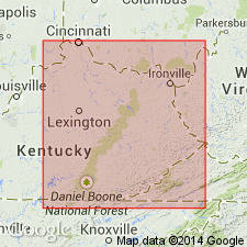
- AAPG geologic province:
-
- Cincinnati arch
Summary:
The Poppin Rock Member of the Slade Formation, here named, consists of thin- to thick-bedded calcarenite with shale partings. The Poppin Rock was previously called the Glen Dean Limestone, but that name is here excluded from the Cumberland Escarpment outcrop area of east-central and northeastern KY. The use of the name Poppin Rock is restricted to the geographic limits of the Slade Formation and it occurs throughout the outcrop belt of the Slade south of Greenup Co. Conformably or disconformably overlies the Maddox Branch Member of the Slade; conformably underlies or intertongues with the Paragon Formation, or disconformably underlies the Paragon, Lee, or Breathitt Formations in the north. Thickness ranges from 0 to 12.2 m. Age is Late Mississippian.
Source: GNU records (USGS DDS-6; Reston GNULEX).

- Usage in publication:
-
- Poppin Rock Member
- Modifications:
-
- Areal extent
- Overview
- AAPG geologic province:
-
- Appalachian basin
Summary:
Slade Formation in the study area is subdivided into only two members: the lower informal Mount Vernon and the overlying Poppin Rock. The two members are commonly separated by sandstones and shales of the Hartselle Sandstone in TN and south-central KY, and by shales of the Maddox Branch Member of the Slade in northeastern and east-central KY, but neither are thick enough to delineate on the cross-sections of this report. The Poppin Rock, a dark-gray limestone, is referred to by drillers as "Little Lime." It reaches a maximum of 75 m to the south, but is absent in the northwestern part of the study area, where the entire Slade Formation is truncated. Cross sections show Slade Formation and its two members extending into TN, WV, and VA. Underlies Bluefield Formation of Pennington Group. According to the author, formal nomenclature presented in this report has been accepted by the Kentucky Stratigraphic Nomenclature Committee. Report includes correlation charts, cross sections, and measured sections.
Source: GNU records (USGS DDS-6; Reston GNULEX).
For more information, please contact Nancy Stamm, Geologic Names Committee Secretary.
Asterisk (*) indicates published by U.S. Geological Survey authors.
"No current usage" (†) implies that a name has been abandoned or has fallen into disuse. Former usage and, if known, replacement name given in parentheses ( ).
Slash (/) indicates name conflicts with nomenclatural guidelines (CSN, 1933; ACSN, 1961, 1970; NACSN, 1983, 2005, 2021). May be explained within brackets ([ ]).