The National Geologic Map Database is migrating to a new infrastructure. We apologize for any service disruptions during this process.
|
|---|


- Usage in publication:
-
- Pool Creek shale member
- Modifications:
-
- Named
- Biostratigraphic dating
- Mapped 1:48k
- Dominant lithology:
-
- Shale
- Bentonite
- AAPG geologic province:
-
- Williston basin
- Powder River basin
Summary:
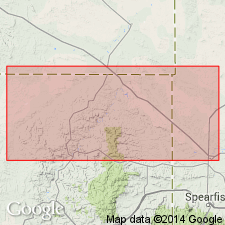
Named as basal of three members of Carlile shale in northern Black Hills, WY and SD in the Powder River and Williston basins. Type locality near the point at which Hwy 85 crosses the head of Pool Creek, 5 mi north of Belle Fourche, SD, NW1/4 sec 14, T9N, R2E, Butte Co, SD, in Williston basin. Type section not given. States that exposures at type locality were described by Cobban (1951, p. 2187; referred as the unnamed member by Cobban). [As described by Cobban (1951) consists of two units. Lower unit, 13 ft thick, is dark-gray papery shale containing thin calcareous shale partings and a few lenses of buff-weathering limestone as much as 1/2 in thick largely made up of minute INOCERAMUS prisms. Limestone concretions, commonly 6-8 in thick and 3 ft in diameter at top of unit. Upper unit, 81 ft thick, is black-gray to dark-gray shale containing in lower part two 6 in bentonite layers, and in upper 37 ft numerous clay ironstone concretions. A layer of white-weathering phosphatic claystone nodules is 15.5 ft below top]. Overlain by Turner sandy member; underlain by the Greenhorn formation. Geologic map shows distribution in parts of Butte Co, SD and Crook Co, WY; measured section; columnar section. Late Cretaceous (Turonian) in age [based on fossils listed by Cobban (1951)].
Source: GNU records (USGS DDS-6; Denver GNULEX).
- Usage in publication:
-
- Pool Creek Shale Member*
- Modifications:
-
- Mapped 1:62.5k
- Overview
- AAPG geologic province:
-
- Powder River basin
Summary:
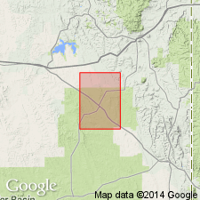
Mapped as lowermost of three members of Carlile Shale. Outcrops as narrow band striking northwest along Black Hills monocline, Powder River basin. Consists mostly of dark-gray noncalcareous shale; laminae of light-gray siltstone occur in upper half of member and become more abundant near top. Lower part thickens southeastward beyond quad at expense of underlying Greenhorn Formation. Fossils near middle of member near Osage, 5 mi southeast of quad, include INOCERAMUS FRAGILIS, SCAPHITES LARVAEFORMAS, and COLLIGNONICERAS WOOLGARI. Measured sections; generalized stratigraphic column. Overlies Greenhorn; underlies Turner Sandy Member of Carlile. Late Cretaceous age.
Source: GNU records (USGS DDS-6; Denver GNULEX).
- Usage in publication:
-
- Pool Creek Member*
- Modifications:
-
- Biostratigraphic dating
- AAPG geologic province:
-
- Powder River basin
Summary:
Occurs from 140-163 m in cored borehole in Osage oilfield on west flank of Black Hills, SWNW sec 30, T46N, R63W, Weston Co, WY, Powder River basin. Is lowermost of three members of Carlile Shale. Consists of calcareous shale. Fig. 1 shows ranges of bivalves and ammonites from cores. Fossils representing zone COLLIGNONICERAS WOOLLGARI (middle Turonian) present in Pool Creek. Overlies Greenhorn Formation; underlies Turner Sandy Member of Carlile. Fossil list.
Source: GNU records (USGS DDS-6; Denver GNULEX).

- Usage in publication:
-
- Pool Creek Member*
- Modifications:
-
- Areal extent
- AAPG geologic province:
-
- Powder River basin
- Williston basin
Summary:
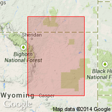
Carlile Shale divided into (ascending): Pool Creek, Turner Sandy, and Sage Breaks Members in the subsurface on the east side of the Powder River basin (Converse, eastern Campbell, Crook, Weston, and Niobrara Cos, WY and Powder River Co, MT, and in the Williston basin, Carter Co, MT). In the Powder River basin subsurface west of where the Greenhorn Formation beneath the Carlile and where the Pool Creek and Turner Sandy Members can be identified, the name Frontier is applied to the post-Clay Spur Bentonite Bed, top bed of Mowry, and pre-Sage Breaks rocks. The Sage Breaks which lies above the Frontier on the west side of the basin is raised to formation rank. Sage Breaks unconformably underlies the Niobrara Formation. Of Late Cretaceous age. [Name used on 22 cross sections in this OC series.]
Source: GNU records (USGS DDS-6; Denver GNULEX).
- Usage in publication:
-
- Pool Creek Member*
- Modifications:
-
- Overview
- AAPG geologic province:
-
- Powder River basin
Summary:
Lowermost of three members of Carlile Shale. Occurs along eastern flank of Powder River basin; here unit consists generally of soft and concretion-bearing, dark-gray shale and silty shale, and sparse laminae of limestone and bentonite. A core taken in Weston Co, WY, consists of interlaminated dark-gray shale and light-gray siltstone, which is calcareous in lower half of unit; many laminae contain small burrows and a minor part of core is bioturbated. Thickness on northern flank of Black Hills is 23-47 m; 12 m in northern Weston Co, and 30 m in east-central Weston Co; perhaps 43 m in eastern and south-central Niobrara Co; is thin to absent in parts of Crook, Weston, Campbell, Converse, and Niobrara Cos. Fossils include foraminifers, mollusks, and bones and scales of fish. Conformably overlies Greenhorn Formation; disconformably underlies Turner Sandy Member of Carlile. Pool Creek is same age as newly named Emigrant Gap Member of Frontier Formation in central Natrona Co. Stratigraphic and biostratigraphic charts; cross sections; geophysical log. Fossils indicate early Turonian to late middle Turonian age.
Source: GNU records (USGS DDS-6; Denver GNULEX).
For more information, please contact Nancy Stamm, Geologic Names Committee Secretary.
Asterisk (*) indicates published by U.S. Geological Survey authors.
"No current usage" (†) implies that a name has been abandoned or has fallen into disuse. Former usage and, if known, replacement name given in parentheses ( ).
Slash (/) indicates name conflicts with nomenclatural guidelines (CSN, 1933; ACSN, 1961, 1970; NACSN, 1983, 2005, 2021). May be explained within brackets ([ ]).