The National Geologic Map Database is migrating to a new infrastructure. We apologize for any service disruptions during this process.
|
|---|


- Usage in publication:
-
- Pitts Meadow Granodiorite*
- Modifications:
-
- Named
- Dominant lithology:
-
- Granodiorite
- AAPG geologic province:
-
- Southern Rocky Mountain region
Summary:
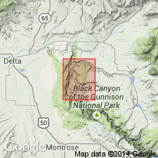
Named for Pitts Meadow in the southwest part of Black Ridge quad, T51N, R9W, Montrose Co, CO, Southern Rocky Mountain region. This locality called the type area. Is well exposed on top of Pitts Meadow and in steep canyon walls that flank mesa above Gunnison River, and along length of Black Canyon between Pitts Meadow and Smiths Fork, and in lower part of gorge of Crystal Creek. Consists chiefly of strongly to weakly foliated, medium-grained, gneissic trondhjemitic granodiorite or quartz diorite. Mineral proportions vary considerably. Is batholithic in size, though exposed in only a few sq mi area. Has a whole rock Rb-Sr age of 1.73 +/-0.19 b.y. Assigned to the Precambrian.
Source: GNU records (USGS DDS-6; Denver GNULEX).
- Usage in publication:
-
- Pitts Meadow Granodiorite*
- Modifications:
-
- Areal extent
- AAPG geologic province:
-
- Southern Rocky Mountain region
Summary:
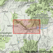
Mapped west of Gunnison River, Red Rock Canyon quad, sec 2, T50N, R9W, Montrose Co, CO in the Southern Rocky Mountain region. [May represent eastern limit of formation.]
Source: GNU records (USGS DDS-6; Denver GNULEX).
- Usage in publication:
-
- Pitts Meadow Granodiorite*
- Modifications:
-
- Overview
- AAPG geologic province:
-
- Southern Rocky Mountain region
Summary:
Probably a batholithic body but exposed only in northwest part of Black Canyon of Gunnison River, Montrose Co, CO in Southern Rocky Mountain region. Listed with granitic rocks of circa 1,700 m.y. (Precambrian X) age group.
Source: GNU records (USGS DDS-6; Denver GNULEX).
- Usage in publication:
-
- Pitts Meadow Granodiorite*
- Modifications:
-
- Overview
- AAPG geologic province:
-
- Southern Rocky Mountain region
Summary:
Is one of nine formally named lithodemic units assigned to the Early Proterozoic Routt Plutonic Suite (new name). Occurs as a pluton in Gunnison area in Southern Rocky Mountain region, CO. It may be present in the subsurface, but its extent beyond the Black Canyon is not known. Is a trondhjemitic granodiorite and quartz diorite.
Source: GNU records (USGS DDS-6; Denver GNULEX).
For more information, please contact Nancy Stamm, Geologic Names Committee Secretary.
Asterisk (*) indicates published by U.S. Geological Survey authors.
"No current usage" (†) implies that a name has been abandoned or has fallen into disuse. Former usage and, if known, replacement name given in parentheses ( ).
Slash (/) indicates name conflicts with nomenclatural guidelines (CSN, 1933; ACSN, 1961, 1970; NACSN, 1983, 2005, 2021). May be explained within brackets ([ ]).