The National Geologic Map Database is migrating to a new infrastructure. We apologize for any service disruptions during this process.
|
|---|


- Usage in publication:
-
- Piney Creek alluvium*
- Modifications:
-
- Original reference
- Dominant lithology:
-
- Alluvium
- AAPG geologic province:
-
- Denver basin
Summary:
Pg. 114-117, pl. 3 (geol. map). Piney Creek alluvium. Alluvium. Mostly highly calcareous, well-stratified clay, silt, and sand; individual beds commonly several inches thick. Material largely silt but contains many thin layers of silty sand and some gravel. Contains a few pebbles or cobbles. Locally, especially in deep and narrow valleys like Lakewood Gulch, alluvium includes layers of coarse cobbly gravel in silt matrix. Layers of clean sand uncommon. Stratification rises toward mouths of tributaries, and composition of sediments varies according to kind of sediments furnished by tributaries. Thickness generally 8+ feet. At type locality is 7 feet thick; underlies archeologic site representing the Woodland Culture (citing Arnold Withers, Univ. Denver) and overlies Wisconsin alluvium. Contains charcoal, hearths, fossils, and stone artifacts. Radiocarbon analyses from the charcoal indicate an age of 1,150 +/-150 yr B.P. (800 +/-150 AD; J.L. Kulp, Columbia Univ.). Possibly reworked Recent vertebrate fossils [listed] identified by C.L. Gazin, Smithsonian, and Jean Hough, USGS. Age is Recent [Holocene].
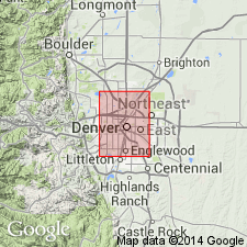
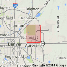
Type locality: along Piney Creek, an eastern tributary to Cherry Creek, in NW/4 NW/4 sec. 25, T. 5 S., R. 66 W., Denver area, [approx. Lat. 39 deg. 35 min. 33 sec. N., Long. 104 deg. 44 min. 00 sec. W., Piney Creek 7.5-min quadrangle], Arapahoe Co., CO. [Additional locality information from USGS historical topographic map collection TopoView, accessed March 27, 2018.]
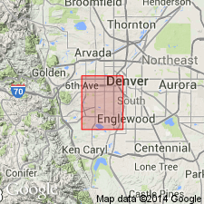
Mapped in several areas along South Platte River, in the Arvada, Derby, Fort Logan, and Englewood quadrangles, north-central Colorado (pl. 3, geol. map).
Source: Publication; US geologic names lexicon (USGS Bull. 1200, p. 3036).

- Usage in publication:
-
- Piney Creek alluvium*
- Modifications:
-
- Mapped 1:24k (Littleton quad, Arapahoe, Douglas, and Jefferson Cos, CO)
- Dominant lithology:
-
- Silt
- Sand
- Clay
- AAPG geologic province:
-
- Denver basin
Summary:
Is upper Recent [Holocene] formation mapped in east-central Jefferson, west Arapahoe, and northwest Douglas Cos, CO (Denver basin). Is youngest formal unit mapped in quadrangle. Older than "post-Piney Creek alluvium" map unit (upper Recent); younger than "eolian sand" map unit (lower Recent). Terrace of Piney Creek is well preserved along most streams; along South Platte River and Deer Creek it is more than one-half mile wide; along small intermittent streams it commonly is less than 10 ft wide. Map unit described as brownish-gray dark-brown or pale-brown well-stratified humic silt, sand, and clay. Well-defined layers of silt and clay range from 1-10 inches thick. Clay and silt are concentrated in upper part and layers of stones as large as 4 inches in diameter are most common in lower part. In sandhills area east of South Platte River, unit is composed entirely of sand. Fossil BISON BISON is abundant; ODOCOILEUS HEMIONUS, mule deer, is less common. Thickness ranges from 4-15 ft; averages about 9 ft.
Source: GNU records (USGS DDS-6; Denver GNULEX).
- Usage in publication:
-
- Piney Creek alluvium*
- Modifications:
-
- Mapped 1:24k (Kassler quad, Douglas and Jefferson Cos, CO)
- Dominant lithology:
-
- Silt
- Sand
- Clay
- AAPG geologic province:
-
- Denver basin
Summary:
Is upper Recent [Holocene] formation mapped in northwestern Douglas and southeastern Jefferson Cos, CO (Denver basin). Is youngest formal unit mapped in quad. Shown on Explanation to be younger than eolian sand unit (Recent); same age as bog clay and landslides units; older than post-Piney Creek alluvium. Unconformably overlies most older deposits. Unit is described (p.42-43) as gray, brownish-gray, olive-gray, grayish-orange, and pale yellowish-brown humic silt, sand, and clay; soil of late Recent age in upper part. Deposited in arroyos previously cut in most deposits in area and was deposited as straths or alluvial fans on older straths of Louviers, Broadway, and pre-Piney Creek alluvium. Broadest deposits are in valleys of South Platte River and Plum Creek; valleys of Willow, Little Willow, Indian, Jarre, and Rainbow Creeks contain sizable deposits. Thickness ranges between 4-25 ft, averaging 10 ft. Measured sections. Vertebrate fossils are abundant with BISON BISON being most abundant. Invertebrate fossils are generally scarce. Is probably about 2,800 years old based on radiocarbon age of charcoal from a correlative of Tsegi alluvium in La Sal Mountains, UT.
Source: GNU records (USGS DDS-6; Denver GNULEX).
- Usage in publication:
-
- Piney Creek Alluvium*
- Modifications:
-
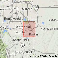
- Mapped 1:24k (Parker quad, Arapahoe and Douglas Cos, CO)
- Dominant lithology:
-
- Sand
- Silt
- Clay
- Gravel
- AAPG geologic province:
-
- Denver basin
Summary:
Is Holocene formation mapped in southwestern Arapahoe and northern Douglas Cos, CO (Denver basin). Is youngest formal unit mapped in quad; conformably underlies post-Piney Creek alluvium (Holocene); overlies eolian sand unit (Pleistocene and Holocene) that was deposited by wind from Cherry Creek valley. Unit described as moderate-yellowish-brown to grayish-brown poorly sorted silt, clay, sand, and interbedded gravel. Humic material common in upper 1-2 ft; locally lower part is all gravel. Main occurrence is in central part of quad along a northwest trend paralleling Parker Road. Is also exposed along most creeks within quad. Commonly 5-15 ft thick, locally up to 30 ft thick; thickest in middle of valley it fills.
Source: GNU records (USGS DDS-6; Denver GNULEX).

- Usage in publication:
-
- Piney Creek Alluvium*
- Modifications:
-
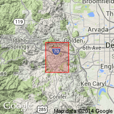
- Mapped 1:24k (Morrison quad, Jefferson Co, CO)
- Dominant lithology:
-
- Silt
- Sand
- AAPG geologic province:
-
- Denver basin
Summary:
Is upper Holocene alluvium mapped in Jefferson Co, CO (Denver basin). Map unit described as dark-gray to reddish-brown humic clayey silt and sand containing layers of pebbles, generally in lower part. Widespread occurrence in quad. Is youngest formal unit mapped in quad. Underlain by older gravelly alluvium or bedrock. Grades upslope into colluvium. Correlates with Holocene young landslide and talus map units and uppermost part of upper Holocene to Pleistocene landslide and colluvium units. Contains upper Holocene weak Brown soil in upper part. Thickness 5-20 ft in this quadrangle. Terrace is 10-20 ft above modern streams. Generally not covered by seasonal floods.
Source: GNU records (USGS DDS-6; Denver GNULEX).
- Usage in publication:
-
- Piney Creek Alluvium*
- Modifications:
-
- Mapped 1:24k (Evergreen quad, Jefferson Co, CO)
- Dominant lithology:
-
- Silt
- Sand
- Gravel
- AAPG geologic province:
-
- Denver basin
Summary:
Is upper Holocene formation mapped in west-central Jefferson Co, CO (Denver basin). Map unit described as dark-gray humic silt and sand, commonly with gravel near base. Underlies upland meadows, where it commonly is cut by narrow gullies. Also caps terraces as much as 20 ft above modern streams.
Source: GNU records (USGS DDS-6; Denver GNULEX).
- Usage in publication:
-
- Piney Creek Alluvium*
- Modifications:
-
- Mapped 1:24k (Indian Hills quad, Jefferson Co, CO)
- Dominant lithology:
-
- Sand
- Silt
- Clay
- Gravel
- AAPG geologic province:
-
- Denver basin
Summary:
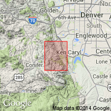
Is upper Holocene formation mapped in central Jefferson Co, CO (Denver basin). Is youngest formal unit mapped in quadrangle. Older than fan and post-Piney Creek alluviums; younger than pre-Piney Creek alluvium and colluvium (early Holocene). Map unit described as dark-brownish-gray to dark-brown mixture of humus-rich silt, sand, and clay containing layers of silt, clay, and gravel 1-18 inches thick. In mountains unit contains angular to rounded pebbles and cobbles of Precambrian rock. Grades into colluvium at sides and heads of valleys. Soil, enriched in calcium carbonate and containing hard, slightly clayey but plastic B horizon, is weakly developed. Alluvium ranges in thickness from less than 5 ft along small arroyos to about 12 ft along major drainages.
Source: GNU records (USGS DDS-6; Denver GNULEX).
- Usage in publication:
-
- Piney Creek Alluvium*
- Modifications:
-
- Mapped 1:24k (Conifer quad, Douglas and Jefferson Cos, CO)
- Dominant lithology:
-
- Silt
- Sand
- Gravel
- AAPG geologic province:
-
- Denver basin
Summary:
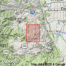
Is upper Holocene formation mapped in west-central Jefferson Co, CO (Denver basin). Is youngest formal unit mapped in quad. Shown on Correlation of Map Units to unconformably overlie Pleistocene older alluvium unit and to be older than upper Holocene post-Piney Creek alluvium unit. Correlates with lower part of upper Holocene colluvium unit. Unit is described as dark-gray humic silt, sand, and gravel. Unit is cut by narrow gullies along many drainages. Grades to colluvium at heads of valleys. No thickness given.
Source: GNU records (USGS DDS-6; Denver GNULEX).
- Usage in publication:
-
- Piney Creek Alluvium*
- Modifications:
-
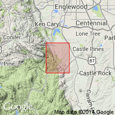
- Mapped 1:24k (Highlands Ranch quad, Arapahoe and Douglas Cos, CO)
- Dominant lithology:
-
- Clay
- Silt
- Sand
- Gravel
- AAPG geologic province:
-
- Denver basin
Summary:
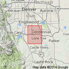
Is Holocene formation mapped in southwestern Arapahoe and northern Douglas Cos, CO (Denver basin). Is youngest formal unit mapped in quad; conformably overlies Broadway Alluvium (Pleistocene); conformably underlies post-Piney Creek alluvium; shown on Correlation of Map Units to be equivalent to middle part of colluvium, eolian sand, and loess units. Unit described as light-gray to light-brown clay, silt, sand, and gravel; humic material common in upper part. Unit is transitional into colluvium on hillsides. Occupies creek-valley floors throughout quad; in some places forms low terraces adjacent to modern stream channels. Commonly 5-15 ft thick.
Source: GNU records (USGS DDS-6; Denver GNULEX).
- Usage in publication:
-
- Piney Creek Alluvium*
- Modifications:
-
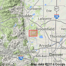
- Mapped 1:24k (Lafayette quad, Adams Boulder, and Jefferson Cos, CO)
- Dominant lithology:
-
- Sand
- Silt
- Clay
- AAPG geologic province:
-
- Denver basin
Summary:
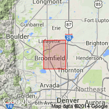
Is Holocene formation mapped in southeastern Boulder, northeastern Jefferson, and northwestern Adams Cos, CO (Denver basin). Is youngest formal unit mapped in quad; shown on Correlation of Map Units to be older than post-Piney Creek alluvium and equivalent in part to colluvium, eolian sand, and undifferentiated alluvium map units; unconformably overlies Broadway Alluvium (Holocene, Pinedale age). Unit described as gray to light-gray-brown well-stratified locally cross-bedded sand, silt, and clay in channel and over bank deposits. Forms low terrace in channels cut in Broadway and, less commonly, Louviers Alluviums. Terrace, when present, is 1.8-2.4 m above modern flood plain. Mainly exposed along courses of Coal, Rock, Big Dry, and Walnut Creeks. Weakly developed zonal soil in upper part of alluvium with very weak veinlets of calcium carbonate. Soil profile shown. Thickness 2-3 m.
Source: GNU records (USGS DDS-6; Denver GNULEX).
- Usage in publication:
-
- Piney Creek Alluvium*
- Modifications:
-
- Mapped 1:24k (Fort Logan quad, Arapahoe, Denver, and Jefferson Cos, CO)
- Dominant lithology:
-
- Gravel
- Sand
- Silt
- Clay
- AAPG geologic province:
-
- Denver basin
Summary:
Is Holocene formation mapped in western Arapahoe, western Denver, and eastern Jefferson Cos, CO (Denver basin). Is youngest formal unit mapped in quad; conformably overlies eolian sand unit (Pleistocene and Holocene); unconformably underlies post-Piney Creek alluvium (Holocene). Correlates in part with Pleistocene and Holocene colluvium unit. Unit described as brown, light-brown, light-gray to dark-gray interbedded sand, silt, and clay. Humic material is common in upper 1-2 ft; interbedded gravel in lower part. Generally well stratified; upper part of alluvium is generally finer grained than lower part. Occupies bottoms of almost every valley except Bear Creek and South Platte River. Engineering properties discussed. Commonly 5-10 ft thick.
Source: GNU records (USGS DDS-6; Denver GNULEX).
- Usage in publication:
-
- Piney Creek Alluvium*
- Modifications:
-
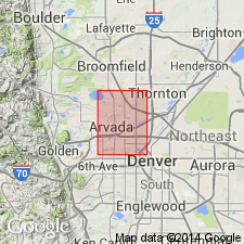
- Mapped 1:24k (Arvada quad, Adams, Denver, and Jefferson Cos, CO)
- Dominant lithology:
-
- Sand
- Silt
- Clay
- Gravel
- AAPG geologic province:
-
- Denver basin
Summary:
Is Holocene formation mapped in southwestern Adams, northwestern Denver, and northeastern Jefferson Cos, CO (Denver basin). Is youngest formal unit mapped in quad; conformably overlies eolian sand unit (Pleistocene and Holocene); unconformably underlies post-Piney Creek alluvium (Holocene). Correlates in part with Pleistocene and Holocene colluvium unit. Unit is described as brown, light-brown, light- to dark-gray interbedded sand, silt, and clay. Humic material common in upper 1-2 ft; interbedded gravel in lower part. Generally well stratified; upper part of alluvium generally finer grained than lower part. Occupies bottoms of almost every valley except Clear Creek and South Platte River. Engineering properties discussed. Is commonly 5-10 ft thick.
Source: GNU records (USGS DDS-6; Denver GNULEX).
- Usage in publication:
-
- Piney Creek Alluvium*
- Modifications:
-
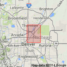
- Mapped 1:24k (Commerce City quad, Adams and Denver Cos, CO)
- Dominant lithology:
-
- Gravel
- Sand
- Silt
- Clay
- AAPG geologic province:
-
- Denver basin
Summary:
Is Holocene formation mapped in northern Denver and western Adams Cos, CO (Denver basin). Is youngest formal unit mapped in quad; conformably overlies eolian sand unit (Pleistocene and Holocene); unconformably underlies post-Piney Creek alluvium (Holocene). Correlates in part with Pleistocene and Holocene colluvium unit. Unit is described as brown, light-brown, light- to dark-gray interbedded sand, silt, and clay. Generally well stratified, humic material common in upper 1-2 ft; interbedded gravel in lower part. Upper part of unit is generally finer grained than lower part. Occurs in bottoms of almost every valley except those of Sand and Clear Creeks and South Platte River. Engineering properties discussed. Thickness is commonly 5-10 ft.
Source: GNU records (USGS DDS-6; Denver GNULEX).
- Usage in publication:
-
- Piney Creek Alluvium*
- Modifications:
-
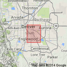
- Mapped 1:24k (Englewood quad, Adams, Arapahoe, and Denver Cos, CO)
- Dominant lithology:
-
- Sand
- Silt
- Clay
- AAPG geologic province:
-
- Denver basin
Summary:
Is upper Holocene formation mapped in southwestern Adams, southwestern Arapahoe, and eastern Denver Cos, CO (Denver basin). Is youngest formal unit mapped in quad; unconformably underlies post-Piney Creek alluvium (upper Holocene); unconformably overlies Broadway Alluvium (Pleistocene). Correlates in part with colluvium unit (Pleistocene and Holocene), eolian sand unit (upper Pleistocene to upper Holocene), and undifferentiated alluvium unit (upper Holocene). Unit described as light-gray to dark grayish-brown, humic, slightly calcareous, sandy silt and clay overlying noncalcareous, clean to silty pebbly sand interbedded with sandy silt along major streams and sandy clay to silty sand along intermittent streams. Forms terraces about 6-8 m above South Platte River, 3-5 m above Cherry Creek, and less than 3 m above Little Dry Creek. Includes thin deposits of post-Piney Creek alluvium along intermittent streams and small alluvial fans. Generally not subject to flooding along major streams but locally covered by periodic floods in tributary drainages. Table of physical properties. Thickness is 1.5-4.5 m along South Platte River and less than 4.5 m along Cherry Creek and Little Dry Creek.
Source: GNU records (USGS DDS-6; Denver GNULEX).
- Usage in publication:
-
- Piney Creek Alluvium*
- Modifications:
-
- Mapped 1:24k (Sable quad, Adams and Denver Cos, CO)
- Dominant lithology:
-
- Gravel
- Sand
- Silt
- Clay
- AAPG geologic province:
-
- Denver basin
Summary:
Is Holocene formation mapped in northeastern Denver and southwestern Adams Cos, CO (Denver basin). Is youngest formal unit mapped in quad; conformably overlies eolian sand unit (Pleistocene and Holocene); unconformably underlies post-Piney Creek alluvium (Holocene). Correlates in part with Pleistocene and Holocene colluvium and loess units. Unit is described as brown, light-brown, light- to dark-gray interbedded sand, silt, and clay. Generally well stratified; humic material common in upper 1-2 ft; interbedded gravel in lower part. Upper part of unit is generally finer grained than lower part. Occupies bottoms of most valley in quad. Engineering properties discussed. Thickness is commonly 5-10 ft.
Source: GNU records (USGS DDS-6; Denver GNULEX).
- Usage in publication:
-
- Piney Creek Alluvium*
- Modifications:
-
- Mapped 1:12k (Jefferson and Boulder Cos, CO)
- Dominant lithology:
-
- Gravel
- Sand
- Silt
- AAPG geologic province:
-
- Denver basin
Summary:
Is Holocene formation mapped undivided with post-Piney Creek alluvium in northern Jefferson and southeastern Boulder Co, CO (Denver basin). Among youngest of map units; shown on Correlation of Map Units to be age equivalent with Holocene part of colluvium, landslide deposits, and Holocene artificial fill units; older than terrace alluvium unit (middle Pleistocene to early Holocene?). (Age assignments for surficial deposits are based chiefly on height above stream level, degree of post-depositional modification of original surface morphology, and degree of soil development.) Occurs along Rock, Walnut and Woman Creeks and their tributaries; underlies low terraces about 1-2 m above stream level. In western part of map area, unit described as clast-supported, slightly bouldery, pebble and cobble gravel containing dark-gray sand matrix; unit fines downstream. In eastern part of map area, unit commonly consists of slightly pebbly, grayish-brown, silty sand to sandy, clayey silt in upper part and poorly sorted, clast-supported, slightly cobbly, pebble gravel that contains light-yellowish-brown, clayey, silty sand matrix in lower part. Piney Creek Alluvium contains stage I carbonate veinlets and locally one or more buried soil A horizons, that are each about 10 cm thick. Locally contains remains of BISON BISON; bones of large vertebrate [not identified] found along Walnut Creek near eastern margin of map. Thickness 1-5 m; averages 3 m.
Source: GNU records (USGS DDS-6; Denver GNULEX).
For more information, please contact Nancy Stamm, Geologic Names Committee Secretary.
Asterisk (*) indicates published by U.S. Geological Survey authors.
"No current usage" (†) implies that a name has been abandoned or has fallen into disuse. Former usage and, if known, replacement name given in parentheses ( ).
Slash (/) indicates name conflicts with nomenclatural guidelines (CSN, 1933; ACSN, 1961, 1970; NACSN, 1983, 2005, 2021). May be explained within brackets ([ ]).