- Usage in publication:
-
- Pine Ridge Sandstone*
- Modifications:
-
- Revised
- Overview
- AAPG geologic province:
-
- Green River basin
Summary:
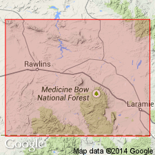
Elevated in rank from Pine Ridge Member of Mesaverde Formation to Pine Ridge Sandstone of Mesaverde Group. Principal reference section designated in NE1/4 SW1/4 NW1/4 sec 16, T20N, R76W, Albany Co, WY. Exposed in the Rock Springs uplift, eastward into the subsurface through the Great Divide and Washakie basins. Exposed in the Hanna and Carbon basin to the east. All of these localities are in the Greater Green River basin. Is a unit 83 ft thick at the principal reference section, where it is composed predominantly of yellowish-gray, fine- to medium-grained sandstone but is interbedded with olive-gray carbonaceous to coaly shale, and some carbonaceous claystone. Rests on Rock River Formation; underlies Lewis Shale. Is a regressive marine sandstone. Is fossiliferous (ammonites). Assigned to the late Campanian. Correlation with other units of the same Late Cretaceous age in south-central WY shown on Table 1.
Source: GNU records (USGS DDS-6; Denver GNULEX).

- Usage in publication:
-
- Pine Ridge Sandstone*
- Modifications:
-
- Areal extent
- AAPG geologic province:
-
- Green River basin
Summary:
Is formation in upper part of Mesaverde Group in east-central part of Sand Wash basin (part of Greater Green River basin), Moffat Co, CO. Gradual southeastward facies change from coastal-plain fluvial deposits of Canyon Creek Member of Ericson Sandstone and Pine Ridge to delta-front and pro-delta deposits in middle part of Williams Fork Formation depicted on interpretive correlation diagram. Pine Ridge is areally extended in subsurface into northwest CO on basis of electric-log correlations. Approximate geographic boundary of nomenclature change located between gas well (station 6, sec 13, T10N, R94W) and dry oil and gas drillhole (station 7, sec 13, T8N, R93W) in Moffat Co, CO. Overlies delta-plain deposits equivalent to middle part of Ericson. Underlies coastal-swamp and lagoon deposits of Almond Formation. Late Cretaceous age.
Source: GNU records (USGS DDS-6; Denver GNULEX).
For more information, please contact Nancy Stamm, Geologic Names Committee Secretary.
Asterisk (*) indicates published by U.S. Geological Survey authors.
"No current usage" (†) implies that a name has been abandoned or has fallen into disuse. Former usage and, if known, replacement name given in parentheses ( ).
Slash (/) indicates name conflicts with nomenclatural guidelines (CSN, 1933; ACSN, 1961, 1970; NACSN, 1983, 2005, 2021). May be explained within brackets ([ ]).

