The National Geologic Map Database is migrating to a new infrastructure. We apologize for any service disruptions during this process.
|
|---|


- Usage in publication:
-
- Pierce Formation
- Modifications:
-
- Principal reference
- Dominant lithology:
-
- Till
- AAPG geologic province:
-
- Wisconsin arch
Summary:
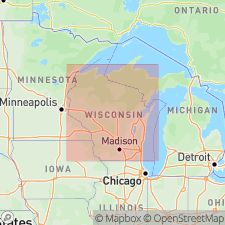
Pg. 4 (table 1); App., p. A4-1+. Pierce Formation. (Follows the informal usage of R.W. Baker, 1984, Wisconsin Geol. Nat. Hist. Survey Gdbk, no. 11.) Occurs in Buffalo, Dunn, Pepin, Pierce, and St. Croix Counties, Wisconsin. Includes the lower Hersey Member (new) and the upper Kinnickinnic Member (new). Consists of gray calcareous till and associated yellowish brown sand and gravel, and laminated silt and clay interpreted to be of glacial lacustrine origin. Thickness <1 to 55 m. Basal contact is unknown except where it overlies Paleozoic bedrock. Underlies the River Falls Formation (new) in northern Pierce and St. Croix Counties, with sharp contact; elsewhere it is the surface unit. Age is Pleistocene (pre-Illinoian).
Type section (=Hersey Member type section): on west side of abandoned gravel pit north of Highway 12, about 0.6 mi (1 km) southwest of Hersey, in [SW/4 SE/4] sec. 29, T. 29 N., R. 15 W., [approx. Lat. 44 deg. 57 min. 36 sec. N., Long. 92 deg. 13 min. 28 sec. W.], Wilson 7.5-min quadrangle, St. Croix Co., western WI.
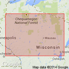
Named from Pierce Co., western WI; name credited to Robert W. Baker.
[Additional locality information from Syverson and others, 2011, Wisconsin lexicon of Pleistocene units, Wisconsin Geol. Nat. Hist. Survey Tech. Rpt., no. 1; supplemented from USGS historical topographic map collection TopoView and Wisconsin Highways www.wisconsinhighways.org, accessed on June 9, 2018.]
[Misprint (p. A4-2). Abandoned gravel pit is in SW/4 SE/4 sec. 29, not SW/4 SE/4 SE/4. See Syverson and others, 2011, Wisconsin Geol. Nat. Hist. Survey Tech. Rpt., no. 1, p. 18 (fig. 7).]
Source: US geologic names lexicon (USGS Bull. 1565, p. 248-249).
- Usage in publication:
-
- Pierce Formation
- Modifications:
-
- Revised
- AAPG geologic province:
-
- Wisconsin arch
Summary:
Pg. vi (chart), 8-13. Pierce Formation. In subsurface of Eau Galle River area, St. Croix, Pierce, and Dunne Counties, western Wisconsin, the Pierce Formation is subdivided into (descending): Hersey Member, [an unnamed organic layer of peat and wood], Woodville Member (new), and Eau Galle Member (new). Is overlain by River Falls Formation. Base of Eau Galle Member not observed thus underlying unit unknown. Possible age-equivalent of Marathon Formation in central part of state (Chippewa Lobe). Age is considered Pleistocene (tentatively pre-Wisconsinan), [probably pre-Illinoian based on Hersey Member, which has reversed remanent magnetism; see Baker, R.W., 1984, Wisconsin Geol. Nat. Hist. Survey Gdbk, no. 11].
Source: Publication.
- Usage in publication:
-
- Pierce Formation
- Modifications:
-
- Overview
- AAPG geologic province:
-
- Wisconsin arch
Summary:
[Not synopsized to date. Lithology, thickness, distinguishing characteristics, contacts, sections, areal extent, age, correlations discussed.]
Pg. 4 (fig. 2), 7 (fig. 3), 8, 18-19, 23-27. Pierce Formation. Incl. (descending): Kinnickinnic Member, Hersey Member, Woodville Member, and Eau Galle Member.
Source: NA
For more information, please contact Nancy Stamm, Geologic Names Committee Secretary.
Asterisk (*) indicates published by U.S. Geological Survey authors.
"No current usage" (†) implies that a name has been abandoned or has fallen into disuse. Former usage and, if known, replacement name given in parentheses ( ).
Slash (/) indicates name conflicts with nomenclatural guidelines (CSN, 1933; ACSN, 1961, 1970; NACSN, 1983, 2005, 2021). May be explained within brackets ([ ]).