

- Usage in publication:
-
- Phi Kappa formation*
- Modifications:
-
- Named
- Dominant lithology:
-
- Sandstone
- Argillite
- Shale
- Sandstone
- AAPG geologic province:
-
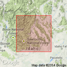
- Idaho Mountains province
- Snake River basin
Summary:
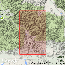
Named for exposures along Phi Kappa Creek, Custer Co, ID in the Snake River basin. Extends into adjoining Blaine Co, Idaho Mountains province. No type locality designated. Is more than 9,400 ft thick. Not divided into mapped parts. Lower part consists of medium and fine-grained quartzitic sandstone and flinty argillite, usually black, which weathers into rusty slabs about 4,750 ft thick; measured section. Upper part is about 4,600 ft thick and consists of black laminated shale and yellow shaly sandstone, measured section. Is younger than East Fork formation (new) and older than Trail Creek formation (new). Graptolites of Normanskill, Early Ordovician or Chazy age (fossils listed) in lower parts of formation. Graptolites of late Middle or Late Ordovician age in upper 25 ft of formation (fossils listed). Geologic maps. Columnar section.
Source: GNU records (USGS DDS-6; Denver GNULEX).
- Usage in publication:
-
- Phi Kappa formation*
- Modifications:
-
- Overview
- Revised
- AAPG geologic province:
-
- Idaho Mountains province
Summary:
Was named for Phi Kappa Creek, T6N, R19E, Hailey quad, Hailey Co, ID in the Idaho Mountains province. Formation extends 12 mi southeast along crest of Pioneer Range in a belt that averages 2-3 mi wide. Is separated at most localities from other Paleozoic rocks by numerous faults. Is locally metamorphosed by igneous intrusions. Upper and lower contacts revised; is younger than Garden Creek phyllite (new) and older than Ramshorn slate (new) in Hailey quad. Faunas listed; one graptolite of Deep Kill (Beekmantown) age, one of Normanskill age, and one probably of Late Ordovician age. Correlation chart. Assigned to the Ordovician.
Source: GNU records (USGS DDS-6; Denver GNULEX).
- Usage in publication:
-
- Phi Kappa Formation*
- Modifications:
-
- Biostratigraphic dating
- AAPG geologic province:
-
- Idaho Mountains province
Summary:
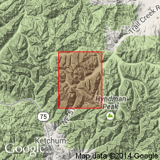
Eight Ordovician graptolite zones (ascending)--DIDYMOGRAPTUS PROTOBIFIDUS, ISOGRAPTUS, GLOSSOGRAPTUS HINCKSII, NEMAGRAPTUS, CLIMACOGRAPTUS BICORNIS, CLIMACOGRAPTUS TUBULIFERUS, PLEUROGRAPTUS LINEARIS, and DICELLOGRAPTUS ORNATUS--recognized at Trail Creek, Blaine Co, ID, Idaho Mountains province, in the Phi Kappa Formation. The first two zones are Early Ordovician or Arenigian; the third zone is late Llanvirnian and Llandeilian or Middle Ordovician; the fourth, fifth, and sixth zones are Caradocian or Middle Ordovician; the seventh is late Caradocian or Late Ordovician; and the eighth is Ashgillian or Late Ordovician. A 16 m-thick section of gray shale and thin-bedded calcsilicate marble above the Ordovician part of the Phi Kappa that was included in the Trail Creek Formation by some is included in the Phi Kappa (following Dover and Ross) in this paper. The age of the Phi Kappa extends up into the Middle Silurian. Two Silurian zones recognized; MONOGRAPTUS CONVOLUTUS zone is Llandoverian or Early Silurian, and the CRYTOGRAPTUS zone is late Llandoverian, Early Silurian, and extends up into the Wenlockian, or Middle Silurian. A partial section at Little Fall Creek has three of the Ordovician graptolite zones.
Source: GNU records (USGS DDS-6; Denver GNULEX).
- Usage in publication:
-
- Phi Kappa Formation*
- Modifications:
-
- Revised
- AAPG geologic province:
-
- Idaho Mountains province
- Snake River basin
Summary:
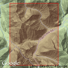
Revised in Pioneer Mountains, Custer Co, Idaho Mountains province and Blaine Co, Snake River basin, ID to include part of original Phi Kappa, the--black, graptolite-bearing, carbonaceous, thin-bedded argillite and shale of Early (late Tremadocian, Arenigian), Middle (Llanvirnian, Llandeilian, early Caradocian), and Late (late Caradocian, Ashgillian) Ordovician age (Berry's zones 2-4 through 15); lithologically identical graptolitic argillite of Early (Llandoverian) and Middle (early Wenlockian) Silurian age, about 25 m thick, formerly of overlying Trail Creek Formation. As revised, is thin (about 240 m) compared to original estimate (3,860 m); is distinctive, mappable, and uniform; occupies about 25 percent of area mapped earlier. Retained because of widespread usage. Geologic map, columnar section. Occurs in imbricated thrust sheet that may override nongraptolitic rocks of Copper Basin, Milligen, or Trail Creek Formation. Some rocks previously mapped as Ramshorn Slate and Saturday Mountain Formation are Phi Kappa. Base is tectonic throughout region. Basal quartzite 60 m thick named Basin Gulch Quartzite Member. Lowest graptolite occurrence 15 cm above member top. Upper contact with Trail Creek gradational through 15-m-thick interval; buff-weathering Trail Creek predominates over slope-forming, black, graptolitic Phi Kappa. Copper Basin present at Phi Kappa Creek; revised Phi Kappa present on Phi Kappa Mountain.
Source: GNU records (USGS DDS-6; Denver GNULEX).
- Usage in publication:
-
- Phi Kappa Formation*
- Modifications:
-
- Overview
- AAPG geologic province:
-
- Idaho Mountains province
- Snake River basin
Summary:
Mapped in northwestern part of study area in Blaine and Custer Cos, ID, Snake River and Idaho Mountains province. Divided into (ascending) Basin Gulch Quartzite Member, main body, and upper part. Mainly consists of black, carbonaceous, graptolite-bearing shale and slabby argillite occurring in complexly folded and imbricated tectonic slices. Thickness is about 240 m. Underlies Trail Creek Formation with gradational contact; basal contact is tectonic; younger than Clayton Mine Quartzite. Basin Gulch is Early Ordovician age based on graptolites; main body is Early to Late Ordovician age based on excellent graptolite zonation ranging from Arenigian through Ashgillian; upper part is Early and Middle Silurian age based on Llandoverian and Wenlockian graptolites.
Source: GNU records (USGS DDS-6; Denver GNULEX).
For more information, please contact Nancy Stamm, Geologic Names Committee Secretary.
Asterisk (*) indicates published by U.S. Geological Survey authors.
"No current usage" (†) implies that a name has been abandoned or has fallen into disuse. Former usage and, if known, replacement name given in parentheses ( ).
Slash (/) indicates name conflicts with nomenclatural guidelines (CSN, 1933; ACSN, 1961, 1970; NACSN, 1983, 2005, 2021). May be explained within brackets ([ ]).