

- Usage in publication:
-
- Petrified Forest member*
- Modifications:
-
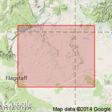
- Areal extent
- Dominant lithology:
-
- Sandstone
- Shale
- AAPG geologic province:
-
- Black Mesa basin
- Paradox basin
- Plateau sedimentary province
Summary:
Pg. 223 (table 1), 228. Petrified Forest member of Chinle formation. Upper part light-red and brown, irregularly bedded sandstones and sandy, argillaceous, carbonaceous, and calcareous shales widely variable in composition; lower part brilliantly variegated friable shales of various composition and degrees of hardness, which weather into badland forms; contains fossil wood. Thickness 300 to 400 feet. Underlies Springdale sandstone member (new); overlies unnamed sandstone in basal part of formation. [Age is Late Triassic.]
Source: US geologic names lexicon (USGS Bull. 1200, p. 2998-2999).
- Usage in publication:
-
- Petrified Forest member*
- Modifications:
-
- Principal reference
- Dominant lithology:
-
- Sandstone
- Conglomerate
- Shale
- Gypsum
- AAPG geologic province:
-
- Black Mesa basin
- Paradox basin
- Plateau sedimentary province
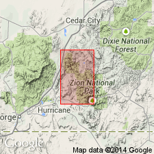
Summary:
Pg. 52 (table), 66, 67-68, strat. sections. Petrified Forest member of Chinle formation. Described in Zion National Park region where it is 650 to 800 feet thick. Age is Late Triassic. Origin of name stated.
Named for fact that it contains band of fossil wood closely resembling dominant rock in Petrified Forest of AZ. Present in all of northern AZ and southern UT, extends into southeastern NV and west-central NM. In most of these areas, forms thickest and most characteristic part of formation.
Source: US geologic names lexicon (USGS Bull. 1200, p. 2998-2999).
- Usage in publication:
-
- Petrified Forest member
- Modifications:
-
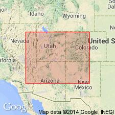
- Areal extent
- AAPG geologic province:
-
- Black Mesa basin
Summary:
Pg. 4 (fig. 1), 5. Petrified Forest member of Chinle formation. In Navajo country, underlies Owl Rock member (new) and overlies Monitor Butte member (new). Locally overlies Shinarump conglomerate. Predominantly claystone but contains sandstone (Sonsela beds) in eastern part. [Age is Late Triassic.]
Source: US geologic names lexicon (USGS Bull. 1200, p. 2998-2999).
- Usage in publication:
-
- Petrified Forest member*
- Modifications:
-
- Areal extent
- AAPG geologic province:
-
- Paradox basin
Summary:
Pg. 457-458. Petrified Forest member of Chinle formation. Described in southeastern Utah where it conformably underlies Owl Rock member; and in most areas conformably overlies Monitor Butte member; conformably overlies Moss Back member in part of White Canyon and Elk Ridge areas. Thickness in Monument Valley area 500 to 700 feet; 100 feet in White Canyon area and southern part of Elk Ridge area; north of these areas 70 feet or less. Near junction of Green and Colorado Rivers, loses identity probably by intertonguing and intergrading with Owl Rock member. Corresponds to "C" division of Chinle formation described by Gregory (USGS Prof. Paper 93, 1917) in northeastern Arizona. Geographically extended into Nevada and New Mexico. [Age is Late Triassic.]
Source: US geologic names lexicon (USGS Bull. 1200, p. 2998-2999).
- Usage in publication:
-
- Petrified Forest member*
- Modifications:
-
- Revised
- AAPG geologic province:
-
- Black Mesa basin
- Plateau sedimentary province
Summary:
Divided in the eastern part of the Black Mesa basin into a lower part, Sonsela sandstone bed, and an upper part. The lower part is a red-purple, grayish-blue, grayish-red mudstone and minor amounts of thin, cross-bedded lenses of sandstone and siltstone. Upper part is similar to the lower part; both weather into a rough puffy surface due to swelling clays, and they form rounded, barren hills and slopes of the "painted desert." The middle conglomeratic sandstone and siltstone, 50 to 200 ft thick named Sonsela, is present along east side of Defiance uplift to the Petrified Forest National Monument. Isopach map; fence diagram. Overlies lower red member at Fort Defiance (or Mesa Redondo member at St. Johns). Underlies Owl Rock member at Fort Defiance. Nomenclature chart. Triassic age.
Source: GNU records (USGS DDS-6; Denver GNULEX).
- Usage in publication:
-
- Petrified Forest Member*
- Modifications:
-
- Areal extent
- AAPG geologic province:
-
- Black Mesa basin
- Great Basin province
- Paradox basin
- Plateau sedimentary province
- San Juan basin
Summary:
Is one of the most distinctive members of the Upper Triassic Chinle Formation. Occurs in northwest NM, San Juan basin; northern AZ, Black Mesa basin and Plateau sedimentary province; southern UT, Paradox basin, Plateau sedimentary and Great Basin provinces; and southeast NV, Great Basin province. Ranges from 0 to 1,110+ ft thick. Isopach map. Thins to north. Grades out into other members of Chinle. Characterized by its bright varied color (red, green, purple, blue, orange, yellow, gray). Consists of three interfingering lithologic types. Type 1 is claystone and clayey siltstone that is structureless, has irregular nodules of limestone 1-2 inches in diameter, and is montmorillonite-rich. Type 2 is cross-stratified, fine- to medium-grained clayey sandstone composed of quartz, volcanic rock grains in matrix of montmorillonitic clay. Type 3 is cross-stratified ledge-forming sandstone and conglomerate, such as the Correo (rank reduced) and Sonsela Sandstone Beds. Nomenclature chart. Cross sections. Measured sections. Mineral studies. Fossils: freshwater pelecypods and branchiopods, reptiles, insect borings in petrified wood, fish, amphibians, plants. Continental origin.
Source: GNU records (USGS DDS-6; Denver GNULEX).
- Usage in publication:
-
- Petrified Forest Member*
- Modifications:
-
- Areal extent
- AAPG geologic province:
-
- Paradox basin
Summary:
Is the fourth member from base (of six) of Upper Triassic Chinle Formation studied in the White and Red Canyon areas, San Juan Co, UT, Paradox basin. Overlies Moss Back Member of Chinle. Underlies Owl Rock Member of Chinle. The bentonitic sandstone and carbonate-nodule conglomerate exhibit large-scale trough cross-stratification and large scale, scour and lateral accretion surfaces. Mudstones have rare lungfish burrows. Tetrapod remains, lungfish toothplates, coprolites, gastropods, and mollusks present. Deposit by sinuous streams that carried abundant suspended load and subject to numerous avulsion events. Presence of bentonite indicates volcanic ash available.
Source: GNU records (USGS DDS-6; Denver GNULEX).
- Usage in publication:
-
- Petrified Forest Member
- Modifications:
-
- Areal extent
- AAPG geologic province:
-
- Basin-and-Range province
- Orogrande basin
- San Juan basin
Summary:
Pg. 193 (fig. 2), 198-201. Petrified Forest Member of Chinle Formation. Consists of (descending): Correo Sandstone Bed; upper unnamed varicolored mudstones and siltstones; Sonsela Sandstone Bed; and lower unnamed bluish and purple bentonitic mudstones. Maximum thickness 300+ m. Lies below Owl Rock Member and above Bluewater Creek Member (both of Chinle). Fossils. Age is Late Triassic.
Recognized in Catron, Cibola, McKinley, and Socorro Cos., central western NM.
Source: Publication.
- Usage in publication:
-
- Petrified Forest Member*
- Modifications:
-
- Mapped
- AAPG geologic province:
-
- Great Basin province
Summary:
Mapped as upper of two members of Chinle Formation. Exposed along west edge of quad, Lincoln Co, NV, Great Basin province where unit is less than 100 m thick. Is characteristically purplish-gray or maroon, slope-forming mudstone with thin interbeds of fine-grained sandstone, and reddish gray shale; ironstone nodules are common in bentonitic beds near top. Fully exposed in adjacent Dodge Spring quad to north (Anderson and Hintze, 1992, USGS GQ-1721). Conformably overlies Shinarump Member of Chinle; conformably underlies Dinosaur Canyon Member of Moenave Formation. Late Triassic age.
Source: GNU records (USGS DDS-6; Denver GNULEX).
For more information, please contact Nancy Stamm, Geologic Names Committee Secretary.
Asterisk (*) indicates published by U.S. Geological Survey authors.
"No current usage" (†) implies that a name has been abandoned or has fallen into disuse. Former usage and, if known, replacement name given in parentheses ( ).
Slash (/) indicates name conflicts with nomenclatural guidelines (CSN, 1933; ACSN, 1961, 1970; NACSN, 1983, 2005, 2021). May be explained within brackets ([ ]).