The National Geologic Map Database is migrating to a new infrastructure. We apologize for any service disruptions during this process.
|
|---|


- Usage in publication:
-
- Percha shale*
- Modifications:
-
- Revised
- Areal extent
- Not used
- AAPG geologic province:
-
- Basin-and-Range province
Summary:
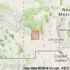
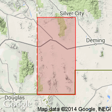
Percha shale revised--lower contact changed. In report by Gordon (1907) naming the Percha, underlying unit was called Mimbres limestone. In this report, Percha shale is shown to be present in Silver City quad, Grant Co, NM in Basin-and-Range province, and to rest unconformably on Silurian Fusselman limestone. Top of Percha is calcareous and merges into Carboniferous Fierro limestone (new). At Lone Mountain and in Silver City Range Percha occupies well-defined valleys between resistant Fusselman on the west and bold scarp of basal Carboniferous strata on the east; at Bear Mountain, however, forms no such valley but lies west of summit and forms part of western slope; in mountains west of Bear Mountain it lies on western side of hills; in vicinity of Georgetown it passes beneath Carboniferous beds; is in fault zone near junction of Little Walnut and Walnut Creeks and on east and west sides of the diorite mass between Fierro and Hanover. At all these localities Percha is a marked topographic feature--the characteristic break on mountain slopes, with resistant Carboniferous beds above standing out as a ledge or capping, beneath which Percha slopes away. Percha extends from Mimbres Mountains westward to the AZ State Line. Does not occur in the Franklin Mountains, NM and TX, Orogrande basin. Upper Devonian fossils (corals, gastropods, bryozoans) found in upper part of formation. Is of Devonian age. Geologic map.
Source: GNU records (USGS DDS-6; Denver GNULEX).
- Usage in publication:
-
- Percha formation
- Modifications:
-
- Revised
- AAPG geologic province:
-
- Orogrande basin
Summary:
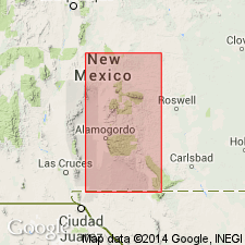
Percha revised in report area, west face of Sacramento Mountains, Otero Co, NM in Orogrande basin. Restricted at top to exclude following Mississippian rocks formerly considered part of Percha (ascending): 1) Caballero formation (new)--formerly the lower part of Lake Valley formation (here revised); and 2) Lake Valley formation--newly divided into (ascending) Alamogordo, Arcente, and Dona Ana members. Devonian strata [Percha as here revised] underlies Caballero formation unconformably. Percha overlies Fusselman [dolomite]. Is of Devonian age. Measured section.
Source: GNU records (USGS DDS-6; Denver GNULEX).
- Usage in publication:
-
- Percha shale
- Modifications:
-
- Revised
- Overview
- AAPG geologic province:
-
- Orogrande basin
Stevenson, F.V., 1945, Devonian of New Mexico: Journal of Geology, v. 53, no. 4, p. 217-245.
Summary:
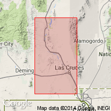
Type section or "neotype" at "The Box," 2 1/2 mi southeast of Hillsboro, SW1/4 SW1/4 SE1/4 sec 14, T16S, R7W, Sierra Co, NM, Orogrande basin, defined and described where formation is divisible into a lower member and an upper member. The lower member is named Ready Pay member and the upper member is named Box member. Percha unconformably overlies Silurian Fusselman limestone; contact is a brown siliceous limestone (Fusselman) under black shale (Ready Pay). A thin brown nonfossiliferous siltstone bed was found at base of Ready Pay at three scattered localities in the Mimbres region. The thin siltstone is similar to a zone in the Sly Gap. Ready Pay consists of gray to black shale 132 ft thick at type. Box consists of gray shale and gray limestone 46.6" at type. Name used in report area from the Sacramento Mountains on the east to the Mimbres area on the west. Percha unconformably underlies Mississippian Lake Valley limestone; contact is a gray calcareous shale (Box) under a yellow calcareous siltstone (Lake Valley). Cross section; columnar section. Of Devonian age.
Source: GNU records (USGS DDS-6; Denver GNULEX).
- Usage in publication:
-
- Percha shale
- Modifications:
-
- Overview
- AAPG geologic province:
-
- Pedregosa basin
Summary:
Geologic map included. Measured section described in SW1/4 sec 23 and E1/2 SE1/4 sec 22, T25S, R21W, Hidalgo Co, NM in Pedregosa basin. No fossils found. Assigned the same age as elsewhere, i.e. late Devonian and possibly early Mississippian (Kinderhookian).
Source: GNU records (USGS DDS-6; Denver GNULEX).
- Usage in publication:
-
- Percha Shale
- Modifications:
-
- Areal extent
- Overview
- AAPG geologic province:
-
- Pedregosa basin
Summary:
Exposed in two localities in report area. Section 280 ft thick measured in Mescal Canyon, sec 29, T30S, R15W, Hidalgo Co, NM in the Pedregosa basin. Overlies Montoya Dolomite unconformably. Underlies Escabrosa Limestone. Fossils rare, and many found have no real age significance. Fish plate and brachiopods identified. Assigned to Late Devonian on basis of regional considerations. Resembles Percha more than Portal.
Source: GNU records (USGS DDS-6; Denver GNULEX).
- Usage in publication:
-
- Percha Formation
- Modifications:
-
- Redescribed
- Areal extent
- Dominant lithology:
-
- Shale
- Dolomite
- Siltstone
- AAPG geologic province:
-
- Basin-and-Range province
- Pedregosa basin
Summary:
Name changed from Percha Shale to Percha Formation and applied to a series of slope-forming shales, siltstones, and, near top, ledgy carbonates disconformably above the Upper Devonian (Frasnian) Martin Formation and below the Mississippian Escabrosa Limestone. These Percha strata were assigned in earlier reports to the Ouray Formation by some and to the Martin by others. The strata are mappable separate from the Martin and are correlated with Percha Shale of NM, hence the name Percha is extended into Greenlee, Pinal, Graham, and Pima Cos, AZ, Basin-and-Range province, and Cochise Co, AZ, Pedregosa basin. Divisible into: 1) lower shale member, 10 to 200 feet thick, olive-green to yellowish- or reddish-brown, slope-forming shale which weathers to small yellow flakes; and 2) upper member, 5 to 100 feet thick, yellowish-brown to pale red to light gray silty dolomite, dolomitic siltstone, and limestone that may be thin to thick-bedded. Locally at base of Percha, a hematitic quartz sandstone contains pebbles of quartz, phosphatic concretions, arthrodiran fish fragments, shark teeth, conodonts (late Fammenian), abraded brachiopod and corals. Fossils in upper member include brachiopods, crinoids, bryozoans, sponges, corals, conodonts (late Fammenian). Isopach map. Of late Late Devonian age.
Source: GNU records (USGS DDS-6; Denver GNULEX).
- Usage in publication:
-
- Percha Shale*
- Modifications:
-
- Revised
- AAPG geologic province:
-
- Pedregosa basin
Summary:
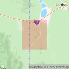
Mapped in central Peloncillo Mountains, Hidalgo Co, NM in Pedregosa basin. Is divided into two members: Ready Pay at base and Box at top. Is about 70 m thick. In many areas is metamorphosed to light-gray to brown hornfels in vicinity of granite porphyry, rhyolite, and quartz-latite dikes. Unconformably overlies El Paso Limestone (Lower Ordovician); unconformably underlies Keating Formation (Lower Mississippian) of Escabrosa Group. Is Late Devonian age; [apparently on basis of previous work].
Source: GNU records (USGS DDS-6; Denver GNULEX).
- Usage in publication:
-
- Percha Shale*
- Modifications:
-
- Areal extent
- Overview
- AAPG geologic province:
-
- Pedregosa basin
Summary:
Upper Devonian rocks vary sufficiently among ranges near Swisshelm Mountains, Cochise Co, AZ, Pedregosa basin so that correlative units have been given different names; though farther away, lithologies remain relatively uniform over large distances and use of some names is widespread. Percha is black shale occurring over wide area of southern NM and correlates with Martin Formation, which is present over wide area of southern and central AZ. In area east of Sulphur Springs Valley (located between Dragoon and Swisshelm Mountains) correlative Upper Devonian rocks are called Portal Formation which consists of alternating thin beds of limestone and shale. In most of Swisshelm Mountains, Swisshelm Formation is present and consists mostly of dolomite and some sandstone and marlstone. In study area, rocks of Swisshelm lithology are present in thrust plate B (fig 2); rocks of Percha lithology are present in thrust plate C on north end of Swisshelm Mountains, a distance of 11 km, suggesting that thrust plates have been tectonically telescoped.
Source: GNU records (USGS DDS-6; Denver GNULEX).

- Usage in publication:
-
- Percha Shale*
- Modifications:
-
- Mapped 1:24k
- Dominant lithology:
-
- Clay
- Shale
- Siltstone
- AAPG geologic province:
-
- Pedregosa basin
Summary:
Percha Shale. Mapped in Big Hatchet Mountains, Hidalgo County, southwestern New Mexico. Medium-gray to pale-yellowish-gray clay, fissile clay shale interbedded with a few thin siltstones, and some thin limestone beds at top. Thickness about 280 feet (85 m). Underlies Lower Mississippian Keating Member (revised locally) of Escabrosa Limestone; disconformably overlies Montoya Group (Middle and Upper Ordovician). Sparsely fossiliferous. Age is Late Devonian.
Source: Publication.
For more information, please contact Nancy Stamm, Geologic Names Committee Secretary.
Asterisk (*) indicates published by U.S. Geological Survey authors.
"No current usage" (†) implies that a name has been abandoned or has fallen into disuse. Former usage and, if known, replacement name given in parentheses ( ).
Slash (/) indicates name conflicts with nomenclatural guidelines (CSN, 1933; ACSN, 1961, 1970; NACSN, 1983, 2005, 2021). May be explained within brackets ([ ]).